Administrative divisions of the Republic of Artsakh
Last updated
Political subdivisions of the Republic of Artsakh
Regions of the Republic of Artsakh Շրջանները Արցախի Հանրապետության (Shrjannerë Arts’akhi Hanrapetut’yan) (Armenian)
Provinces of the Republic of Artsakh. Solid colors: Soviet-era NKAO controlled by Artsakh from 2020 to 2023; horizontal stripes: Azerbaijani-ruled, claimed by Artsakh
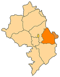
The administrative divisions of the Republic of Artsakh were of two types; provinces and cities. There were six provinces and one special administrative city (the capital of the Republic, Stepanakert).[1]
Municipalities in Artsakh were divided into 2 categories: urban communities and rural communities. Before the 2020 war, there were 10 towns (urban) and 322 villages (rural) in Artsakh.[2]
Administrative divisions
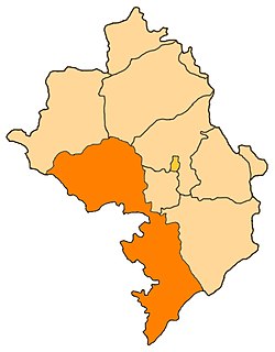
These divisions included territories never controlled by the Republic of Artsakh. They were officially considered occupied by Azerbaijan.[3]
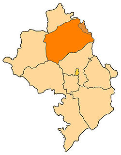
Former Soviet Shahumyan district and the territory known as "Getashen subdistrict" where Shahumyan Province was originally formed
Before the Artsakh republic was established, the territory was organized by the Republic of Azerbaijan into a number of rayons (districts).[citation needed] Artsakh extended its provinces across the border of the former Nagorno-Karabakh Autonomous Oblast (NKAO), removing the administrative distinction between the two areas.[5] The following districts, which were not part of the NKAO but were in Azerbaijan proper, were completely within the de facto borders of Artsakh before the 2020 Nagorno-Karabakh war: Lachin, Qubadli, Zangilan, Jabrayil, Kalbajar. Additionally, parts of the following districts were partly under the control of Artsakh: Agdam District and Fuzuli District.
Regions of Artsakh before the 2020 war: 1: Martakert; 2: Askeran; 3: Stepanakert (city); 4: Martuni; 5: Shushi; 6: Hadrut; 7: Shahumyan; 8: Kashatagh (Vertical dashed lines indicate territory outside of the former Nagorno-Karabakh Autonomous Oblast and Shahumyan Region. Horizontal dashed lines indicate territory under the control of Azerbaijan before the war.)
This page is based on this Wikipedia article Text is available under the CC BY-SA 4.0 license; additional terms may apply. Images, videos and audio are available under their respective licenses.