Afram River

Last updated
Afram River
River
River Afram.JPG
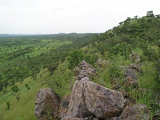
Afram River which binds with the Volta Lake.
Country Ghana
Mouth Volta River
 - location Lake Volta
 - coordinates 6°50′53″N0°43′25″W / 6.84806°N 0.72361°W / 6.84806; -0.72361 Coordinates: 6°50′53″N0°43′25″W / 6.84806°N 0.72361°W / 6.84806; -0.72361
Basin 1,000 km2 (386 sq mi)

The Afram River is a 100 km river in Ghana. Prior to the construction of the Akosombo Dam in the 1960s, the Afram is a principal tributary of the Volta River and today is an equally important tributary of Lake Volta. The river runs roughly in a southwesterly direction. It collects all the drainage of the Kwahu Plateau. [1]

Ghana Republic in West Africa

Ghana, officially the Republic of Ghana, is a country located along the Gulf of Guinea and Atlantic Ocean, in the subregion of West Africa. Spanning a land mass of 238,535 km2 (92,099 sq mi), Ghana is bordered by the Ivory Coast in the west, Burkina Faso in the north, Togo in the east and the Gulf of Guinea and Atlantic Ocean in the south. Ghana means "Warrior King" in the Soninke language.

Akosombo Dam dam

The Akosombo Dam, also known as the Volta Dam, is a hydroelectric dam on the Volta River in southeastern Ghana in the Akosombo gorge and part of the Volta River Authority. The construction of the dam flooded part of the Volta River Basin, and led to the subsequent creation of Lake Volta. Lake Volta is the largest man-made lake in the world by surface area. It covers 8,502 square kilometres (3,283 sq mi), which is 3.6% of Ghana's land area. With a volume of 148 cubic kilometers, Lake Volta is the world's third largest man-made lake by volume, the largest being Lake Kariba which is located between Zimbabwe and Zambia in Southern Africa and contains 185 cubic kilometers of water.

Volta River river in Ghana

The Volta River is the main river system in the West African country of Ghana. It flows into Ghana from Bobo-Dioulasso highlands of Burkina Faso. The main part of the river are the Black Volta, the White Volta, and the Red Volta. In the northwest, the Black Volta forms the international boundaries between the Ivory Coast, Ghana, and Burkina Faso. The Volta flows southward along Akwapim-Togoland highlands, and it empties into the Atlantic Ocean at the Gulf of Guinea at Ada. It has a smaller tributary river, the Oti, which enters Ghana from Togo in the east. The Volta River has been dammed at Akosombo for the purpose of generating hydroelectricity. The reservoir named Lake Volta stretches from Akosombo in the south to the northern part of the country, thus being one of the largest man-made reservoirs in the world.

Related Research Articles

Geography of Ghana

Ghana is a country in Africa, along the Gulf of Guinea, just a few degrees north of the equator. Wikimedia Atlas of Ghana

Black Volta river in Burkina Faso, Ivory Coast, and Ghana

The Black Volta or Mouhoun is a river that flows through Burkina Faso flowing about 1,352 km (840 mi) to the White Volta in Dagbon, Ghana. The Black Volta forms part of the border between Ghana and Côte d'Ivoire and Burkina Faso. Within Ghana, it forms the border between the Northern Region and the Brong-Ahafo Region. The Bui Dam is built on the river in Ghana. The river bisects Bui National Park in Ghana.

Lake Volta largest reservoir by surface area in the world located in Ghana

Lake Volta, the largest artificial reservoir in the world in terms of surface area, is contained behind the Akosombo Dam. It is completely within the country of Ghana and has a surface area of 8,502 square kilometres (3,283 sq mi). Stretching from Akosombo in the south to the northern part of the country, it is one of the largest man-made reservoirs in the world.

White Volta river

The White Volta or Nakanbé is the headstream of the Volta River, Ghana's main waterway. The White Volta emerges in northern Burkina Faso, flows through North Ghana and empties into Lake Volta in Ghana. The White Volta's main tributaries are the Black Volta and the Red Volta.

Oti River river in West-Central Africa

The Oti River or Pendjari River is an international river in West-Central Africa. It rises in Benin, forms the border between Benin and Burkino Faso, flows through Togo, and joins the Volta River in Ghana.

Eastern Region (Ghana) region in Ghana

The Eastern Region is located in south Ghana and is one of ten administrative regions. Eastern region is bordered to the east by the Lake Volta, to the north by Brong-Ahafo region and Ashanti region, to the west by Ashanti region, to the south by Central region and Greater Accra region. Akans are the dominant inhabitants and natives of Eastern region and Akan, Ewe and English are the main spoken languages. The Eastern region is the location of the Akosombo dam and the economy of the Eastern region is dominated by its high-capacity electricity generation. Eastern region covers an area of 19,323 square kilometres, which is about 8.1% of Ghana's total landform.

Togo Mountains mountain range in Africa

The Togo Mountains is a mountain range which stretches across the central region of the West African country of Togo and across the eastern and western borders of that country into Ghana and Benin. In Ghana, the range is also known as the Akwapim Hills, and in Benin it is also known as the Atakora Mountains. Part of the range is associated with the country of Niger, where the W National Park is found. The African wild dog, Lycaon pictus, was historically found in this region but may now be extirpated from this locale.

The Volta River Authority (VRA) is the main generator and supplier of electricity in Ghana.

South Dayi (Ghana parliament constituency)

South Dayi is one of the constituencies represented in the Parliament of Ghana. It elects one Member of Parliament (MP) by the first past the post system of election. South Dayi is located in the South Dayi district of the Volta Region of Ghana.

Fishing in Ghana

Fishing in Ghana is made up of both ocean caught fish, as well as freshwater fishing in lakes and rivers.

Atakora River river in Ghana

The Atakora River is a tributary of Lake Volta in Ghana, it flows about 60 km east to the Lake Volta. Its entire course is in south Ghana.

Sekyere Afram plains (Ghana parliament constituency)

Sekyere Afram Plains is one of the constituencies represented in the Parliament of Ghana. It elects one Member of Parliament (MP) by the first past the post system of election. Sekyere Afram Plains is located in the Sekyere Afram Plains District of the Ashanti Region of Ghana.

References

  1. Afram Kwawu. Accessed August 3, 2012.