Alawa, Northern Territory

Last updated

Alawa
Darwin,  Northern Territory
Alawa NT.jpg
Darwin-Palmerston locator map.svg
Red pog.svg
Alawa
Alawa, Northern Territory
Coordinates 12°22′48″S130°52′23″E / 12.380°S 130.873°E / -12.380; 130.873
Population2,078 (SAL 2021) [1]
Established1960s
Postcode(s) 0810
Area1.2 km2 (0.5 sq mi)
Location12 km (7 mi) from Darwin
LGA(s) City of Darwin
Territory electorate(s) Johnston
Federal division(s) Solomon
Suburbs around Alawa:
Brinkin Casuarina Wanguri
Rapid Creek Alawa Wagaman
Millner Jingili Moil

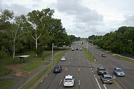
Alawa is a northern suburb of the city of Darwin, Northern Territory, Australia. It is bounded by Trower and Dripstone Roads, Lakeside Drive and the Rapid Creek in the local government area of City of Darwin. It is the traditional country and waterways of the Larrakia people. [2]

Contents

History

The suburb of Alawa was constructed in the late 1960s. Alawa is named after the Alawa Aboriginal tribe known as the Larrakia [3] who inhabited an area on the southern tributaries. [4] The street names in Alawa commemorate the residents and workers, at the old Post Office, who were killed in the bombing of Darwin by the Japanese in 1942, and the boats and people associated with the early settlement of Palmerston (Port Darwin).

Present day

Alawa's boundary borders the Casuarina Shopping centre which is the largest shopping centre in the Territory. The suburb also has a primary school and a smaller shopping centre.

Curlews, Alawa Curlews, Alawa.jpg
Curlews, Alawa
Forest Kingfisher, Alawa Forest Kingfisher, Alawa.jpg
Forest Kingfisher, Alawa
Little friarbird, Alawa Little friarbird, Alawa.jpg
Little friarbird, Alawa
Chestnut-breasted manikin, Alawa Chestnut-breasted manikin, Alawa.jpg
Chestnut-breasted manikin, Alawa
Spangled-drongo, Alawa Spangled-drongo, Alawa.jpg
Spangled-drongo, Alawa

Related Research Articles

Casuarina is one of the northern suburbs of Darwin, the capital of the Northern Territory of Australia. It is the traditional country and waterways of the Larrakia people.

<span class="mw-page-title-main">Wagaman, Northern Territory</span> Suburb of Darwin, the Northern Territory, Australia

Wagaman is a suburb of the Australian city of Darwin, Northern Territory. It lies in the band of locations known as the northern suburbs. It is on the traditional Country and waterways of the Larrakia people. An established residential area, Wagaman is bounded by Vanderlin Drive in the north, Lee Point Road in the east, Parer Drive in the south and Trower Road in the west; these confines correspond to the neighbouring suburbs of Alawa, Moil, Anula, Wanguri and Casuarina.

<span class="mw-page-title-main">City of Darwin</span> Local government area in the Northern Territory, Australia

The City of Darwin is a local government area of the Northern Territory, Australia. It includes the central business district of the capital, Darwin City, and represents two-thirds of its metropolitan population. Located on the traditional land and waterways of the Larrakia people, the city now covers an area of 111 square kilometres (43 sq mi) and, in June 2018, had a population of 84,613 people.

<span class="mw-page-title-main">Tiwi, Northern Territory</span> Suburb of Darwin, the Northern Territory, Australia

Tiwi is a northern suburb of the city of Darwin, Northern Territory, Australia. The suburb is bounded by Trower Road, Henbury Avenue and a coastal strip, separating Casuarina Beach and Lee Point Beach. It is in the Local Government Area of City of Darwin. It is home to Dripstone Middle School.

<span class="mw-page-title-main">Gunn, Northern Territory</span> Suburb of Palmerston, the Northern Territory, Australia

Gunn is an inner-city suburb of Palmerston, Northern Territory, Australia. It is 23 km southeast of the Darwin CBD. Its local government area is the City of Palmerston. It is located on the traditional Country and waterways of the Larrakia people.

<span class="mw-page-title-main">Rapid Creek, Northern Territory</span> Suburb of Darwin, the Northern Territory, Australia

Rapid Creek refers to both a creek in the city of Darwin, Northern Territory, Australia and the name of a suburb north of the city, situated where the creek meets Darwin Harbour. It is the traditional country and waterways of the Larrakia people.

<span class="mw-page-title-main">Coconut Grove, Northern Territory</span> Suburb of Darwin, the Northern Territory, Australia

Coconut Grove is a northern suburb of the city of Darwin, Northern Territory, Australia within the local government area of City of Darwin. It is the traditional country and waterways of the Larrakia people.

<span class="mw-page-title-main">The Gardens, Northern Territory</span> Suburb of Darwin, the Northern Territory, Australia

The Gardens is an inner suburb of the city of Darwin, Northern Territory, Australia. It is the traditional country and waterways of the Larrakia people.

<span class="mw-page-title-main">Ludmilla, Northern Territory</span> Suburb of Darwin, the Northern Territory, Australia

Ludmilla is a northern inner suburb of the city of Darwin, Northern Territory, Australia. It is the traditional country and waterways of the Larrakia people.

<span class="mw-page-title-main">Jingili, Northern Territory</span> Suburb of Darwin, the Northern Territory, Australia

Jingili is a northern suburb of the city of Darwin, Northern Territory, Australia. It is the traditional country and waterways of the Larrakia people.

<span class="mw-page-title-main">Moil, Northern Territory</span> Suburb of Darwin, the Northern Territory, Australia

Moil is a northern suburb of the city of Darwin, Northern Territory, Australia. It is the traditional country and waterways of the Larrakia people.

<span class="mw-page-title-main">Marrara, Northern Territory</span> Suburb of Darwin, the Northern Territory, Australia

Marrara is a northern suburb of the city of Darwin, Northern Territory, Australia. It is on the traditional Country and waterways of the Larrakia people.

<span class="mw-page-title-main">Leanyer, Northern Territory</span> Suburb of Darwin, the Northern Territory, Australia

Leanyer is a northern suburb of Darwin, Northern Territory, Australia.

<span class="mw-page-title-main">The Narrows, Northern Territory</span> Suburb of Darwin, the Northern Territory, Australia

The Narrows is a northern inner suburb of the city of Darwin, Northern Territory, Australia. It is the traditional country and waterways of the Larrakia people.

<span class="mw-page-title-main">Winnellie, Northern Territory</span> Suburb of Darwin, the Northern Territory, Australia

Winnellie is a northern suburb of Darwin in the Northern Territory of Australia. It is the traditional country and waterways of the Larrakia people.

<span class="mw-page-title-main">Archer, Northern Territory</span> Suburb of Palmerston, the Northern Territory, Australia

Archer is a relatively new and still sparsely populated suburb in the southwestern part of Palmerston. It is 25 km SE of the Darwin CBD and 5.4 km from Palmerston City. It is on the traditional Country and waterways of the Larrakia people. Its local government area is the City of Palmerston. Archer is the largest suburb of Palmerston by area.

Bellamack is a suburb of Palmerston. It is 26.5 km southeast of the Darwin CBD. Its local government area is the City of Palmerston. It is on the traditional Country and waterways of the Larrakia people.

<span class="mw-page-title-main">Farrar, Northern Territory</span> Suburb of Darwin, the Northern Territory, Australia

Farrar is an outer eastern suburb of Palmerston. It is 21 km SE of the Darwin CBD. Its Local Government Area is the City of Palmerston. Farrar is bounded to the north and east by the Stuart Highway, to the west Roystonea Avenue. Farrar was originally part of Gunn when Palmerston was divided into suburbs in 1984. It is on the traditional Country and waterways of the Larrakia people.

<span class="mw-page-title-main">Marlow Lagoon, Northern Territory</span> Suburb of Darwin, the Northern Territory, Australia

Marlow Lagoon is an outer western suburb of Palmerston 24 km SE of the Darwin CBD. Its local government area is the City of Palmerston. Marlow Lagoon is bounded to the west by the Adelaide-Darwin Railway, and to the east by Elrundie Ave. It is on the traditional Country and waterways of the Larrakia people.

Moulden is an outer-city suburb of Palmerston, Australia. It is 24.9 kilometres (15.5 mi) southeast of the Darwin CBD by road, about 16 kilometres (9.9 mi) as the crow flies. Its local government area is the City of Palmerston. It is on the traditional Country and waterways of the Larrakia people.

References

  1. Australian Bureau of Statistics (28 June 2022). "Alawa (suburb and locality)". Australian Census 2021 QuickStats. Retrieved 28 June 2022.  OOjs UI icon edit-ltr-progressive.svg
  2. "The Larrakia People". Larrakia Nation. 31 March 2023. Retrieved 8 December 2023.
  3. "Alawa | City of Darwin | Darwin Council, Northern Territory". darwin.nt.gov.au. Retrieved 4 August 2023.
  4. The Origin of Suburbs, Localities, Towns and Hundreds in the Greater Darwin area Archived 29 June 2011 at the Wayback Machine . Retrieved 2007-12-16