
Darwin is the capital city of the Northern Territory, Australia. The city has nearly 53% of the Northern Territory's population, with 139,902 at the 2021 census. It is the smallest, wettest, and most northerly of the Australian capital cities and serves as the Top End's regional centre.

Darwin Harbour is a body of water close to the city of Darwin in the Northern Territory of Australia. It is the traditional waterways of the Larrakia people.
Casuarina is one of the northern suburbs of Darwin, the capital of the Northern Territory of Australia. It is the traditional country and waterways of the Larrakia people.
The history of Darwin details the city's growth from a fledgling settlement into a thriving colonial capital and finally a modern city.

Millner is a northern suburb in the city of Darwin, in the Northern Territory of Australia. It is the traditional country and waterways of the Larrakia people.

Fannie Bay is a middle/inner suburb of the city of Darwin, Northern Territory, Australia. It is the traditional country and waterways of the Larrakia people.

Tiwi is a northern suburb of the city of Darwin, Northern Territory, Australia. The suburb is bounded by Trower Road, Henbury Avenue and a coastal strip, separating Casuarina Beach and Lee Point Beach. It is in the Local Government Area of City of Darwin. It is home to Dripstone Middle School.

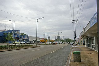
Rapid Creek refers to both a creek in the city of Darwin, Northern Territory, Australia and the name of a suburb north of the city, situated where the creek meets Darwin Harbour. It is the traditional country and waterways of the Larrakia people.

Brinkin is a northern suburb of Darwin, the capital city of the Northern Territory, Australia. It is located 12 kilometres (7 mi) north of Darwin's central business district, and is home to the Casuarina campus of Charles Darwin University. It is the traditional country and waterways of the Larrakia people.

Alawa is a northern suburb of the city of Darwin, Northern Territory, Australia. It is bounded by Trower and Dripstone Roads, Lakeside Drive and the Rapid Creek in the local government area of City of Darwin. It is the traditional country and waterways of the Larrakia people.

Coconut Grove is a northern suburb of the city of Darwin, Northern Territory, Australia within the local government area of City of Darwin. It is the traditional country and waterways of the Larrakia people.

East Point is an inner northern suburb of the city of Darwin, Northern Territory of Australia. It is the traditional country and waterways of the Larrakia people.

Ludmilla is a northern inner suburb of the city of Darwin, Northern Territory, Australia. It is the traditional country and waterways of the Larrakia people.

Marrara is a northern suburb of the city of Darwin, Northern Territory, Australia. It is on the traditional Country and waterways of the Larrakia people.
Stuart Park is an inner suburb of the city of Darwin, Northern Territory, Australia. It is the traditional country and waterways of the Larrakia people.
Durack is an inner-city suburb of Palmerston. It is 22 km southeast of the Darwin CBD. Its local government area is the City of Palmerston. It is located on the traditional Country and waterways of the Larrakia people.
Mitchell is a suburb in the Northern Territory of Australia located in the city of Palmerston about 18 kilometres (11 mi) south-east of Darwin City.
Woodroffe is an inner-city suburb of Palmerston, located 2.1 km from Palmerston City and 25 kilometres southeast of the Darwin CBD. Its local government area is the City of Palmerston. It is on the traditional Country and waterways of the Larrakia people.

Darwin City is a suburb in metropolitan Darwin which comprises the original settlement, the central business district, parkland and other built-up areas. It is the traditional country and waterways of the Larrakia people. It is original site of occupation and includes many of the city's important institutions and landmarks, such as Parliament, Government House, the Northern Territory Supreme Court, Bicentennial Park and the George Brown Darwin Botanic Gardens. The city centre is located in the local government areas of the City of Darwin and the Darwin Waterfront Precinct.

Charles Darwin is an eastern suburb in the city of Darwin, in the Northern Territory of Australia. It is the traditional Country and waterways of the Larrakia people.


