East Point, Northern Territory

Last updated

East Point
Darwin,  Northern Territory
East Point Reserve entrance.jpg
Entrance into East Point
Darwin-Palmerston locator map.svg
Red pog.svg
East Point
Coordinates 12°24′39″S130°49′20″E / 12.41083°S 130.82222°E / -12.41083; 130.82222
Population14 (2016 census) [1]
Established1869
Postcode(s) 0820
Location6.7 km (4 mi) from Darwin
LGA(s) City of Darwin
Territory electorate(s) Fannie Bay
Federal division(s) Solomon
Suburbs around East Point:
Darwin Harbour Darwin Harbour
Nightcliff
Coconut Grove
Darwin Harbour East Point Ludmilla
Darwin Harbour Darwin Harbour
Fannie Bay
Ludmilla
Fannie Bay
FootnotesAdjoining suburbs [2] [3]

East Point is an inner northern suburb of the city of Darwin, Northern Territory of Australia. [4] It is the traditional country and waterways of the Larrakia people. [5]

Contents

East Point, Lee Point and Point Charles all appear on Goyder's original plan of Port Darwin in 1869. This point, the easterly extremity of the entrance to Darwin Harbour has been used for a variety of purposes. It was the site of naval and anti-aircraft guns during World War II (1942–46), a post war golf course and currently a recreation reserve including a pony club and a war museum.

In the 2016 census the suburb of East Point had a population of 14 people. [6]

See also

Related Research Articles

<span class="mw-page-title-main">Larrakeyah</span> Suburb of Darwin, Australia

Larrakeyah is an inner suburb of Darwin, the capital city of Australia's Northern Territory. It is the traditional country and waterways of the Larrakia people. It was one of the first parts of the city to be developed, and borders the Darwin Central Business District.

<span class="mw-page-title-main">City of Darwin</span> Local government area in the Northern Territory, Australia

The City of Darwin is a local government area of the Northern Territory, Australia. It includes the central business district of the capital, Darwin City, and represents two-thirds of its metropolitan population. Located on the traditional land and waterways of the Larrakia people, the city now covers an area of 111 square kilometres (43 sq mi) and, in June 2018, had a population of 84,613 people.

<span class="mw-page-title-main">Fannie Bay, Northern Territory</span> Suburb of Darwin, the Northern Territory, Australia

Fannie Bay is a middle/inner suburb of the city of Darwin, Northern Territory, Australia. It is the traditional country and waterways of the Larrakia people.

<span class="mw-page-title-main">Tiwi, Northern Territory</span> Suburb of Darwin, the Northern Territory, Australia

Tiwi is a northern suburb of the city of Darwin, Northern Territory, Australia. The suburb is bounded by Trower Road, Henbury Avenue and a coastal strip, separating Casuarina Beach and Lee Point Beach. It is in the Local Government Area of City of Darwin. It is home to Dripstone Middle School.

<span class="mw-page-title-main">Brinkin, Northern Territory</span> Suburb of Darwin, the Northern Territory, Australia

Brinkin is a northern suburb of Darwin, the capital city of the Northern Territory, Australia. It is located 12 kilometres (7 mi) north of Darwin's central business district, and is home to the Casuarina campus of Charles Darwin University. It is the traditional country and waterways of the Larrakia people.

<span class="mw-page-title-main">Coconut Grove, Northern Territory</span> Suburb of Darwin, the Northern Territory, Australia

Coconut Grove is a northern suburb of the city of Darwin, Northern Territory, Australia within the local government area of City of Darwin. It is the traditional country and waterways of the Larrakia people.

<span class="mw-page-title-main">The Gardens, Northern Territory</span> Suburb of Darwin, the Northern Territory, Australia

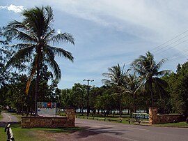
The Gardens is an inner suburb of the city of Darwin, Northern Territory, Australia. It is the traditional country and waterways of the Larrakia people.

<span class="mw-page-title-main">Ludmilla, Northern Territory</span> Suburb of Darwin, the Northern Territory, Australia

Ludmilla is a northern inner suburb of the city of Darwin, Northern Territory, Australia. It is the traditional country and waterways of the Larrakia people.

<span class="mw-page-title-main">Hidden Valley, Northern Territory</span> Suburb of Darwin, the Northern Territory, Australia

Hidden Valley is an eastern suburb in the city of Darwin, in the Northern Territory of Australia. It is the traditional country and waterways of the Larrakia people.

<span class="mw-page-title-main">Jingili, Northern Territory</span> Suburb of Darwin, the Northern Territory, Australia

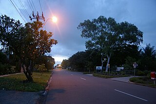
Jingili is a northern suburb of the city of Darwin, Northern Territory, Australia. It is the traditional country and waterways of the Larrakia people.

<span class="mw-page-title-main">Lyons, Northern Territory</span> Suburb of Darwin, the Northern Territory, Australia

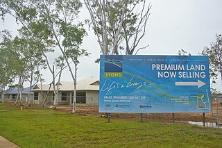
Lyons is a northern suburb of the city of Darwin, Northern Territory, Australia. It is the traditional lands and waterways of the Larrakia people.

<span class="mw-page-title-main">Stuart Park, Northern Territory</span> Suburb of Darwin, the Northern Territory, Australia

Stuart Park is an inner suburb of the city of Darwin, Northern Territory, Australia. It is the traditional country and waterways of the Larrakia people.

<span class="mw-page-title-main">Leanyer, Northern Territory</span> Suburb of Darwin, the Northern Territory, Australia

Leanyer is a northern suburb of Darwin, Northern Territory, Australia.

<span class="mw-page-title-main">Winnellie, Northern Territory</span> Suburb of Darwin, the Northern Territory, Australia

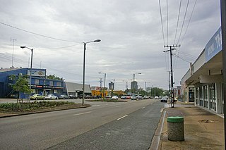
Winnellie is a northern suburb of Darwin in the Northern Territory of Australia. It is the traditional country and waterways of the Larrakia people.

<span class="mw-page-title-main">Darwin central business district</span> Suburb of Darwin, the Northern Territory, Australia

Darwin City is a suburb in metropolitan Darwin which comprises the original settlement, the central business district, parkland and other built-up areas. It is the traditional country and waterways of the Larrakia people. It is original site of occupation and includes many of the city's important institutions and landmarks, such as Parliament, Government House, the Northern Territory Supreme Court, Bicentennial Park and the George Brown Darwin Botanic Gardens. The city centre is located in the local government areas of the City of Darwin and the Darwin Waterfront Precinct.

Buffalo Creek is a northern suburb of the city of Darwin, Northern Territory, Australia. It is the traditional country and waterways of the Larrakia people.

<span class="mw-page-title-main">Charles Darwin, Northern Territory</span> Suburb of Darwin, the Northern Territory, Australia

Charles Darwin is an eastern suburb in the city of Darwin, in the Northern Territory of Australia. It is the traditional Country and waterways of the Larrakia people.

<span class="mw-page-title-main">Eaton, Northern Territory</span> Suburb of City of Darwin, the Northern Territory, Australia

Eaton is a suburb in the Northern Territory of Australia located in the city of Darwin. It is the traditional country and waterways of the Larrakia people.

Holmes is a suburb in the Northern Territory of Australia located in Darwin. It is on the traditional Country and waterways of the Larrakia people.

East Arm is a suburb in the Northern Territory of Australia located in Darwin about 8 kilometres (5.0 mi) east of Darwin City overlooking a part of Darwin Harbour known as the East Arm. It is the traditional land and waterways of the Larrakia people.

References

  1. Australian Bureau of Statistics (27 June 2017). "East Point (State Suburb)". 2016 Census QuickStats. Retrieved 28 June 2017. OOjs UI icon edit-ltr-progressive.svg
  2. "East Point". NT Atlas and Spatial Data Directory. Northern Territory Government. Retrieved 30 April 2019.
  3. "Darwin City Council Suburbs" (PDF). Place Names Committee. Northern Territory Government. Archived from the original (PDF) on 18 March 2019. Retrieved 30 April 2019.
  4. "Place Names Register Extract for "East Point" (Suburb)". NT Place Names Register. Northern Territory Government. Retrieved 26 March 2019.
  5. "The Larrakia People". Larrakia Nation. 31 March 2023. Retrieved 1 December 2023.
  6. Australian Bureau of Statistics (27 June 2017). "East Point (SSC)". 2016 Census QuickStats. Retrieved 27 April 2022. OOjs UI icon edit-ltr-progressive.svg