
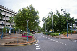
Darwin is the capital city of the Northern Territory, Australia. With an estimated population of 147,255 as of 2019, the city contains the majority of the residents of the sparsely populated Northern Territory.

Humpty Doo is a small town in Australia's Northern Territory, situated just south of the Arnhem Highway, approximately 40 km from Darwin. At the 2016 census, Humpty Doo had a population of 4,313 people. Its local government area is Litchfield Municipality. The town is a popular stopping point for tourists travelling between Darwin and Kakadu National Park, and boasts many attractions of its own. The main industries are agriculture and tourism; however, most residents commute to Darwin or Palmerston for work, and many regard it as a dormitory town.
Palmerston is a planned satellite city of Darwin, the capital and largest city in Australia's Northern Territory. The city is situated approximately 20 kilometres from Darwin and 10 kilometres from Howard Springs and the surrounding rural areas. Palmerston had a population of 33,695 at the 2016 census, making it the second largest city in the Northern Territory.
Casuarina is one of the northern suburbs of Darwin, the capital of the Northern Territory of Australia.
Larrakeyah is an inner suburb of Darwin, the capital city of Australia's Northern Territory. It was one of the first parts of the city to be developed, and borders the Darwin Central Business District. At the 2016 Census, there were 3,729 people in Larrakeyah. 54.9% of people were born in Australia. The next most common countries of birth were England 4.3%, Philippines 4.0% and New Zealand 2.7%. 66.0% of people spoke only English at home. The most common responses for religion were No Religion 31.8% and Catholic 23.5%. The suburb is located within the federal electorate of Solomon and the territory electorate of Port Darwin.
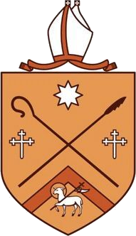
The Anglican Diocese of the Northern Territory covers Australia's Northern Territory and is part of the Province of Queensland in the Anglican Church of Australia.

Wagaman is a suburb of the Australian city of Darwin, Northern Territory. It lies in the band of locations known as the northern suburbs. An established residential area, Wagaman is bounded by Vanderlin Drive in the north, Lee Point Road in the east, Parer Drive in the south and Trower Road in the west; these confines correspond to the neighbouring suburbs of Alawa, Moil, Anula, Wanguri and Casuarina.

Gunn is an inner-city suburb of Palmerston, Northern Territory, Australia. It is 23 km southeast of the Darwin CBD. Its local government area is the City of Palmerston. Gunn is bounded to the north by the Temple Tce and Roystonea Ave, to the west is Chung Wah Terrace, and to the south is Lambrick Ave and East is Roystonea Ave. The suburb is mostly composed of developments from the 2000s to 2010s after Cyclone Tracy struck Darwin in 1974.

Rapid Creek is both a creek in the city of Darwin, Northern Territory, Australia and the name of a suburb north of the city, situated where the creek empties into Darwin Harbour.

Alawa is a northern suburb of the city of Darwin, Northern Territory, Australia. It is bounded by Trower and Dripstone Roads, Lakeside Drive and the Rapid Creek. It is in the local government area of City of Darwin.

Berrimah is an eastern suburb in the city of Darwin, in the Northern Territory of Australia.

Jingili is a northern suburb of the city of Darwin, Northern Territory, Australia.

Moil is a northern suburb of the city of Darwin, Northern Territory, Australia.

The Royal Darwin Hospital (RDH) is a 360-bed Australian teaching hospital located in Tiwi, a northern suburb of Darwin, Northern Territory. It is part of the Top End Health Service, which covers an area of 475,338 km2 (183,529 sq mi). RDH is the only tertiary referral hospital in the Northern Territory, also providing complex, high-level clinical services for patients in parts of Western Australia and Southeast Asia. Following the 2002 Bali bombings, the National Critical Care and Trauma Response Centre was established by the Australian Government, bolstering Royal Darwin Hospital's capacity to respond to trauma and support deployed medical assistance teams during crises and medical emergencies in the Asia-Pacific.
Leanyer is a northern suburb of Darwin, in the Northern Territory of Australia.

Wulagi is a Northern suburb of Darwin, Northern Territory, in the Northern Territory of Australia.
Driver is an inner-city suburb of Palmerston. It is 23 km SE of the Darwin CBD. Its Local Government Area is the City of Palmerston. Durack is bounded to the north by University Ave, to the west Elrundie Avenue, to the east Temple Terrace and to the south Tilston Avenue. The suburb is mostly composed of developments from the early 1980s.

Wagait Beach is a locality approximately 8 km west of Darwin, on the opposite side of the harbour. It makes up the Wagait Shire local government area. The population was 461 in 2016. Wagait Beach is not part of Darwin, but many of its residents use the Mandorah ferry to travel to work in Darwin.
Bees Creek is an outer rural area of Darwin, Northern Territory, Australia. It is 33 km southeast of the Darwin central business district. It is the council seat of the local government area of the Litchfield Municipality, although most council facilities, public amenities and the actual Municipal offices are in the neighbouring locality of Freds Pass. Bees Creek is mostly rural, with large residential blocks often not served by town sewers or sealed roads. Nevertheless, the area is popular with those wishing to enjoy a rural lifestyle within an easy commuting distance of the city.

Coolalinga is an outer suburban area in Darwin. It is 29 kilometres (18 mi) south east of Darwin, 10 kilometres (6.2 mi) south east of Palmerston and 6 kilometres (3.7 mi) east of the proposed city of Weddell. Its Local Government Area is the Litchfield Municipality. The name was first used by Len Cant for his store and caravan park on the Stuart Highway. Since Coolalinga Store, the area has become an important commercial centre for the Shire.

