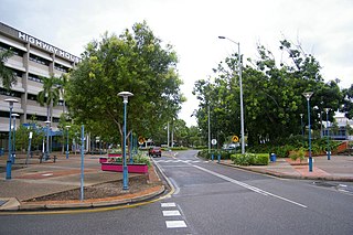
Palmerston is a planned satellite city of Darwin, the capital and largest city of Australia's Northern Territory. The city is situated approximately 20 kilometres from Darwin and 10 kilometres from Howard Springs and the surrounding rural areas. Palmerston had a population of 33,695 at the 2016 census, making it the second largest city in the Northern Territory.

Wagaman is a suburb of the Australian city of Darwin, Northern Territory. It lies in the band of locations known as the northern suburbs. It is on the traditional Country and waterways of the Larrakia people. An established residential area, Wagaman is bounded by Vanderlin Drive in the north, Lee Point Road in the east, Parer Drive in the south and Trower Road in the west; these confines correspond to the neighbouring suburbs of Alawa, Moil, Anula, Wanguri and Casuarina.

The City of Darwin is a local government area of the Northern Territory, Australia. It includes the central business district of the capital, Darwin City, and represents two-thirds of its metropolitan population. Located on the traditional land and waterways of the Larrakia people, the city now covers an area of 111 square kilometres (43 sq mi) and, in June 2018, had a population of 84,613 people.

Tiwi is a northern suburb of the city of Darwin, Northern Territory, Australia. The suburb is bounded by Trower Road, Henbury Avenue and a coastal strip, separating Casuarina Beach and Lee Point Beach. It is in the Local Government Area of City of Darwin. It is home to Dripstone Middle School.

Gunn is an inner-city suburb of Palmerston, Northern Territory, Australia. It is 23 km southeast of the Darwin CBD. Its local government area is the City of Palmerston. It is located on the traditional Country and waterways of the Larrakia people.

Rapid Creek refers to both a creek in the city of Darwin, Northern Territory, Australia and the name of a suburb north of the city, situated where the creek meets Darwin Harbour. It is the traditional country and waterways of the Larrakia people.

Alawa is a northern suburb of the city of Darwin, Northern Territory, Australia. It is bounded by Trower and Dripstone Roads, Lakeside Drive and the Rapid Creek in the local government area of City of Darwin. It is the traditional country and waterways of the Larrakia people.

Coconut Grove is a northern suburb of the city of Darwin, Northern Territory, Australia within the local government area of City of Darwin. It is the traditional country and waterways of the Larrakia people.

The Gardens is an inner suburb of the city of Darwin, Northern Territory, Australia. It is the traditional country and waterways of the Larrakia people.

Ludmilla is a northern inner suburb of the city of Darwin, Northern Territory, Australia. It is the traditional country and waterways of the Larrakia people.

Jingili is a northern suburb of the city of Darwin, Northern Territory, Australia. It is the traditional country and waterways of the Larrakia people.
Leanyer is a northern suburb of Darwin, Northern Territory, Australia.

Wulagi is a Northern suburb of Darwin, Northern Territory, in the Northern Territory of Australia.

Archer is a relatively new and still sparsely populated suburb in the southwestern part of Palmerston. It is 25 km SE of the Darwin CBD and 5.4 km from Palmerston City. It is on the traditional Country and waterways of the Larrakia people. Its local government area is the City of Palmerston. Archer is the largest suburb of Palmerston by area.

Farrar is an outer eastern suburb of Palmerston. It is 21 km SE of the Darwin CBD. Its Local Government Area is the City of Palmerston. Farrar is bounded to the north and east by the Stuart Highway, to the west Roystonea Avenue. Farrar was originally part of Gunn when Palmerston was divided into suburbs in 1984. It is on the traditional Country and waterways of the Larrakia people.
Marlow Lagoon is an outer western suburb of Palmerston 24 km SE of the Darwin CBD. Its local government area is the City of Palmerston. Marlow Lagoon is bounded to the west by the Adelaide-Darwin Railway, and to the east by Elrundie Ave. It is on the traditional Country and waterways of the Larrakia people.
Bees Creek is an outer rural area of Darwin, Northern Territory, Australia. It is 33 km southeast of the Darwin central business district. It is the council seat of the local government area of the Litchfield Municipality, although most council facilities, public amenities and the actual Municipal offices are in the neighbouring locality of Freds Pass. Bees Creek is mostly rural, with large residential blocks often not served by town sewers or sealed roads. Nevertheless, the area is popular with those wishing to enjoy a rural lifestyle within an easy commuting distance of the city.

Coolalinga is an outer suburban area in Darwin. It is 29 kilometres (18 mi) south east of central Darwin, 10 kilometres (6 mi) south east of Palmerston and 6 kilometres (4 mi) east of the proposed city of Weddell. Its Local Government Area is the Litchfield Municipality. The name was first used by Len Cant for his store and caravan park on the Stuart Highway. Since Coolalinga Store, the area has become an important commercial centre for the Shire.

Yarrawonga is an outer northern suburb of Palmerston. It is on the traditional Country and waterways of the Larrakia people.

Pinelands is an outer northern suburb of Palmerston, Northern Territory, Australia. It is 21 km southeast of the Darwin CBD and 2.1 km from Palmerston City. Its local government area is the City of Palmerston. It is on the traditional Country and waterways of the Larrakia people.


