Timaru is a port city in the southern Canterbury Region of New Zealand, located 157 km (98 mi) southwest of Christchurch and about 196 km (122 mi) northeast of Dunedin on the eastern Pacific coast of the South Island. The Timaru urban area is home to 28,900 people, and is the largest urban area in South Canterbury, and the third-largest in the Canterbury Region overall, after Christchurch and Rolleston. The town is the seat of the Timaru District, which includes the surrounding rural area and the towns of Geraldine, Pleasant Point and Temuka, which combined have a total population of 48,900.

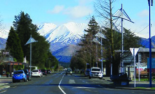
Fairlie is a Mackenzie District service town located in the Canterbury region of the South Island of New Zealand. The estimated population was 950 as of June 2023. Being on state highway 8 between Christchurch and Queenstown, tourism is fast becoming a major industry within the town. Kimbell is 8 km west of Fairlie via state highway 8. Geraldine is 45 km east via state highway 79 and Timaru is 58 km southeast of Fairlie via state highway 8. Fairlie sits at an altitude of 301 metres above sea level.

Twizel is the largest town in the Mackenzie District, in the Canterbury Region of the South Island of New Zealand. The town was founded in 1968 to house construction workers on the Upper Waitaki Hydroelectric Scheme. Today, Twizel is a service and tourist town for visitors to the area. It has a resident population of 1,850 ; during the summer, holidaymakers nearly triple the town's population.
Methven is a small town in the Canterbury region of the South Island of New Zealand. It is located near the western edge of the Canterbury Plains, 35 km (22 mi) north of Ashburton and 95 km (59 mi) west of Christchurch, and at an elevation of 320 m (1,050 ft). The town is a service centre for agriculture in the surrounding area, and is a base for skiing at the nearby Mount Hutt skifield. The town slogan is "Amazing Space".

Mount Cook Village, officially Aoraki / Mount Cook, is located within New Zealand's Aoraki / Mount Cook National Park at the end of State Highway 80, only 15 kilometres (9.3 mi) south of the summit of the country's highest mountain, also called Aoraki / Mount Cook, in the Southern Alps.

The Rangitata River is one of the braided rivers of the Canterbury Plains in southern New Zealand. It flows southeast for 120 kilometres (75 mi) from the Southern Alps, entering the Pacific Ocean 30 kilometres (19 mi) northeast of Timaru. The river has a catchment area of 1,773 square kilometres (685 sq mi), and a mean annual flow of 95 cubic metres per second (3,400 cu ft/s) at Klondyke.
Western Springs is a residential suburb in the city of Auckland in the north of New Zealand. It is located four kilometres to the west of the city centre, Auckland CBD. The park is situated to the north of State Highway 16 and the residential suburb is located southeast of the park on the opposite side of State Highway 16.

Mackenzie District is a local government district on New Zealand's South Island, administered by the Mackenzie District Council. It is part of the larger Canterbury Region. The region takes its name from the Mackenzie Basin, an elliptical intermontane basin which covers much of inland Canterbury.
Mt Evelyn Aqueduct was a former feature of the Melbourne water supply infrastructure that was built by the Melbourne and Metropolitan Board of Works The O'Shannassy Water Supply. Where the aqueduct crossed the lower lying areas around Wandin and approaching Mount Evelyn, it was in steel or wood-stave piping, converting to open concrete-lined channel when the higher levels were reached. It went through the township of Mount Evelyn in open channel winding around the local contours to just above what is now Johns Crescent, then part of the 'Pine Mont Estate.'

Mitta Mitta is a small town in the Australian state of Victoria in the Mitta Mitta Valley. It stands on the Omeo Highway and is 415 km from Melbourne, and is located on the Mitta Mitta River not far from Dartmouth Dam. At the 2016 census, Mitta Mitta and the surrounding area had a population of 171.
The Fairlie Branch was a branch line railway in southern Canterbury which formed part of New Zealand's national railway network. Construction began in 1874, and at its farthest extent, it terminated just beyond Fairlie in Eversley. Its closure came in 1968, but a portion remains open in Pleasant Point as the Pleasant Point Museum and Railway.
Winscombe is a lightly populated locality in the southern part of the Canterbury region of New Zealand's South Island. It is situated inland from Timaru on State Highway 8 between Pleasant Point and Fairlie. It is located in a very rural setting.

The Goldfields Water Supply Scheme is a pipeline and dam project that delivers potable water from Mundaring Weir in Perth to communities in Western Australia's Eastern Goldfields, particularly Coolgardie and Kalgoorlie. The project was commissioned in 1896 and completed in 1903.

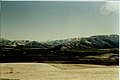
Burkes Pass is a mountain pass and at its base, a small town on State Highway 8 at the entrance to the Mackenzie Country in South Canterbury, New Zealand. It is named after Michael John Burke, a graduate of Trinity College Dublin, who drove a team of bullocks through the passageway which leads up into the Mackenzie Country in 1855. This was an alternative route to the Mackenzie Pass, which the notorious alleged sheep stealer, James Mckenzie, had used to take his sheep into the Otago goldfields. Burkes Pass separates the Two Thumb Range to the north from the Rollesby and Albury ranges to the south, and sits at an altitude of 709 metres (2,326 ft). A memorial to Burke stands close to the pass's saddle.

Lake Moawhango is a small artificial lake located with the New Zealand Army's Waiouru Military Camp. It is fed by the Mangaio Stream, boosted by tributaries diverted from the slopes of Mt Ruapehu, and by the Moawhango River. Water is taken from the lake for the Tongariro Power Scheme, feeding the Tongariro River via the Moawhango Tunnel, although some water is released to continue down the Moawhango River nearby the settlement of Moawhango. The lake is dammed at the southern end.

The Somerset Region is a local government area located in the West Moreton region of South East Queensland, Australia, northwest of the City of Brisbane. The region is centred on the town of Esk, which also serves as the council seat. Somerset was created in 2008 from a merger of the shires of Esk and Kilcoy, and is known as the Brisbane Valley, owing to the Brisbane River which courses through the region. However, significant parts of the region lie outside the hydrological Brisbane Valley.

Walka Water Works is a heritage-listed 19th-century pumping station at 55 Scobies Lane, Oakhampton Heights, City of Maitland, New South Wales, Australia. Originally built in 1887 to supply water to Newcastle and the lower Hunter Valley, it has since been restored and preserved and is part of Maitland City Council's Walka Recreation and Wildlife Reserve. It was added to the New South Wales State Heritage Register on 2 April 1999.
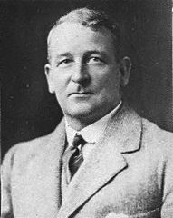
Thomas David Burnett was a New Zealand politician of the Reform Party, and joined the National Party after the 1935 election.

The Rangitata Diversion Race or RDR is a combined irrigation and power generation scheme that diverts water from the Rangitata River to irrigate over 66,000 hectares of farmland in Mid-Canterbury, New Zealand. The RDR project was the first major river diversion in New Zealand, and the largest irrigation scheme in the country. It was originally constructed by the Public Works Department between 1937 and 1944. The main canal is 67 km long, 10 m wide and 3 m deep.

The Tekapo A Power Station is a hydroelectric facility at the southern end of Lake Tekapo in the Mackenzie Basin, Canterbury, New Zealand. It is a short distance south of the township. The power station is owned and operated by Genesis Energy Limited.