Alexander, Manitoba

Last updated

Alexander
Canada Manitoba location map 2.svg
Red pog.svg
Alexander
Location of Alexander in Manitoba
Coordinates: 49°49′48″N100°17′43″W / 49.83000°N 100.29528°W / 49.83000; -100.29528
Country Flag of Canada (Pantone).svg  Canada
Province Flag of Manitoba.svg  Manitoba
Region Westman
Census Division No. 7
Government
   MP Larry Maguire (Brandon–Souris)
   MLA Grant Jackson (Spruce Woods)
Population
  Total321
Time zone UTC−6 (CST)
  Summer (DST) UTC−5 (CDT)
Postal Code
R0C 0E0
Area code 204

Alexander, Manitoba, is a local urban district [1] in the Rural Municipality of Whitehead, situated on Highway 1, west of Brandon.

Contents

The community's closest city is Brandon, Manitoba, and their school is part of the Brandon School Division. [2]

History

In 1882, the site was made a rail point on the Canadian Pacific Railway (CPR) and a post office was opened, initially known as Pulteney. [3] [4] Built as a small hotel, residence and store, with the central portion occupied by the post office, the structure was built by the community's first postmaster, James Frederick Walker, whose family provided postal services to the community until 1949. [5] [6]

The site was renamed Alexander Station in 1885, which was shortened to Alexander in 1891. [4] There are two main explanations for the current name. First is that the name was selected by the CPR after an early settler named Alexander Speers. The other explanation is that it got its name from the first Canadian Prime Minister John A. Macdonald's middle name. [4]

Around 1916, a wooden grain elevator at Alexander was opened and operated by Paterson Grain. Traded to Manitoba Pool Elevators in mid-1988, it was destroyed by fire on 10 September 1990. [7]

On 23 July 1922, a monument was unveiled by the Alexander branch of the Imperial Order Daughters of the Empire in commemoration of people from the local area killed during military service. [8]

Today, the Alexander Post Office was one of the oldest privately owned post offices in continuous use in Manitoba. It became a municipally-designated historic site in 1993. [5] Later in 2023 the Alexander Post Office was demolished and replaced with a home.

Religion

The first Anglican church services at Alexander were held between 1884 and 1887 in the waiting room of the CPR station, after which they used the local Presbyterian church. A dedicated wood-frame church building was constructed in 1900. Services were held until October 1974 and a fieldstone cairn in front of the church building was installed in 1975. The building was turned over to the Diocese of Brandon in May 1978 and it was eventually renovated into a private residence. [9]

A church was built in Alexander for a Presbyterian congregation in 1889. In 1919, the congregation merged with that of the local Methodist church to form a United church (known as Union church until 1925); the Presbyterian building continued to be used for services while the Methodist building was sold for use as a Masonic lodge. [10]

School

The Alexander School District was formally established in October 1884, with the first 18-by-26-foot (5.5 m × 7.9 m) schoolhouse being built in 1886 on the south side of the railway at a cost of $600. [11]

Due to growing student enrollment, a second classroom was constructed in 1892. It was a three-room brick veneer building, built at a cost of $2,930. Ten years later, a two-storey brick building was erected. [11]

In 1945, Alexander School gained more students as the nearby Dalton School and Assiniboine School closed. In 1960, high school students were bused to Brandon, leaving only students in grades 1 to 8 at Alexander. In 1967, the Alexander School District became part of the Brandon School Division. The two-storey school was demolished sometime in the 1980s. [11]

Demographics

In the 2021 Census of Population conducted by Statistics Canada, Alexander had a population of 321 living in 119 of its 131 total private dwellings, a change of

Related Research Articles

Neelin is a small community in the Canadian province of Manitoba. It is located on Manitoba Provincial Highway 5 in the Rural Municipality of Argyle, about 29 km east of Killarney, or about 200 km southwest of Winnipeg.

<span class="mw-page-title-main">St. John's College, Manitoba</span>

St. John's College is an Anglican-based independent constituent college of the University of Manitoba, located on the university's Fort Garry campus in Winnipeg, Manitoba.

<span class="mw-page-title-main">Charleswood, Winnipeg</span> Suburb of Winnipeg

Charleswood is a residential community and neighbourhood in Winnipeg, Manitoba, Canada. It is located in the South-West of the city and is bordered by the neighbourhoods Tuxedo to the East, Fort Whyte to the South, and the Rural Municipality of Headingley on the West. It's boundaries are Roblin and the Assiniboine River to the north, Shaftesbury Boulevard on the East, Wilkes Avenue to the South and the Perimeter Highway to the West.

<span class="mw-page-title-main">Winnipegosis</span> Unincorporated urban community in Manitoba, Canada

Winnipegosis is an unincorporated urban community in the Rural Municipality of Mossey River, Manitoba, Canada. It lies at the mouth of the Mossey River on Lake Winnipegosis in west-central Manitoba.

<span class="mw-page-title-main">Killarney, Manitoba</span> Unincorporated in Manitoba, Canada

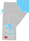
Killarney is an unincorporated community in southwestern Manitoba, Canada, at the corner of Manitoba Provincial Trunk Highways 3 and 18.

Ashern is a local urban district located in the Municipality of West Interlake in Manitoba's Interlake Region.

Lundar is a local urban district in the Rural Municipality of Coldwell, Manitoba, Canada. Located in Manitoba's Interlake Region, it is situated 99 km (62 mi) north of Winnipeg on Highway 6.

<span class="mw-page-title-main">Wesley College (Manitoba)</span>

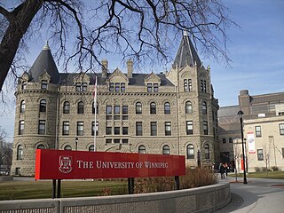
Wesley College was a college that existed in Winnipeg, Manitoba, Canada, from 1888 to 1938. In 1924, Wesley College became part of the United Church of Canada. It was one of the University of Winnipeg's founding colleges.

<span class="mw-page-title-main">Rural Municipality of St. Clements</span> Rural municipality in Manitoba, Canada

St. Clements is a rural municipality (RM) in Manitoba, Canada. It is located to the north-east of Winnipeg, stretching from East St. Paul and Birds Hill Provincial Park in the south to Lake Winnipeg and Grand Beach Provincial Park to the north. The Red River demarcates the western boundary of the municipality. St. Clements contains the communities of East Selkirk, and Lockport east of the Red River. It almost completely surrounds the Brokenhead 4 Indian reserve, with the exception of a small lakefront on Lake Winnipeg.

<span class="mw-page-title-main">Riverton, Manitoba</span> Place in Manitoba, Canada

Riverton is an unincorporated urban community in the Municipality of Bifrost-Riverton within the Canadian province of Manitoba.

<span class="mw-page-title-main">Warren, Manitoba</span> Unincorporated Community in Manitoba, Canada

Warren is an unincorporated community recognized as a local urban district 26.3 kilometres north-west of Winnipeg, Manitoba. It is located in the Rural Municipality of Woodlands.

Bernice is an unincorporated place in the Municipality of Two Borders, 115 kilometres (71 mi) south-west of Brandon, Manitoba, Canada.

Woodlands is an unincorporated community in the Rural Municipality of Woodlands in the Interlake Region of Manitoba, Canada. It is located approximately 40 kilometres north-west of Winnipeg.

St. François Xavier is an unincorporated urban centre located in the Rural Municipality of St. François Xavier, Manitoba, Canada. It is located about 15 km west of the city of Winnipeg on the Assiniboine River.

<span class="mw-page-title-main">Municipality of Bifrost-Riverton</span> Rural municipality in Manitoba, Canada

The Municipality of Bifrost-Riverton is a rural municipality (RM) in the Canadian province of Manitoba, and is one of the northernmost rural municipalities in the Interlake Region.

Sarto is an unincorporated community in Manitoba, Canada, within the Rural Municipality of Hanover. The community is centred on PR 205, 7.5 kilometres west of Grunthal and 16 kilometres south-west of Steinbach.

Gordon is an unincorporated community in Manitoba, Canada, within the Rural Municipality of Rosser. The community is centred on PTH 6, approximately 3.5 kilometres north-west of Winnipeg and 9.5 kilometres south-east of Grosse Isle. It is named for James Gordon, who was in charge of leases in the General Manager's Office of the Canadian National Railway.

Roseland, Manitoba is an historical district located in the Canadian province of Manitoba. It is located just west of Manitoba Provincial Highway 10, in the Rural Municipalities of Whitehead and Cornwallis.

References

  1. "Local Urban Districts Regulation". Government of Manitoba. April 23, 2016. Retrieved April 24, 2016.
  2. "Alexander School". www.bsd.ca. Retrieved September 3, 2023.
  3. "Alexander Post Office". www.rmofwhitehead.ca. Retrieved September 3, 2023.
  4. 1 2 3 "Manitoba Communities: Alexander (Unincorporated Village)". www.mhs.mb.ca. Retrieved September 3, 2023.
  5. 1 2 "Historic Sites of Manitoba: Alexander Post Office (Alexander, RM of Whitehead)". www.mhs.mb.ca. Retrieved September 3, 2023.
  6. "Manitoba Municipal Heritage Site No. 97 - Alexander Post Office | Municipal Heritage Sites | Historic Resources Branch". gov.mb.ca. Retrieved September 3, 2023.
  7. "Historic Sites of Manitoba: Paterson Grain Elevator (Alexander, RM of Whitehead)". www.mhs.mb.ca. Retrieved September 3, 2023.
  8. "Historic Sites of Manitoba: Alexander War Memorial (Alexander, RM of Whitehead)". www.mhs.mb.ca. Retrieved September 3, 2023.
  9. "Historic Sites of Manitoba: St. Paul's Anglican Church (Alexander, RM of Whitehead)". www.mhs.mb.ca. Retrieved September 3, 2023.
  10. "Historic Sites of Manitoba: Alexander Presbyterian Church / Alexander United Church (Alexander, RM of Whitehead)". www.mhs.mb.ca. Retrieved September 3, 2023.
  11. 1 2 3 "Historic Sites of Manitoba: Alexander School No. 338 (Alexander, RM of Whitehead)". www.mhs.mb.ca. Retrieved September 3, 2023.
  12. "Population and dwelling counts: Canada and designated places". Statistics Canada. February 9, 2022. Retrieved September 3, 2022.

Further reading