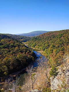
Arab is an unincorporated community in southern Bollinger County, Missouri, United States. It is located about four miles south of Zalma and 12 miles north of Puxico on at the intersection of Highway 51 with Highway C and Highway P, twenty miles northwest of Dexter. The community was founded in 1908 and receives its name from the city of Arab, Alabama. Like that city, the name of the community is pronounced "AY-rab".
Goose Creek is a stream in northern Wayne and southern Iron counties in the U.S. state of Missouri. It is a tributary of Big Creek.
Knob Creek is a stream in Iron and St. Francois counties in the U.S. state of Missouri. It is a tributary of Stouts Creek.
Shut-in Creek is a stream in Iron and Reynolds Counties in the U.S. state of Missouri. It is a tributary of Imboden Fork.
Vail Mountain is a summit in Iron County in the U.S. state of Missouri. The summit has an elevation of 1,404 feet (428 m). Vail Mountain lies to the east of Russell Mountain and the road to the summit of Taum Sauk Mountain passes just west of the summit of Vail Mountain. Routes 21 and 72 traverse the south spur of the mountain before heading south through Royal Gorge. The summit is about 3 miles (4.8 km) southwest of Arcadia and Ironton.

Black Mountain is a summit in western Madison County in the U.S. state of Missouri. The peak has an elevation of 1,503 feet (458 m). The St. Francis River flows past the east side of the mountain at an elevation of about 560 feet. Missouri Route E passes the east and south side of the mountain. The community of French Mills lies adjacent to the St. Francis just to the south of the mountain.
Tin Mine Mountain is a summit in Madison County in the U.S. state of Missouri. It has an elevation of 1,115 feet (340 m).
Bain Hill is a summit in St. Francois County, Missouri. It has a peak elevation of 1,106 feet (337 m). The hill rises to the east of and about 200 feet above the Little St. Francis River. Knob Lick lies about four miles to the west and Mine La Motte is about five miles to the south in Madison County.
Oak Mountain is a summit in the southwestern corner of St. Francois County in the U.S. state of Missouri. The summit has an elevation of 1,631 feet (497 m). The peak is on a north-south trending ridge that extends south into Iron County and the city of Pilot Knob lies just southwest of the mountain. The community of Middlebrook is to the northwest and Iron Mountain Lake is to the north. The source area of Knob Creek is on the west flank of the mountain.
Pine Mountain is a summit in St. Francois County in the U.S. state of Missouri. The summit has an elevation of 1,499 feet (457 m). The mountain is about 3.5 miles south of Bismarck along Missouri Route N. The peak rises just south of the confluence of Indian Creek with the St. Francis River.
Tetley Hill is a summit in St. Francois County in the U.S. state of Missouri. It has an elevation of 984 feet (300 m). The hill is at the southeast end of a ridge between the St. Francis River to the east and Doe Run Creek to the west. Route H passes the north and east side of the hill and route AA crosses the ridge northwest of the peak. Farmington is about four miles to the north and Doe Run is about four miles to the northwest.
Clark Mountain is a summit in northwest Wayne County in the U.S. state of Missouri. The summit rises to an elevation of 1,440 feet (440 m). The mountain is located northeast of Piedmont and due west of Patterson. Missouri Route 34 passes by the south side of the mountain and Missouri Route 49 is to the west.
Finleys Mountains is an area in Wayne County in the U.S. state of Missouri. The elevation of the location is 663 feet (202 m). The location is along Greasy Creek about two miles north of Piedmont and US Geological Survey maps show no mountain at the location.
Flynn Hill is a summit in Wayne County in the U.S. state of Missouri. It has a peak elevation of 584 feet (178 m). The peak is juat west of Missouri Route B about three miles southeast of Greenville. Wappapello Lake on the St. Francis River lies about one-half mile to the southwest.
Grassy Mountain is a summit in northwest Wayne County in the U.S. state of Missouri. The peak has an elevation of 991 feet (302 m). The peak lies just to the northwest of Clark Mountain. Gads Hill lies about two miles to the north-northwest along Missouri Route 49. Piedmont lies to the southwest.
Gray Mountain is a summit in the northwestern of Wayne County in the U.S. state of Missouri. Gray Mountain has an elevation of 722 feet (220 m). Gray Mountain lies above the St. Francis River to the southeast. The taller Graves Mountain lies just to the northwest and extends into Madison County south of Beulah. Graves Mountain State Forest includes portions of Gray Mountain. Missouri Route 143 passes by to the west.
Logan Creek is a stream in Wayne County in the U.S. state of Missouri. It is a tributary of the St. Francis River.
Wilkinson Mountain is a summit in northern Wayne County in the U.S. state of Missouri. The peak has an elevation of 735 feet (224 m). The peak lies south of Coldwater and U.S. Route 67 passes to the northwest.
Lead Hill is a peak in southwestern Wright County in the Ozarks of southern Missouri. The peak has an elevation of 1,744 feet (532 m).


