
St. Louis County is located in the eastern-central portion of Missouri. It is bounded by the City of St. Louis and the Mississippi River to the east, the Missouri River to the north, and the Meramec River to the south. At the 2020 census, the total population was 1,004,125, making it the most populous county in Missouri. Its county seat is Clayton. The county is included in the St. Louis, MO–IL metropolitan statistical area.

Phelps County is a county in the central portion of the U.S. state of Missouri. As of the 2020 United States Census, the population was 44,638. The largest city and county seat is Rolla. The county was organized on November 13, 1857, and was named for U.S. Representative and Governor of Missouri John Smith Phelps.

Daviess County is a county located in the U.S. state of Missouri. As of the 2020 census, the population was 8,430. Its county seat is Gallatin. The county was organized December 29, 1836, from Ray County and named for Major Joseph Hamilton Daveiss, a soldier from Kentucky who was killed in 1811 at the Battle of Tippecanoe.
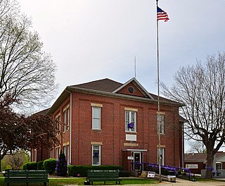
Bollinger County is a county located in the southeastern part of the U.S. state of Missouri. As of the 2020 census, the county's population was 10,567. The county seat, largest and only city, is Marble Hill. The largely rural county is supported by agriculture and construction. The county was officially organized in March 1851 from portions of Wayne, Cape Girardeau and Stoddard Counties, and named in honor of George Frederick Bollinger, an early settler.

Madison County is a county in the U.S. state of Illinois. It is a part of the Metro East in southern Illinois. According to the 2020 census, it had a population of 264,776, making it the eighth-most populous county in Illinois and the most populous in the southern portion of the state. The county seat is Edwardsville, and the largest city is Granite City.

Southern Illinois is a region of the U.S. state of Illinois comprising the southern third of the state, principally south of Interstate 70. Part of downstate Illinois, it is bordered by the two most voluminous rivers in the United States: the Mississippi below its connection with the Missouri River to the west and the Ohio River to the east and south, with the Wabash as a tributary. Some areas of Southern Illinois are known historically as Little Egypt.
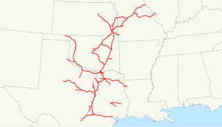
The Missouri–Kansas–Texas Railroad was a Class I railroad company in the United States, with its last headquarters in Dallas, Texas. Established in 1865 under the name Union Pacific Railroad (UP), Southern Branch, it came to serve an extensive rail network in Texas, Oklahoma, Kansas, and Missouri. In 1988, it merged with the Missouri Pacific Railroad; today, it is part of UP.

The James–Younger Gang was a notable 19th-century gang of American outlaws that revolved around Jesse James and his brother Frank James. The gang was based in the state of Missouri, the home of most of the members.

Thomas Coleman Younger was an American Confederate guerrilla during the American Civil War and later an outlaw leader with the James–Younger Gang. He was the elder brother of Jim, John and Bob Younger, who were also members of the gang.
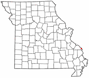
Wittenberg is an unincorporated community in Brazeau Township in eastern Perry County, Missouri, United States. It is located on the Mississippi River, 14 miles (23 km) southeast of Perryville. Wittenberg is situated in the Brazeau Bottoms on Brazeau Creek opposite Grand Tower, Illinois, and Tower Rock, the latter a landmark island in the Mississippi River.

Lutesville was a city in Bollinger County, Missouri, United States. It was adjacent to and southwest of Marble Hill on Route 51 and Route 34. Crooked Creek flows between Lutesville and Marble Hill and Opossum Creek flows past to the south.
The Centralia Massacre was an incident during the American Civil War in which 24 unarmed U.S. Army soldiers were captured and executed in Centralia, Missouri on September 27, 1864, by a band led by the pro-Confederate guerrilla leader William T. Anderson. Future outlaw Jesse James was among the guerrillas.
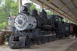
The St. Louis, Iron Mountain and Southern Railway, commonly known as the Iron Mountain, was an American railway company that operated from 1856 until 1917 when it was merged into the Missouri Pacific Railroad.
The Reno Gang, also known as the Reno Brothers Gang and The Jackson Thieves, were a group of criminals that operated in the Midwestern United States during and just after the American Civil War. Though short-lived, the gang carried out the first three peacetime train robberies in U.S. history. Most of the stolen money was never recovered.
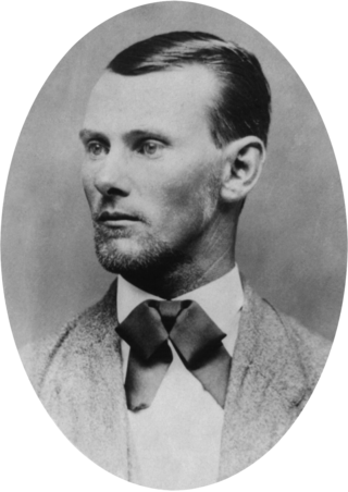
Jesse Woodson James was an American outlaw, bank and train robber, guerrilla and leader of the James–Younger Gang. Raised in the "Little Dixie" area of Western Missouri, James and his family maintained strong Southern sympathies. He and his brother Frank James joined pro-Confederate guerrillas known as "bushwhackers" operating in Missouri and Kansas during the American Civil War. As followers of William Quantrill and "Bloody Bill" Anderson, they were accused of committing atrocities against Union soldiers and civilian abolitionists, including the Centralia Massacre in 1864.

The Wabash Railroad was a Class I railroad that operated in the mid-central United States. It served a large area, including track in the states of Ohio, Indiana, Illinois, Iowa, Michigan, and Missouri and the province of Ontario. Its primary connections included Chicago, Illinois; Kansas City, Missouri; Detroit, Michigan; Buffalo, New York; St. Louis, Missouri; and Toledo, Ohio.

Aley Mountain is a summit in northwest Wayne County, Missouri. The mountain forms an arc shaped mountain mass with three distinct peaks. The western peak has an elevation of 1,184 feet (361 m) while the two peaks to the northeast are each above 1200 feet.
Ojibway is an extinct town in southern Wayne County, in the U.S. state of Missouri. The community location lies adjacent to the Otter Creek arm of Lake Wappapello approximately one mile from the end of Missouri Route PP. Previous to the formation of the lake the community was along Otter Creek and the St. Louis and San Francisco Railroad line just west of Chaonia.
Lewis Eldon Atherton (1905–1989) was an American historian and academic from Missouri. He taught at the University of Missouri in Columbia, Missouri, for over 30 years.
The Gads Hill Train Robbery was a crime committed by the James–Younger Gang in Gads Hill, Missouri. In January 1874, five members of the James–Younger gang robbed a train and stole $12,000 in cash. All five escaped.

