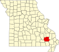
Ojibway is an extinct town in southern Wayne County, Missouri, United States. [1] The community location lies adjacent to the Otter Creek arm of Lake Wappapello approximately one mile from the end of Missouri Route PP. [2] Previous to the formation of the lake the community was along Otter Creek and the St. Louis and San Francisco Railroad line just west of Chaonia. [3]
Ojibway had its start as a town in 1888 when the railroad was extended near that point. [4] A post office called Ojibway was established in 1901, and remained in operation until 1940. [5] The community has the name of the Ojibway Indians. [4]
Chadwick is an unincorporated community in eastern Christian County, Missouri, United States. The total population of Chadwick Township per the 2020 census was 403. It is located approximately six miles southeast of Sparta along Missouri Route 125. The community of Oldfield is approximately three miles to the north along Route 125. It is part of the Springfield, Missouri Metropolitan Statistical Area. Its ZIP code is 65629.
Coldwater is an unincorporated community in northern Wayne County, Missouri, United States. It is located just east of U.S. Route 67, approximately seventeen miles south of Fredericktown and one mile south of the Madison-Wayne county line. The community is on Cedar Creek about three miles west of the St. Francis River.
Eaudevie is an extinct town in southern Christian County, in the U.S. state of Missouri. The community was located along the east bank of Bull Creek at 36°50′30″N93°10′59″W at an elevation of 900 feet. U.S. 65 passes two miles west of the location.
Medford is an unincorporated community in southern Johnson County in the U.S. state of Missouri.
Cornwall is an unincorporated community in eastern Madison County, in the U.S. state of Missouri.
Luna is an extinct town in Ozark County, in the U.S. state of Missouri. The GNIS classifies it as a populated place. The community is on a ridge between Bryant Creek to the east and Pine Creek to the west and is located on Missouri Route FF. Zanoni, on Missouri Route 181, lies approximately two miles to the northwest. The community church is one and one-half miles west on Caney Creek and Missouri Route AA. The Pine Creek confluence with Bryant Creek is one and one-quarter miles to the south, at the north end of Norfork Lake.
Boynton is an unincorporated community in Sullivan County, in the U.S. state of Missouri.
Adelbert is an extinct town in Washington County, in the U.S. state of Missouri. The site is adjacent to the Missouri Pacific Railroad line on the west side of Mill Creek and one mile north of Mineral Point and southeast of Fountain Farm. Cadet lies approximately two miles to the northeast on Missouri Route 47.
White is an extinct town in Washington County, in the U.S. state of Missouri. The community was located on Keyes Branch near its confluence with Mill Creek along the railroad line. Cadet lies one mile to the north and Mineral Point is 2.5 south-southeast of the location.
Barlow is an extinct town in Wayne County, in the U.S. state of Missouri. The community was on the railroad line along the east bank of the Black River between Leeper to the northwest and Williamsville to the southeast.
Chaonia is an extinct town in Wayne County, in the U.S. state of Missouri. The site was on the bank of the St. Francis River and is now within Lake Wappapello. The Chaonia Landing recreation area at the end of Missouri Route W is about one-half mile south of the original location. The Chaonia Cemetery is on a ridge one half mile east of the recreation area.
Gaylor is an unincorporated community in Wayne County, in the U.S. state of Missouri. The community was on the Black River south of Clearwater Lake approximately one mile north of Leeper.
Holliday Creek is a stream in Wayne County in the U.S. state of Missouri. It is a tributary to the St. Francis River within Lake Wappapello.
Hubble Creek is a stream in Wayne County in the U.S. state of Missouri. It is a tributary of the St. Francis River.
Keener Cave, Keener Cave Resort or Keener is a ghost town in southern Wayne County, in the U.S. state of Missouri. The GNIS classifies it as a populated place.
Kerrigan is a ghost town in southwest Wayne County, in the U.S. state of Missouri.
Ladero was an unincorporated community in southern Wayne County, in the U.S. state of Missouri. The community is on Otter Creek approximately one mile west of US Route 67 and the St. Francis River.
Lost Creek is a stream in Wayne County in the U.S. state of Missouri. It is a tributary of the St. Francis River.
Mingo Creek is a stream in Stoddard and Wayne counties in the U.S. state of Missouri. It is a tributary of St. Francis River.
Snow Creek is a stream in Wayne County in the U.S. state of Missouri. It is a tributary of the St. Francis River within Lake Wappapello.
36°58′24″N90°24′32″W / 36.9733859°N 90.4089996°W