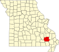
Ladero was an unincorporated community in southern Wayne County, in the U.S. state of Missouri. [1] The community is on Otter Creek approximately one mile west of US Route 67 and the St. Francis River. [2]
Ladero had its start when the railroad was extended to that point. [3] It is unknown why the name "Ladero" was applied to this community. [3]
Wayne County is a county located in the Ozark foothills in the U.S. state of Missouri. As of the 2020 census, the population was 10,974. The county seat is Greenville. The county was officially organized on December 11, 1818, and is named after General "Mad" Anthony Wayne, who served in the American Revolution. As of August 28, 2023, Wayne County is designated the UFO Capital of Missouri, along with the city of Piedmont.
Keeners is an unincorporated community in northern Butler County, in the U.S. state of Missouri. U.S. Route 67 passes approximately 1.5 mile to the southeast. The Missouri Pacific Railway passes the west side of the community along the Black River floodplain.
Lilly is an unincorporated community in Clinton County, in the U.S. state of Missouri.
Butts is an unincorporated community in eastern Crawford County, in the U.S. state of Missouri. The community is on the north side of Henpeck Hollow about one-half mile east of Courtois Creek. Access is via a county road from Missouri Route 8, approximately five miles east of Elayer. The location is within the Mark Twain National Forest and a campground is located on the Courtois River to the west of the site.
Cane Hollow is a valley in Douglas County in the Ozarks of southern Missouri.
Wrightsville is an unincorporated community in Dunklin County, in the U.S. state of Missouri. The community lies on County road 327 approximately 4.5 miles ESE of Campbell and 2.1 miles northwest of Clarkton.
Bem is an unincorporated community in Gasconade County, in the U.S. state of Missouri.
Milton is an unincorporated community in Randolph County, in the U.S. state of Missouri. An old variant name was "Firth".
Boschertown is an unincorporated community in St. Charles County, in the U.S. state of Missouri.
Palmer is an extinct town in southwestern Washington County, in the U.S. state of Missouri. The GNIS classifies it as a populated place. Palmer is located on the banks of Hazel Creek on Missouri Route Z. The area is within the Hazel Creek Recreation Area in the Mark Twain National Forest.
Bull Run Camp is an unincorporated community in Wayne County, in the U.S. state of Missouri.
Chaonia is an extinct town in Wayne County, in the U.S. state of Missouri. The site was on the bank of the St. Francis River and is now within Lake Wappapello. The Chaonia Landing recreation area at the end of Missouri Route W is about one-half mile south of the original location. The Chaonia Cemetery is on a ridge one half mile east of the recreation area.
Keener Cave, Keener Cave Resort or Keener is a ghost town in southern Wayne County, in the U.S. state of Missouri. The GNIS classifies it as a populated place.
Mingo Creek is a stream in Stoddard and Wayne counties in the U.S. state of Missouri. It is a tributary of St. Francis River.
Ojibway is an extinct town in southern Wayne County, in the U.S. state of Missouri. The community location lies adjacent to the Otter Creek arm of Lake Wappapello approximately one mile from the end of Missouri Route PP. Previous to the formation of the lake the community was along Otter Creek and the St. Louis and San Francisco Railroad line just west of Chaonia.
Taskee Station is an extinct town in Wayne County, in the U.S. state of Missouri.
Upalika is an extinct town in southwest Wayne County, in the U.S. state of Missouri. The GNIS classifies it as a populated place. The community is on County Road 426 five miles southwest of Williamsville and 5.5 miles east of Ellsinore in adjacent Carter County.
Black River Township is an inactive township in Wayne County, in the U.S. state of Missouri.
Mill Spring Township is an inactive township in Wayne County, in the U.S. state of Missouri.
Williams Township is an inactive township in Wayne County, in the U.S. state of Missouri.
36°59′45″N90°28′12″W / 36.99583°N 90.47000°W