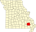
Silva, Missouri

Last updated

Silva
USA Missouri location map.svg
Red pog.svg
Silva
Location within the state of Missouri
Coordinates: 37°10′34″N90°27′49″W / 37.17611°N 90.46361°W / 37.17611; -90.46361
Country United States
State Missouri
County Wayne
Elevation
[1]
404 ft (123 m)
Time zone UTC-6 (Central (CST))
  Summer (DST) UTC-5 (CDT)
ZIP code
63964 [2]
Area code 573
GNIS feature ID752158 [1]

Silva is an unincorporated community in Wayne County, Missouri, United States.

Contents

History

A post office called Silva has been in operation since 1902. [3] An early postmaster gave the community the name of one of her acquaintances. [4]

Silva is home to Camp Lewallen, a Boy Scout Camp serving the Scouts of the Greater St. Louis Area Council. [5] It has a replica statue of the Strengthen the Arm of Liberty. [6]

Silva was struck by three tornadoes. The first one struck the town on May 21, 1957, hitting four farms, damaging other structures, and unroofing a few houses. [7] The second one struck on May 25, 2011. A camper, a mobile home, and several vehicles were destroyed, churches were damaged, and many roads were blocked by fallen trees. Two people were injured by one of those fallen trees. [8] In the 2011 Super Outbreak, it was also struck by an F1 tornado, which damaged the side of a church and downed several trees. [9]

Geography

Silva is located on U.S. Route 67 just south of Missouri Route 34, approximately thirteen miles east of Piedmont and three miles north of Greenville. The community is at the north end of Lake Wappapello and the St. Francis River flows past one mile to the west. Two tributaries of the St. Francis River, Bounds Creek and Hubble Creek, also flow through Silva. The community has access to Sam A. Baker State Park from the west. [10]

Education

Silva is served by the Greenville R-II School District in nearby Greenville. The community is also home to New Hope Christian Academy.

Related Research Articles

<span class="mw-page-title-main">Joplin, Missouri</span> City in Missouri, United States

Joplin is a city in Jasper and Newton counties in the southwestern corner of the U.S. state of Missouri. The bulk of the city is in Jasper County, while the southern portion is in Newton County. Joplin is the largest city located within both Jasper and Newton Counties – even though it is not the county seat of either county. With a population of 51,762 as of the 2020 census, Joplin is the 12th most-populous city in the state. The city covers an area of 35.69 square miles (92.41 km2) on the outer edge of the Ozark Mountains. Joplin is the main hub of the three-county Joplin-Miami, Missouri-Oklahoma Metro area, which is home to 210,077 people; this makes the city the fifth largest metropolitan area in Missouri. In May 2011, a violent EF5 tornado killed more than 150 people and destroyed one-third of the city.

<span class="mw-page-title-main">1974 Super Outbreak</span> Tornado outbreaks in the U.S. and Canada

The 1974 Super Outbreak was the second-largest tornado outbreak on record for a single 24-hour period, just behind the 2011 Super Outbreak. It was also the most violent tornado outbreak ever recorded, with 30 violent tornadoes confirmed. From April 3–4, 1974, there were 148 tornadoes confirmed in 13 U.S. states and the Canadian province of Ontario. In the United States, the tornadoes struck Illinois, Indiana, Michigan, Ohio, Kentucky, Tennessee, Alabama, Mississippi, Georgia, North Carolina, Virginia, West Virginia, and New York. The outbreak caused roughly $600 million USD in damage. The outbreak extensively damaged approximately 900 sq mi (2,331 km2) along a total combined path length of 2,600 mi (4,184 km). At one point, as many as 15 separate tornadoes were occurring simultaneously.

<span class="mw-page-title-main">Tornado outbreak of April 6–9, 1998</span> Weather event in the United States

The tornado outbreak of April 6–9, 1998 was a large tornado outbreak that started on April 6 across the Great Plains and ended on April 9 across the Carolinas and Georgia. A total of 62 tornadoes touched down from the Middle Atlantic States to the Midwestern United States and Texas. The outbreak is infamous for producing a deadly F5 that tore through the suburbs of Birmingham, Alabama, killing 32 people. The Birmingham tornado was one of only two F5 tornadoes that year. The other hit in Lawrence County, Tennessee, on April 16, as part of the same outbreak as the Nashville F3 tornado. This tornado outbreak was responsible for 41 deaths: 7 in Georgia and 34 in Alabama.

<span class="mw-page-title-main">Tornadoes of 2006</span> List of notable worldwide tornadoes that occurred in 2006

This page documents notable tornadoes and tornado outbreaks worldwide in 2006. Strong and destructive tornadoes form most frequently in the United States, Bangladesh, and Eastern India, but they can occur almost anywhere under the right conditions. Tornadoes also develop occasionally in southern Canada during the Northern Hemisphere's summer and somewhat regularly at other times of the year across Europe, Asia, Argentina, Brazil and Australia. Tornadic events are often accompanied with other forms of severe weather, including strong thunderstorms, strong winds, and hail.

There is a long history of destructive tornadoes in the St. Louis metropolitan area. The third-deadliest, and the costliest in United States history, the 1896 St. Louis–East St. Louis tornado, injured more than one thousand people and caused at least 255 fatalities in the City of St. Louis and in East St. Louis. The second-costliest tornado also occurred in St. Louis in September 1927. More tornado fatalities occurred in St. Louis than any other city in the United States. Also noteworthy is that destructive tornadoes occur in winter and autumn, as well as the typical months of spring. Additionally, damaging tornadoes occur in the morning and late at night, as well as the more common late afternoon to early evening maximum period.

<span class="mw-page-title-main">Tornadoes of 2003</span>

This page documents notable tornadoes and tornado outbreaks worldwide in 2003. Strong and destructive tornadoes form most frequently in the United States, Bangladesh, and Eastern India, but they can occur almost anywhere under the right conditions. Tornadoes also develop occasionally in southern Canada during the Northern Hemisphere's summer and somewhat regularly at other times of the year across Europe, Asia, and Australia. Tornadic events are often accompanied with other forms of severe weather, including strong thunderstorms, strong winds, and hail.

<span class="mw-page-title-main">Tornadoes of 2008</span> List of notable tornadoes occurring in 2008

This page documents notable tornadoes and tornado outbreaks worldwide in 2008. Strong and destructive tornadoes form most frequently in the United States, Bangladesh, and Eastern India, but they can occur almost anywhere under the right conditions. Tornadoes also develop occasionally in southern Canada during the Northern Hemisphere's summer and somewhat regularly at other times of the year across Europe, Asia, and Australia. Tornadic events are often accompanied with other forms of severe weather, including strong thunderstorms, strong winds, and hail.

<span class="mw-page-title-main">Tornado outbreak sequence of May 7–11, 2008</span> Weather event in the United States

A long-lived tornado outbreak sequence affected the Southern Plains, the southeastern and Middle Atlantic region of the United States from May 7–11, 2008. The storm produced 120 confirmed tornadoes starting on May 7 and lasting until late on May 11. The outbreak sequence killed 28 people across several states; 25 were killed by tornadoes. The event occurred less than a week after a deadly tornado outbreak that principally affected the state of Arkansas and killed 7 people.

The tornado outbreak sequence of June 3–11, 2008 was a series of tornado outbreaks affecting most of central and eastern North America from June 3–11, 2008. 192 tornadoes were confirmed, along with widespread straight–line wind wind damage. Seven people were killed from a direct result of tornadoes; four in Iowa, two in Kansas, and one in Indiana. Eleven additional people were killed across five states by other weather events including lightning, flash flooding, and straight-line winds. Severe flooding was also reported in much of Indiana, Wisconsin, Minnesota and Iowa as a result of the same thunderstorms, while high heat and humidity affected much of eastern North America; particularly along the eastern seaboard of the United States from New York City to the Carolinas.

<span class="mw-page-title-main">Strengthen the Arm of Liberty</span> Historical event

Strengthen the Arm of Liberty is the theme of the Boy Scouts of America's fortieth anniversary celebration in 1950. The campaign was inaugurated in 1949 with a dramatic ceremony held at the base of the Statue of Liberty. Approximately 200 BSA Statue of Liberty replicas were installed across the United States.

<span class="mw-page-title-main">Tornadoes of 2010</span>

This page documents the tornadoes and tornado outbreaks of 2010. The majority of tornadoes form in the U.S., but they can occur almost anywhere under the right conditions. A lesser number occur outside the U.S., most notably in parts of neighboring southern Canada during the Northern Hemisphere's summer season, but are also known in South America, Europe, Asia, and Australia.

<span class="mw-page-title-main">Tornado outbreak of April 22–25, 2010</span> Tornado outbreak in the United States

The tornado outbreak of April 22–25, 2010 was a multi-day tornado outbreak across a large portion of the Southern United States, originally starting in the High Plains on April 22, 2010, and continuing through the Southern Plains on April 23, and the Mississippi and Tennessee Valleys on April 24. The most severe activity was on April 24, particularly in Mississippi. The outbreak was responsible for ten tornado-related fatalities on April 24, all in Mississippi from a single supercell that crossed the entire state.

<span class="mw-page-title-main">Tornadoes of 2011</span>

This page documents the tornadoes and tornado outbreaks of 2011. Extremely destructive tornadoes form most frequently in the United States, Bangladesh, Brazil and Eastern India, but they can occur almost anywhere under the right conditions. Tornadoes also appear regularly in neighboring southern Canada during the Northern Hemisphere's summer season, and somewhat regularly in Europe, Asia, and Australia.

<span class="mw-page-title-main">2011 St. Louis tornado</span> Tornado in 2011

On April 22, 2011, a violent EF4 tornado, with winds of 170 mph (270 km/h), struck the St. Louis metropolitan area. The tornado, which was the strongest to hit St. Louis County or City since January 1967, moved through many suburbs and neighborhoods, damaging and destroying many homes and businesses. The worst damage was in the Bridgeton area, where a few homes were completely leveled. In its 21.3-mile (34.3 km) track across the St. Louis metropolitan area, the tornado damaged thousands of homes, left thousands without power, and caused heavy damage to St. Louis Lambert International Airport, closing it for nearly 24 hours. The tornado crossed into Illinois and tore the roofs off homes in Granite City before dissipating. The tornado was part of a period of high tornado activity that preceded the 2011 Super Outbreak.

<span class="mw-page-title-main">2011 Super Outbreak</span> Largest tornado outbreak in United States history

The 2011 Super Outbreak was the largest, costliest, and one of the deadliest tornado outbreaks ever recorded, taking place in the Southern, Midwestern, and Northeastern United States from April 25 to 28, 2011, leaving catastrophic destruction in its wake. Over 175 tornadoes struck Alabama, Mississippi, and Tennessee, which were the most severely damaged states. Other destructive tornadoes occurred in Arkansas, Georgia, Kentucky, Louisiana, New York, and Virginia, with storms also affecting other states in the Southern and Eastern United States. In total, 367 tornadoes were confirmed by NOAA's National Weather Service (NWS) and Government of Canada's Environment Canada in 21 states from Texas to New York to southern Canada. Widespread and destructive tornadoes occurred on each day of the outbreak. April 27 was the most active day, with a record 223 tornadoes touching down that day from midnight to midnight CDT. Four of the tornadoes were rated EF5, which is the highest ranking on the Enhanced Fujita scale; typically these tornadoes are recorded no more than once a year.

<span class="mw-page-title-main">Tornado outbreak sequence of May 21–26, 2011</span> United States meteorological event

From May 21 to May 26, 2011, one of the largest tornado outbreaks on record affected the Midwestern and Southern regions of the United States. A six-day tornado outbreak sequence, most of the tornadoes developed in a corridor from Lake Superior southwest to central Texas, while isolated tornadoes occurred in other areas. An especially destructive EF5 tornado destroyed one-third of Joplin, Missouri, resulting in 158 deaths and over 1,000 injuries. The Joplin tornado was the deadliest in the United States since April 9, 1947, when an intense tornado killed 181 in the Woodward, Oklahoma, area. Tornado-related deaths also occurred in Arkansas, Kansas, Minnesota, and Oklahoma. Overall, the tornado outbreak resulted in 186 deaths, 8 of those non-tornadic, making it second only to the 2011 Super Outbreak as the deadliest since 1974. It was the second costliest tornado outbreak in United States history behind that same April 2011 outbreak, with insured damage estimated at $4–7 billion.

<span class="mw-page-title-main">Tornado outbreak of March 2–3, 2012</span> Windstorms in the southern United States

On March 2 and 3, 2012, a deadly tornado outbreak occurred over a large section of the Southern United States into the Ohio Valley region. The storms resulted in 41 tornado-related fatalities, 22 of which occurred in Kentucky. Tornado-related deaths also occurred in Alabama, Indiana, and Ohio. The outbreak was the second deadliest in early March for the U.S. since official records began in 1950; only the 1966 Candlestick Park tornado had a higher death toll for a tornadic system in early March.

<span class="mw-page-title-main">Tornado outbreak of May 26–31, 2013</span> Tornado outbreak in the United States

A prolonged and widespread tornado outbreak affected a large portion of the United States in late-May 2013 and early-June 2013. The outbreak was the result of a slow-moving but powerful storm system that produced several strong tornadoes across the Great Plains states, especially in Kansas and Oklahoma. Other strong tornadoes caused severe damage in Nebraska, Missouri, Illinois, and Michigan. The outbreak extended as far east as Upstate New York. 27 fatalities were reported in total, with nine resulting from tornadoes.

<span class="mw-page-title-main">Tornadoes of 1958</span>

This page documents the tornadoes and tornado outbreaks of 1958, primarily in the United States. Most tornadoes form in the U.S., although some events may take place internationally. Tornado statistics for older years like this often appear significantly lower than modern years due to fewer reports or confirmed tornadoes.

Tornado outbreak of December 10–11, 2021 Late-season tornado outbreak in the U.S. Mississippi Valley

A deadly late-season tornado outbreak, the deadliest on record in December, produced catastrophic damage and numerous fatalities across portions of the Southern United States and Ohio Valley from the evening of December 10 to the early morning of December 11, 2021. The event developed as a trough progressed eastward across the United States, interacting with an unseasonably moist and unstable environment across the Mississippi Valley. Tornado activity began in northeastern Arkansas, before progressing into Missouri, Illinois, Tennessee, and Kentucky.

References

  1. 1 2 U.S. Geological Survey Geographic Names Information System: Silva, Missouri
  2. "Silva ZIP Code". zipdatamaps.com. 2022. Retrieved November 30, 2022.
  3. "Post Offices". Jim Forte Postal History. Retrieved January 1, 2017.
  4. "Wayne County Place Names, 1928–1945". The State Historical Society of Missouri. Archived from the original on June 24, 2016. Retrieved January 1, 2017.
  5. "Camp Lewallen". Greater St. Louis Area Council. Retrieved January 2, 2017.
  6. "Replica Statue of Liberty Search". BSA Troop 101. Cheyenne, WY. Archived from the original on September 10, 2011. Retrieved October 28, 2016.
  7. "Storm Events Database". ncdc.noaa.gov. NOAA.
  8. "Missouri Event Report: EF3 Tornado". National Centers for Environmental Information. 2011. Retrieved June 29, 2023.
  9. "Damage Survey Results For Wayne County Missouri Tornado". National Weather Service Office in Paducah, Kentucky. National Oceanic and Atmospheric Administration. May 4, 2011. Retrieved January 4, 2014.
  10. Missouri Atlas & Gazetteer, DeLorme, First edition, 1998, pp. 56-7 ISBN   0899332242