Brunot, Missouri

Last updated

Brunot
USA Missouri location map.svg
Red pog.svg
Brunot
Location within the state of Missouri
Coordinates: 37°18′37″N90°32′24″W / 37.31028°N 90.54000°W / 37.31028; -90.54000
Country United States
State Missouri
County Wayne
Elevation
[1]
495 ft (151 m)
Time zone UTC-6 (Central (CST))
  Summer (DST) UTC-5 (CDT)
ZIP codes
63636
Area code 573
GNIS feature ID730456 [1]

Brunot is an unincorporated community in the northwest corner of Wayne County, Missouri, United States. [1] It is located approximately six miles east of Des Arc on Route 143. The community is on the west bank of Crane Pond Creek. [2]

Contents

History

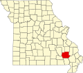
The area of modern-day Brunot was part of a concession given to Domitille DeHault by the Spanish lieutenant-governor in 1800. Brunot was named for Felix A.R. Brunot, one of the partners of Singer and Company who helped start the community. He also owned mineral rights in the area. Brunot was originally created to be a county seat, but it is now located in Greenville. [3]

Brunot Christian Church Brunot Christian Church.jpg
Brunot Christian Church

It was given the name Brunot by 1860 and it officially had a post office which was designated in 1858. The post office during the American Civil War was often the only one that operated in Wayne County. The post office officially closed in 1957, when any stores that had existed in the town had also closed. [4]

Religion

The town maintained two different churches, including a Christian and Methodist church, both of which are long abandoned. The Christian church was founded in the 1880s and continued services until the 1950s. The longest serving pastor, Reverend Isaac Brooks, preached there as a circuit riding pastor from 1909 to 1934. [5]

Related Research Articles

<span class="mw-page-title-main">Wayne County, Missouri</span> County in Missouri, United States

Wayne County is a county located in the Ozark foothills in the U.S. state of Missouri. As of the 2020 census, the population was 10,974. The county seat is Greenville. The county was officially organized on December 11, 1818, and is named after General "Mad" Anthony Wayne, who served in the American Revolution. As of August 28, 2023, Wayne County is designated the UFO Capital of Missouri, along with the city of Piedmont.

<span class="mw-page-title-main">Cape Girardeau County, Missouri</span> County in Missouri, United States

Cape Girardeau County is located in the southeastern part of the U.S. state of Missouri; its eastern border is formed by the Mississippi River. At the 2020 census, the population was 81,710. The county seat is Jackson, the first city in the US to be named in honor of President Andrew Jackson. Officially organized on October 1, 1812, the county is named after Ensign Sieur Jean Baptiste de Girardot, an official of the French colonial years. The "cape" in the county's name is named after a former promontory rock overlooking the Mississippi River; this feature was demolished during railroad construction. Cape Girardeau County is the hub of the Cape Girardeau–Jackson metropolitan area. Its largest city is Cape Girardeau.

<span class="mw-page-title-main">Bollinger County, Missouri</span> County in Missouri, United States

Bollinger County is a county located in the southeastern part of the U.S. state of Missouri. As of the 2020 census, the county's population was 10,567. The county seat, largest and only city, is Marble Hill. The largely rural county is supported by agriculture and construction. The county was officially organized in March, 1851 from portions of Wayne, Cape Girardeau and Stoddard Counties, and named in honor of George Frederick Bollinger, an early settler.

<span class="mw-page-title-main">Jackson, Missouri</span> City in Missouri, United States

Jackson is a city in and the county seat of Cape Girardeau County, Missouri, United States. It is a principal city of the Cape Girardeau–Jackson, MO-IL Metropolitan Statistical Area. The population of Jackson was 15,481 at the 2020 census.

<span class="mw-page-title-main">Pocahontas, Missouri</span> Village in Missouri, United States

Pocahontas is a village in Cape Girardeau County, Missouri, United States. The population was 97 at the 2020 census. It is part of the Cape Girardeau–Jackson, MO-IL Metropolitan Statistical Area.

<span class="mw-page-title-main">Cape Girardeau, Missouri</span> City in Missouri, United States

Cape Girardeau is a city in Cape Girardeau and Scott Counties in the U.S. state of Missouri. At the 2020 census, the population was 39,540. The city is one of two principal cities of the Cape Girardeau-Jackson, MO-IL Metropolitan Statistical Area, which encompasses Alexander County, Illinois, Bollinger County, Missouri and Cape Girardeau County, Missouri and has a population of 97,517. The sliver of the city located in Scott County is part of the Sikeston Micropolitan Statistical Area, and the entire city forms the core of the Cape Girardeau-Sikeston Combined Statistical Area.

<span class="mw-page-title-main">Roman Catholic Diocese of Springfield–Cape Girardeau</span> Latin Catholic ecclesiastical jurisdiction in Missouri, USA

The Diocese of Springfield–Cape Girardeau is a Latin Church ecclesiastical territory, or diocese, of the Catholic Church in southern Missouri in the United States. It is a suffragan diocese in the ecclesiastical province of the metropolitan Archdiocese of Saint Louis.

<span class="mw-page-title-main">Hunter, Missouri</span> Census-Designated Place in Missouri, United States

Hunter is an unincorporated community and census-designated place in Carter County, Missouri, United States. As of the 2020 census it had a population of 95.

<span class="mw-page-title-main">Friedheim, Missouri</span> Unincorporated community in the American state of Missouri

Friedheim is an unincorporated community in Apple Creek Township in northwestern Cape Girardeau County, Missouri, United States.

<span class="mw-page-title-main">Fruitland, Missouri</span> Unincorporated community in the American state of Missouri

Fruitland is an unincorporated community in Cape Girardeau County, Missouri, United States. It is located on U.S. Route 61, 5 mi (8.0 km) north of Jackson and just over one mile north of the intersection of U.S. 61 and Interstate 55.

<span class="mw-page-title-main">New Wells, Missouri</span> Unincorporated community in the American state of Missouri

New Wells is an unincorporated community in northern Cape Girardeau County, Missouri, United States. It is located 20 miles (32 km) north of Cape Girardeau and is part of the Cape Girardeau–Jackson, MO-IL Metropolitan Statistical Area.

<span class="mw-page-title-main">Gipsy, Missouri</span> Unincorporated community in the American state of Missouri

Gipsy is an unincorporated community in the northwestern part of Wayne Township in the western part of Bollinger County, Missouri, United States. It is located on Missouri Supplemental Route E, fourteen miles southwest of Marble Hill on Lick Log Creek.

<span class="mw-page-title-main">Leopold, Missouri</span> Unincorporated community in Missouri, United States

Leopold is an unincorporated community in eastern Bollinger County in Southeast Missouri, United States. It is located on Missouri Route N, approximately four miles southeast of Marble Hill. The community consists of roughly 65 residents and has one of the smallest public school districts in the state of Missouri. Heavily Roman Catholic and of Dutch-German descent, the community is one of the most affluent in Southeast Missouri.

<span class="mw-page-title-main">Sturdivant, Missouri</span> Unincorporated community in the American state of Missouri

Sturdivant is an unincorporated community in the southern part of Wayne Township in extreme southern Bollinger County, Missouri, United States. It is located approximately sixteen miles north of Dexter along State Highway V. The zip code is 63782. It is part of the Cape Girardeau–Jackson, MO-IL Metropolitan Statistical Area.

<span class="mw-page-title-main">Hanover Lutheran Church</span> Historic church in Missouri, United States

Hanover Lutheran Church is a Lutheran congregation in Cape Girardeau, Missouri, that is a member of the Lutheran Church–Missouri Synod. The congregation's original organization came about in 1846 as a result of the heavy German immigration to Missouri in the 19th century. The church's name, "Hanover", was chosen to reflect the place of origin of the majority of its members, since many of the Germans who had settled northwest of the town of Cape Girardeau had immigrated from Hanover, Germany.

<span class="mw-page-title-main">Silver Lake, Missouri</span> Unincorporated settlement in the American state of Missouri

Silver Lake is an unincorporated settlement in Saint Mary's Township in Perry County, Missouri, United States.

<span class="mw-page-title-main">Shawneetown, Missouri</span> Unincorporated community in the American state of Missouri

Shawneetown is an unincorporated community in Shawnee Township in northern Cape Girardeau County, Missouri, United States. It is located twenty miles north of Cape Girardeau and is part of the Cape Girardeau–Jackson, MO-IL Metropolitan Statistical Area.

Egypt Mills is an unincorporated community in Randol Township in eastern Cape Girardeau County, Missouri, United States. It is located approximately 12 miles east of Jackson.

Arnsberg is an unincorporated community in Cape Girardeau County, Missouri, United States.

References

  1. 1 2 3 "Brunot, Missouri". Geographic Names Information System . United States Geological Survey, United States Department of the Interior.
  2. Brunot, Missouri, 7.5 Minute Topographic Quadrangle, USGS, 1968
  3. "Wayne County, Missouri Place Names, 1928-1945 | The State Historical Society of Missouri". shsmo.org. Archived from the original on June 24, 2016. Retrieved July 10, 2016.
  4. Cramer, Rose Fulton (1972). Wayne County Missouri. Cape Girardeau, Missouri: The Ramfree Press. pp. 598–600. ISBN   0-911208-22-4.
  5. Cramer, Rose Fulton (1972). Wayne County Missouri. Cape Girardeau , Missouri: The Ramfree Press. p. 522. ISBN   0-911208-22-4.