Gravelton, Missouri

Last updated

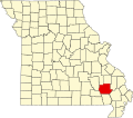
Gravelton is an unincorporated community in northeastern Wayne County, in the U.S. state of Missouri. [1] The community is on the banks of Big Creek and one mile east of the community of Cascade. [2]

Contents

History

A post office called Gravelton was established in 1868, and remained in operation until 1956. [3] The community was named for the gravel used to construct the town's early concrete buildings. [4]

Notable person

John Henry Raney, a U.S. Representative from Missouri, was born at Gravelton in 1849. [5]

Related Research Articles

Bendavis is an unincorporated community in western Texas County, Missouri, United States. It is located approximately thirteen miles west of Houston on Route 38.

Cascade is an unincorporated community in northeastern Wayne County, Missouri, United States. It is located on Missouri Supplemental Route M, approximately eighteen miles west of Marble Hill. The community is on Little Creek, just south of Big Creek. The community of Gravelton is one mile to the east of Cascade on Big Creek.

Gravelton is an unincorporated community in Elkhart and Kosciusko counties, in the U.S. state of Indiana.

Allbright is an unincorporated community in southeastern Madison County, in the U.S. state of Missouri.

Buckhorn is an unincorporated community in southeastern Madison County, in the U.S. state of Missouri.

Hadley is an unincorporated community in southern Reynolds County, in the U.S. state of Missouri. The community is in the southeast corner of the county and approximately 4.5 mile west of Leepr in adjacent Wayne County.

Alice is an unincorporated community in southwest Texas County, in the U.S. state of Missouri.

Burbank is an unincorporated community in Wayne County, in the U.S. state of Missouri. The community is located on Missouri Route E, approximately 2.5 miles east-northeast of Greenville.

Burch is an unincorporated community in northeast Wayne County, in the U.S. state of Missouri.

Damon is an extinct town in Wayne County, in the U.S. state of Missouri. The GNIS classifies it as a populated place.

Dees Town is an unincorporated community in Wayne County, in the U.S. state of Missouri.

Gaylor is an unincorporated community in Wayne County, in the U.S. state of Missouri. The community was on the Black River south of Clearwater Lake approximately one mile north of Leeper.

Keener Cave, Keener Cave Resort or Keener is a ghost town in southern Wayne County, in the U.S. state of Missouri. The GNIS classifies it as a populated place.

Kerrigan is a ghost town in southwest Wayne County, in the U.S. state of Missouri.

Kime is an extinct town in Wayne County, in the U.S. state of Missouri. The GNIS classifies it as a populated place.

Kyles is an extinct town in Wayne County, in the U.S. state of Missouri.

Ojibway is an extinct town in southern Wayne County, in the U.S. state of Missouri. The community location lies adjacent to the Otter Creek arm of Lake Wappapello approximately one mile from the end of Missouri Route PP. Previous to the formation of the lake the community was along Otter Creek and the St. Louis and San Francisco Railroad line just west of Chaonia.

<span class="mw-page-title-main">Upalika, Missouri</span>

Upalika is an extinct town in southwest Wayne County, in the U.S. state of Missouri. The GNIS classifies it as a populated place. The community is on County Road 426 five miles southwest of Williamsville and 5.5 miles east of Ellsinore in adjacent Carter County.

Virginia Settlement is an unincorporated community in Wayne County, in the U.S. state of Missouri.

Mill Spring Township is an inactive township in Wayne County, in the U.S. state of Missouri.

References

  1. U.S. Geological Survey Geographic Names Information System: Gravelton, Missouri
  2. Missouri Atlas & Gazetteer, DeLorme, 1998, First edition, p. 57, ISBN   0-89933-224-2
  3. "Post Offices". Jim Forte Postal History. Retrieved January 1, 2017.
  4. "Wayne County Place Names, 1928–1945". The State Historical Society of Missouri. Archived from the original on June 24, 2016. Retrieved January 1, 2017.
  5. Congress, United States. (1913). A Biographical Congressional Directory. U.S. Government Printing Office. p.  943.
37°17′54″N90°15′14″W / 37.29833°N 90.25389°W / 37.29833; -90.25389