Kime, Missouri

Last updated

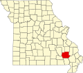
Kime is an extinct town in Wayne County, in the U.S. state of Missouri. The GNIS classifies it as a populated place. [1]

The community was located approximately 4.5 miles southeast of Greenville about one mile east of the St. Francis River (currently the upper reaches of Lake Wappapello) and adjacent to Missouri Route BB. [2]

A post office called Kime was established in 1904, and remained in operation until 1937. [3] The community has the name of Samuel Kime, an early settler. [4]

Related Research Articles

<span class="mw-page-title-main">Grovespring, Missouri</span> Census-Designated Place in Missouri, United States

Grovespring is an unincorporated community in Wright County, Missouri, United States. It is located on Missouri Route 5, approximately 20 miles (32 km) south of Lebanon, Missouri in neighbouring Laclede County.

Altona is an unincorporated community in northern Bates County, in the U.S. state of Missouri. The community is on Missouri Route Z just north of Missouri route 18 and approximately 5.5 miles east of Adrian.

Youngers is an unincorporated community in northwest Callaway County, in the U.S. state of Missouri. The community is in the extreme northwest corner of Callaway County and just east of Cedar Creek. Auxvasse is about twelve miles to the east, Mexico is about 14 miles to the northeast in Audrain County and Columbia is about nine miles to the southwest in Boone County.

Crane Pond Creek is a stream in Iron and Wayne counties in the U.S. state of Missouri.

Buckhorn is an unincorporated community in southeastern Madison County, in the U.S. state of Missouri.

Hadley is an unincorporated community in southern Reynolds County, in the U.S. state of Missouri. The community is in the southeast corner of the county and approximately 4.5 mile west of Leepr in adjacent Wayne County.

Venice is an unincorporated community in Shannon County, in the U.S. state of Missouri. The community is located on Missouri Route 19, northwest of Eminence and south of Round Spring.

Vada is an unincorporated community in northern Texas County, in the U.S. state of Missouri. The community is located on Missouri Route 32, approximately three miles northeast of Success.

Burbank is an unincorporated community in Wayne County, in the U.S. state of Missouri. The community is located on Missouri Route E, approximately 2.5 miles east-northeast of Greenville.

Burch is an unincorporated community in northeast Wayne County, in the U.S. state of Missouri.

Chaonia is an extinct town in Wayne County, in the U.S. state of Missouri. The site was on the bank of the St. Francis River and is now within Lake Wappapello. The Chaonia Landing recreation area at the end of Missouri Route W is about one-half mile south of the original location. The Chaonia Cemetery is on a ridge one half mile east of the recreation area.

Damon is an extinct town in Wayne County, in the U.S. state of Missouri. The GNIS classifies it as a populated place.

Gaylor is an unincorporated community in Wayne County, in the U.S. state of Missouri. The community was on the Black River south of Clearwater Lake approximately one mile north of Leeper.

Goose Creek is a stream in northeastern Wayne County in the U.S. state of Missouri. It is a tributary of Bear Creek.

Gravelton is an unincorporated community in northeastern Wayne County, in the U.S. state of Missouri. The community is on the banks of Big Creek and one mile east of the community of Cascade.

Kerrigan is a ghost town in southwest Wayne County, in the U.S. state of Missouri.

Ladero was an unincorporated community in southern Wayne County, in the U.S. state of Missouri. The community is on Otter Creek approximately one mile west of US Route 67 and the St. Francis River.

Ojibway is an extinct town in southern Wayne County, in the U.S. state of Missouri. The community location lies adjacent to the Otter Creek arm of Lake Wappapello approximately one mile from the end of Missouri Route PP. Previous to the formation of the lake the community was along Otter Creek and the St. Louis and San Francisco Railroad line just west of Chaonia.

<span class="mw-page-title-main">Upalika, Missouri</span>

Upalika is an extinct town in southwest Wayne County, in the U.S. state of Missouri. The GNIS classifies it as a populated place. The community is on County Road 426 five miles southwest of Williamsville and 5.5 miles east of Ellsinore in adjacent Carter County.

Virginia Settlement is an unincorporated community in Wayne County, in the U.S. state of Missouri.

References

  1. U.S. Geological Survey Geographic Names Information System: Kime
  2. Missouri Atlas & Gazetteer, DeLorme, 1st ed., 1998, p. 67 ISBN   0899332242
  3. "Post Offices". Jim Forte Postal History. Retrieved January 1, 2017.
  4. "Wayne County Place Names, 1928–1945". The State Historical Society of Missouri. Archived from the original on June 24, 2016. Retrieved January 1, 2017.

37°03′04″N90°23′59″W / 37.05111°N 90.39972°W / 37.05111; -90.39972