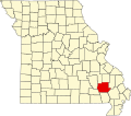
Keener Cave, Missouri

Last updated

Keener Cave, Keener Cave Resort or Keener is a ghost town in southern Wayne County, in the U.S. state of Missouri. The GNIS classifies it as a populated place. [1]

The cave and associated community lie above the west bank of the Black River on Missouri Route JJ just north of the Wayne-Butler county line. The community of Keeners lies just to the southeast in Butler County on the river's east bank. [2] [3]

The community most likely has the name of a family who were active in the local lumber industry. [4] A post office called Keeners was established in 1877, and remained in operation until 1879. [5]

Related Research Articles

<span class="mw-page-title-main">Butler County, Missouri</span> County in Missouri, United States

Butler County is a county located in the southeast Ozark Foothills Region in the U.S. state of Missouri. As of the 2020 Census, the county's population was 42,130. The largest city and county seat is Poplar Bluff. The county was officially organized from Wayne County on February 27, 1849, and is named after former U.S. Representative William O. Butler (D-Kentucky), who was also an unsuccessful candidate for Vice President of the United States. The first meeting in the Butler County Courthouse was held on June 18, 1849.

Flat is an unincorporated community in southern Phelps County, Missouri, United States. It is located approximately sixteen miles southwest of Rolla. The community is at the intersection of Missouri routes M and T. Edgar Springs lies about four miles to the southeast at the intersection of route M and U.S. Route 63. The headwaters of Mill Creek are just to the east of the community. The village lies within the boundaries of the Mark Twain National Forest.

<span class="mw-page-title-main">Hendrickson, Missouri</span> Unincorporated community in the American state of Missouri

Hendrickson is an unincorporated community in northern Butler County, Missouri, United States. It is located along Missouri Route O approximately one mile south of U.S. Route 67. It is approximately ten miles north of Poplar Bluff, within the Mark Twain National Forest. The community of Wilby lies three miles to the southeast along Route O. It sits on the east margin of the Black River floodplain. The Missouri Pacific Railway passes the west side of the community along the Black River floodplain.

<span class="mw-page-title-main">Lake Wappapello</span> Reservoir in Missouri, United States

Lake Wappapello is a reservoir on the St. Francis River, formed by Wappapello Dam. Created in 1938, this 8,400-acre (34 km2) lake is located 120 miles (190 km) south of St. Louis, Missouri. The reservoir lies mostly in Wayne County, but its southernmost reaches extend into northern Butler County, both in Missouri. Both the dam and reservoir are owned and operated for the public by the United States Army Corps of Engineers.

Hazleton is an extinct town in Texas County, in the U.S. state of Missouri. The GNIS classifies it as a populated place. The village is on the bank of the Big Piney River within the Mark Twain National Forest.

Ash Hill is an unincorporated community in eastern Butler County, in the U.S. state of Missouri. The community is located on Missouri Route 51 ten miles east of Poplar Bluff and just over one mile west of Fisk and the St. Francis River which forms the Butler-Stoddard county line. The Missouri Pacific Railway passes through the community.

Bluewater Creek is a stream in northern Butler and southern Wayne counties in the U.S. state of Missouri. It is a tributary of Asher Creek.

Hilliard is an unincorporated community in northern Butler County, in the U.S. state of Missouri. The community is located on Missouri Route W about three miles north of Poplar Bluff. It sits on the east margin of the Black River floodplain at an elevation of 361 feet. The community of Wilby lies three miles to the north-northwest along the Black River. The Missouri Pacific Railway passes the east side of the community along the margin of the Black River floodplain. The small Lake Locloma lies just to the west of the Black River along Route W.

Keeners is an unincorporated community in northern Butler County, in the U.S. state of Missouri. U.S. Route 67 passes approximately 1.5 mile to the southeast. The Missouri Pacific Railway passes the west side of the community along the Black River floodplain.

Wilby is an unincorporated community in northern Butler County, in the U.S. state of Missouri. The community is on Missouri Route O approximately seven miles north of Poplar Bluff. It sits on the east margin of the Black River floodplain at an elevation of 361 feet. The community of Hilliard lies three miles to the south-southeast along the Black River. The Missouri Pacific Railway passes the west side of the community along the Black River floodplain. The community lies within the Mark Twain National Forest.

Warren Branch is a stream in Newton County, Missouri and Ottawa County, Oklahoma. It is a tributary of the Spring River.

Current View is an unincorporated community in Clay County, Arkansas and Ripley County, Missouri, United States. The community straddles the Missouri-Arkansas border on the northeast bank of the Current River. Arkansas Highway 211 connects to the south and Missouri Route E is to the north. Doniphan, Missouri lies approximately eight miles to the north-northwest and Success, Arkansas is about five miles south.

Barlow is an extinct town in Wayne County, in the U.S. state of Missouri. The community was on the railroad line along the east bank of the Black River between Leeper to the northwest and Williamsville to the southeast.

Bull Run Camp is an unincorporated community in Wayne County, in the U.S. state of Missouri.

Chaonia is an extinct town in Wayne County, in the U.S. state of Missouri. The site was on the bank of the St. Francis River and is now within Lake Wappapello. The Chaonia Landing recreation area at the end of Missouri Route W is about one-half mile south of the original location. The Chaonia Cemetery is on a ridge one half mile east of the recreation area.

Kerrigan is a ghost town in southwest Wayne County, in the U.S. state of Missouri.

Ladero was an unincorporated community in southern Wayne County, in the U.S. state of Missouri. The community is on Otter Creek approximately one mile west of US Route 67 and the St. Francis River.

<span class="mw-page-title-main">Mingo Creek (St. Francis River tributary)</span> Stream in the American state of Missouri

Mingo Creek is a stream in Stoddard and Wayne counties in the U.S. state of Missouri. It is a tributary of St. Francis River.

Ojibway is an extinct town in southern Wayne County, in the U.S. state of Missouri. The community location lies adjacent to the Otter Creek arm of Lake Wappapello approximately one mile from the end of Missouri Route PP. Previous to the formation of the lake the community was along Otter Creek and the St. Louis and San Francisco Railroad line just west of Chaonia.

<span class="mw-page-title-main">Upalika, Missouri</span>

Upalika is an extinct town in southwest Wayne County, in the U.S. state of Missouri. The GNIS classifies it as a populated place. The community is on County Road 426 five miles southwest of Williamsville and 5.5 miles east of Ellsinore in adjacent Carter County.

References

  1. U.S. Geological Survey Geographic Names Information System: Keener Cave
  2. Missouri Atlas & Gazetteer, DeLorme, 1998, First edition, p. 67, ISBN   0-89933-224-2
  3. Williamsville, Missouri, 7.5 Minute Topographic Quadrangle, USGS, 1980
  4. "Wayne County Place Names, 1928–1945". The State Historical Society of Missouri. Archived from the original on June 24, 2016. Retrieved January 1, 2017.
  5. "Post Offices". Jim Forte Postal History. Retrieved January 1, 2017.

36°55′45″N90°31′30″W / 36.92917°N 90.52500°W / 36.92917; -90.52500