References
- ↑ U.S. Geological Survey Geographic Names Information System: Taskee Station (historical)
- 1 2 "Wayne County Place Names, 1928–1945". The State Historical Society of Missouri. Archived from the original on June 24, 2016. Retrieved January 1, 2017.
- ↑ "Post Offices". Jim Forte Postal History. Retrieved January 1, 2017.
Municipalities and communities of Wayne County, Missouri, United States | ||
|---|---|---|
| Cities | 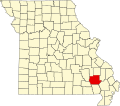 | |
| Village | ||
| Townships | ||
| Unincorporated communities | ||
| Ghost towns | ||
36°59′33″N90°27′01″W / 36.99255°N 90.45039°W
| | This Missouri ghost town-related article is a stub. You can help Wikipedia by expanding it. |
| | This Wayne County, Missouri state location article is a stub. You can help Wikipedia by expanding it. |