Bull Run Camp, Missouri

Last updated

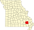
Bull Run Camp is an unincorporated community in Wayne County, in the U.S. state of Missouri. [1]

The location was adjacent to the west bank of the Black River approximately two miles west of Williamsville. [1]

The community was so named on account of work animals in the nearby logging district. [2]

Related Research Articles

<span class="mw-page-title-main">Wayne County, Missouri</span> County in Missouri, United States

Wayne County is a county located in the Ozark foothills in the U.S. state of Missouri. As of the 2020 census, the population was 10,974. The county seat is Greenville. The county was officially organized on December 11, 1818, and is named after General "Mad" Anthony Wayne, who served in the American Revolution.

New Hamburg is an unincorporated community in Scott County, in the U.S. state of Missouri.

Keeners is an unincorporated community in northern Butler County, in the U.S. state of Missouri. U.S. Route 67 passes approximately 1.5 mile to the southeast. The Missouri Pacific Railway passes the west side of the community along the Black River floodplain.

Crites Corner is an unincorporated community in Carter County, in the U.S. state of Missouri. The community is located on U.S. Route 60, west of Ellsinore.

Dundee is an unincorporated community in northern Franklin County, in the U.S. state of Missouri. The community is above the Missouri River floodplain on Missouri Route 100 approximately six miles northwest of Washington and five miles east of New Haven.

Garner is an unincorporated community in northern Linn County, in the U.S. state of Missouri.

Allbright is an unincorporated community in southeastern Madison County, in the U.S. state of Missouri.

Buckhorn is an unincorporated community in southeastern Madison County, in the U.S. state of Missouri.

Bryants Creek is a stream in Pike and Lincoln counties of eastern Missouri. It is a tributary of the Mississippi River.

Leibig is an unincorporated community in southwestern Ripley County, in the U.S. state of Missouri. The community is located approximately eight miles southwest of Doniphan and three miles north of the Missouri-Arkansas border. The Fourche River is just west of the village.

Mineral City is an unincorporated community in southern St. Francois County, in the U.S. state of Missouri. The community lies on Missouri Route W, southwest of Doe Run. Stono Mountain and the headwaters of Doe Run Creek lie to the west.

Edanville is an extinct town in northern Texas County, in the U.S. state of Missouri. The GNIS classifies it as a populated place.

Burbank is an unincorporated community in Wayne County, in the U.S. state of Missouri. The community is located on Missouri Route E, approximately 2.5 miles east-northeast of Greenville.

Burch is an unincorporated community in northeast Wayne County, in the U.S. state of Missouri.

Gravelton is an unincorporated community in northeastern Wayne County, in the U.S. state of Missouri. The community is on the banks of Big Creek and one mile east of the community of Cascade.

Keener Cave, Keener Cave Resort or Keener is a ghost town in southern Wayne County, in the U.S. state of Missouri. The GNIS classifies it as a populated place.

Ladero was an unincorporated community in southern Wayne County, in the U.S. state of Missouri. The community is on Otter Creek approximately one mile west of US Route 67 and the St. Francis River.

<span class="mw-page-title-main">Mingo Creek (St. Francis River tributary)</span> Stream in the American state of Missouri

Mingo Creek is a stream in Stoddard and Wayne counties in the U.S. state of Missouri. It is a tributary of St. Francis River.

Ojibway is an extinct town in southern Wayne County, in the U.S. state of Missouri. The community location lies adjacent to the Otter Creek arm of Lake Wappapello approximately one mile from the end of Missouri Route PP. Previous to the formation of the lake the community was along Otter Creek and the St. Louis and San Francisco Railroad line just west of Chaonia.

<span class="mw-page-title-main">Upalika, Missouri</span>

Upalika is an extinct town in southwest Wayne County, in the U.S. state of Missouri. The GNIS classifies it as a populated place. The community is on County Road 426 five miles southwest of Williamsville and 5.5 miles east of Ellsinore in adjacent Carter County.

References

  1. 1 2 U.S. Geological Survey Geographic Names Information System: Bull Run Camp, Missouri
  2. "Wayne County Place Names, 1928–1945". The State Historical Society of Missouri. Archived from the original on June 24, 2016. Retrieved January 1, 2017.

36°57′57″N90°35′36″W / 36.96583°N 90.59333°W / 36.96583; -90.59333