Altavilla Vicentina | |
|---|---|
| Comune di Altavilla Vicentina | |
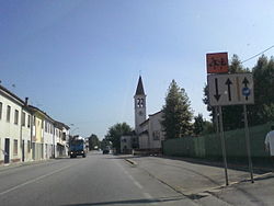 View of Altavilla Vicentina | |
 Coat of arms | |
 Altavilla Vicentina Location of Altavilla Vicentina in Italy  Altavilla Vicentina Altavilla Vicentina (Veneto) | |
| Coordinates: 45°31′N11°27′E / 45.517°N 11.450°E | |
| Country | Italy |
| Region | Veneto |
| Province | Vicenza (VI) |
| Frazioni | Sant'Agostino, Tavernelle, Valmarana |
| Government | |
| • Mayor | Claudio Catagini |
| Area | |
• Total | 16.72 km2 (6.46 sq mi) |
| Elevation | 45 m (148 ft) |
| Population (30 April 2017) [2] | |
• Total | 12,012 |
| • Density | 718.4/km2 (1,861/sq mi) |
| Demonym | Altavillesi |
| Time zone | UTC+1 (CET) |
| • Summer (DST) | UTC+2 (CEST) |
| Postal code | 36077 |
| Dialing code | 0444 |
| Patron saint | Holy Reedimer |
| Website | Official website |
Altavilla Vicentina is a town and comune in the province of Vicenza, Veneto, northern Italy. It is located southwest of Vicenza.
The town originates from a castle (Rocca) built in the Middle Ages over a hill at the feet of the Colli Berici, and now in ruins.
In the communal territory is the Villa Morosini, a picturesque Venetian villa. It was built in 1724 by architect Moroni for count Benedetto Valmarana.