Altissimo, Veneto

Last updated
Altissimo
Comune di Altissimo
Altissimopanorama.jpg
Location of Altissimo
Altissimo, Veneto
Italy provincial location map 2016.svg
Red pog.svg
Altissimo
Location of Altissimo in Italy
Italy Veneto location map.svg
Red pog.svg
Altissimo
Altissimo (Veneto)
Coordinates: 45°37′N11°14′E / 45.617°N 11.233°E / 45.617; 11.233
Country Italy
Region Veneto
Province Vicenza (VI)
Frazioni Campanella, Molino
Government
  MayorLiliana Teresa Monchelato
Area
[1]
  Total15.09 km2 (5.83 sq mi)
Elevation
115 m (377 ft)
Population
 (30 April 2017) [2]
  Total2,247
  Density150/km2 (390/sq mi)
Demonym Altissimensi
Time zone UTC+1 (CET)
  Summer (DST) UTC+2 (CEST)
Postal code
36070
Dialing code 0444
Website Official website

Altissimo is a comune (municipality) in the province of Vicenza, Veneto, Italy. It is located in the hills of Chiampo valley.

Contents

History

Even though the civic and religious organization of the area must be placed earlier, the inhabited territory evolved in the 13th century following the colonization of ethnic German populations (the so-called Cimbri). On February 5, 1287, the Cimbrian Olderico da Altissimo signed a contract with Verona's bishop, Bartolomeo della Scala, to become steward of the area.

There is little information on the medieval period, and it largely pertains to the church of San Nicola and the districts of Molino and Costa; there is no evidence of castles. [3]

Altissimo, together with Padua and Venice, fought against Mastino II della Scala in 1336. The Scaligeri were followed by the Visconti in 1387, and afterwards by the Republic of Venice (1404).

During the Serenissima's reign, the economy shifted from a subsistence economy based on small and medium-sized local proprietors to a profit economy dominated by nobles and bourgeois.

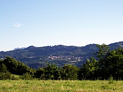
Altissimo became a municipality of the Lombardo-Veneto Kingdom after the Napoleonic period, located in the Arzignano district of the province of Vicenza, a condition that has largely been preserved to the current day.

The Second World War period is notable. Following Cassibile's armistice, the locals saved several disbanded soldiers going through the area. Furthermore, in the beginning of October 1943, the first partisan units emerged, with the assistance of many local families, despite the risk of Nazi-fascist retaliation. The town was traversed by retreating German forces in the days following the conflict's end: some were confronted and disarmed, while others ransacked houses and kidnapped hostages. [4]

Related Research Articles

<span class="mw-page-title-main">Veneto</span> Region of Italy

Veneto or Venetia is one of the 20 regions of Italy. Its population is about five million, ranking fourth in Italy. The region's capital is Venice while the biggest city is Verona.

<span class="mw-page-title-main">Vittorio Veneto</span> Comune in Veneto, Italy

Vittorio Veneto is a city and comune situated in the Province of Treviso, in the region of Veneto, Italy, in the northeast of Italy, between the Piave and the Livenza rivers, borders with the following municipalities:

<span class="mw-page-title-main">Province of Vicenza</span> Province of Italy

The Province of Vicenza is a province in the Veneto region in northern Italy. Its capital city is Vicenza.

<span class="mw-page-title-main">Castelfranco Veneto</span> Comune in Veneto, Italy

Castelfranco Veneto is a town and comune of Veneto, northern Italy, in the province of Treviso, 30 kilometres by rail from the town of Treviso. It is approximately 40 km (25 mi) inland from Venice.

<span class="mw-page-title-main">Montebelluna</span> Comune in Veneto, Italy

Montebelluna is a city and comune in Veneto, Italy, approximately 50 kilometres (31 mi) northwest of Venice. It has an estimated population of 32,000.

Rosà is a town of 14.328 inhabitants in the province of Vicenza, Veneto, Italy. The name comes from the Latin word "roxata", the ancient name of the biggest irrigation channel that passed in that area. The municipality has got 4 hamlets. Rosà is officially European Town of Sport 2011.

<span class="mw-page-title-main">Bovolone</span> Comune in Veneto, Italy

Bovolone is a town and a comune (municipality) in the Province of Verona in the Italian region Veneto, located about 90 kilometres (56 mi) west of Venice and about 25 kilometres (16 mi) southeast of Verona.

Buttapietra is a comune (municipality) in the Province of Verona in the Italian region Veneto, located about 110 kilometres (68 mi) west of Venice and about 10 kilometres (6 mi) southwest of Verona. As of 31 December 2004, it had a population of 6,195 and an area of 17.2 square kilometres (6.6 sq mi).

Erbé is a comune (municipality) in the Province of Verona in the Italian region Veneto, located about 110 kilometres (68 mi) west of Venice and about 20 kilometres (12 mi) south of Verona. As of December 2008, it had a population of 1,720 and an area of 15.9 square kilometres (6.1 sq mi).

<span class="mw-page-title-main">Gazzo Veronese</span> Comune in Veneto, Italy

Gazzo Veronese is a comune (municipality) in the Province of Verona in the Italian region Veneto, located about 100 km (62 mi) southwest of Venice and about 30 km (19 mi) south of Verona.

Illasi is a comune (municipality) in the Province of Verona in the Italian region Veneto, about 90 kilometres (56 mi) west of Venice and about 15 kilometres (9 mi) east of Verona. As of 31 December 2004, it had a population of 5,112 and an area of 25.0 square kilometres (9.7 sq mi).

<span class="mw-page-title-main">Isola della Scala</span> Comune in Veneto, Italy

Isola della Scala is a comune (municipality) of c. 10,000 inhabitants in the Province of Verona in the Italian region of Veneto, located about 90 kilometres (56 mi) west of Venice and about 20 kilometres (12 mi) southeast of Verona.

<span class="mw-page-title-main">Malcesine</span> Comune in Veneto, Italy

Malcesine is a comune (municipality) on the eastern shore of Lake Garda in the Province of Verona in the Italian region Veneto, located about 120 kilometres northwest of Venice and about 40 kilometres northwest of Verona.

Nogara is a comune (municipality) in the Province of Verona in the Italian region Veneto, located about 100 kilometres (62 mi) southwest of Venice and about 30 kilometres (19 mi) south of Verona.

Pastrengo is a comune (municipality) in the Province of Verona in the Italian region Veneto, located about 120 kilometres (75 mi) west of Venice and about 15 kilometres (9 mi) northwest of Verona. As of 31 December 2004, it had a population of 2,486 and an area of 9.0 square kilometres (3.5 sq mi).

<span class="mw-page-title-main">Salizzole</span> Comune in Veneto, Italy

Salizzole is a comune (municipality) in the Province of Verona in the Italian region Veneto, located about 100 kilometres (62 mi) west of Venice and about 20 kilometres (12 mi) southeast of Verona. Economy includes production of rice and of artistic furniture.

<span class="mw-page-title-main">Vestenanova</span> Comune in Veneto, Italy

Vestenanova is a comune (municipality) in the Province of Verona in the Italian region Veneto, located about 90 kilometres (56 mi) west of Venice and about 25 kilometres (16 mi) northeast of Verona.

Vigasio is a comune (municipality) in the Province of Verona in the Italian region Veneto, located about 110 kilometres (68 mi) west of Venice and about 14 kilometres (9 mi) southwest of Verona. As of 31 December 2004, it had a population of 7,393 and an area of 30.8 square kilometres (11.9 sq mi).

Pederobba is a comune (municipality) in the Province of Treviso in the Italian region Veneto, located about 60 kilometres (37 mi) northwest of Venice and about 30 kilometres (19 mi) northwest of Treviso. As of 31 December 2021, it had a population of 7,280 and an area of 29.3 square kilometres (11.3 sq mi).

Cartura is a comune (municipality) in the Province of Padua in the Italian region Veneto, located about 40 kilometres (25 mi) southwest of Venice and about 15 kilometres (9 mi) south of Padua. As of 31 December 2004, it had a population of 4,268 and an area of 16.2 square kilometres (6.3 sq mi).

References

  1. "Superficie di Comuni Province e Regioni italiane al 9 ottobre 2011". Italian National Institute of Statistics. Retrieved 16 March 2019.
  2. All demographics and other statistics from the Italian statistical institute (Istat)
  3. Antonio Canova e Giovanni Mantese, I castelli medievali del vicentino, Accademia Olimpica, Vicenza, 1979, p. 39
  4. "Storia di Altissimo" . Retrieved 7 August 2018.