Vicenza | |
|---|---|
| Comune di Vicenza | |
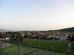 View of Nanto | |
 Nanto within the Province of Vicenza | |
 Vicenza Location of Vicenza in Italy  Vicenza Vicenza (Veneto) | |
| Coordinates: 45°26′N11°35′E / 45.433°N 11.583°E | |
| Country | Italy |
| Region | Veneto |
| Province | Vicenza (VI) |
| Frazioni | Anzolin, Bosco di Nanto, Ca' Nova, Cazzola, Ponte di Nanto, Priare, Prietta, Sambugaro, Torretta, Vegre |
| Government | |
| • Mayor | Ulisse Borotto |
| Area | |
• Total | 14 km2 (5.4 sq mi) |
| Elevation | 20 m (66 ft) |
| Population (31 May 2011) [2] | |
• Total | 3,071 |
| • Density | 220/km2 (570/sq mi) |
| Demonym | Nantesi |
| Time zone | UTC+1 (CET) |
| • Summer (DST) | UTC+2 (CEST) |
| Postal code | 36024 |
| Website | Official website |
Nanto is a town and comune in the province of Vicenza, Veneto, northern Italy. As of 2011 its population was 3,071. [3]


