Kochel am See is a municipality and a town in the district of Bad Tölz-Wolfratshausen in Bavaria, on the shores of Kochelsee. The municipality consists of the districts Altjoch, Brunnenbach, Ort, Pessenbach, Pfisterberg, Walchensee and Ried.

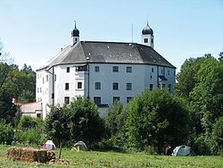
Mantel is a municipality located in the district of Neustadt an der Waldnaab in Bavaria, Germany. It is known as a Markt, a town that was historically granted 'market rights'. The town was first mentioned in official documents in 1212, and in 1945 it was incorporated into the municipality of Rupprechtsreuth. As part of the regional reform in Bavaria, parts of the dissolved municipality of Hütten were added to it in 1972. The town's population fell by 77 people, 2.8%, to 2728 between 1988 and 2018. Mantel is best known for its nature preserve, Naturwaldreservat Gscheibte Loh, as well as its castle, Schloss Steinfels.
Kolbermoor is a town in the district of Rosenheim, in Bavaria, Germany.
Grünwald is a municipality in the district of Munich, in the state of Bavaria, Germany. It is located on the right bank of the Isar, 12 km southwest of Munich (centre). As of 31 December 2011 it had a population of 11,109.

Mönchsroth is a municipality in the district of Ansbach in Bavaria in Germany.
Gessertshausen is a municipality in the district of Augsburg in Bavaria in Germany. It lies on the Schmutter River.

Bischofswiesen is a municipality in the district of Berchtesgadener Land in Bavaria in Germany.

Hausen is a municipality in the district of Forchheim in Bavaria in Germany.

Eching am Ammersee is a municipality in the district of Landsberg in Bavaria in Germany. It has a size of 6.15km2.

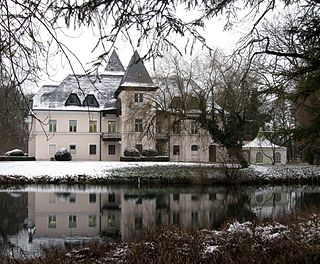
Valley is a municipality in the district of Miesbach in Bavaria in Germany. The municipality of Valley holds, as of 2006, 2949 inhabitants.

Bodenmais is a municipality in the district of Regen in Bavaria in Germany. It lies at one end of the Zeller Valley in the Bavarian Forest.

Brannenburg is a municipality in the district of Rosenheim in Bavaria in Germany. There is a train station is located in Brannenburg.

Griesstätt is a municipality in the district of Rosenheim in Bavaria, Germany. It lies on the river Inn.

Söchtenau is a municipality in the district of Rosenheim in Bavaria in Germany.

Sennfeld is a municipality in the district of Schweinfurt in Bavaria, Germany. Historically, along with its neighboring village of Gochsheim, it had the rare situation of being a Reichsdorf or Imperial Village.

Pfaffenhausen is a municipality in the district of Unterallgäu in Bavaria, Germany. The town is seat of a municipal association with Breitenbrunn, Swabia, Oberrieden, Bavaria and Salgen.

Güntersleben is a municipality in the district of Würzburg in Bavaria in Germany.

Tittling is a municipality in the district of Passau in Bavaria in Germany.

Breitbrunn am Chiemsee is a municipality in the district of Rosenheim in Bavaria in Germany.

Höslwang is a municipality in the district of Rosenheim in Bavaria in Germany.