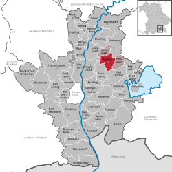
Rosenheim is a Landkreis (district) in the south of Bavaria, Germany. Neighboring districts are, clockwise from the west, Miesbach, Munich, Ebersberg, Mühldorf, and Traunstein, with the Austrian province Tirol across the southern border. The district entirely surrounds the city of Rosenheim, which is independently administered but hosts the district's administration; both the city and the district share the "RO" designation for their license plates.
Rohrdorf is a municipality in the district of Rosenheim in Upper Bavaria, Germany. It is located in the Inn valley.
Freilassing, until 1923 Salzburghofen is a town of some 16,000 inhabitants in the southeastern corner of Bavaria, Germany. It belongs to the "Regierungsbezirk" Oberbayern and the "Landkreis" (County) of Berchtesgadener Land. Freilassing can be seen as the biggest suburb of Salzburg, the famous Austrian city just on the other side of the border.
Kolbermoor is a town in the district of Rosenheim, in Bavaria, Germany.

Bruckmühl is a market town in the district of Rosenheim, in Bavaria, Germany. It is situated on the river Mangfall, 16 km west of Rosenheim.

Vilsbiburg is a town on the river Große Vils, 18 km southeast of Landshut, in the district of Landshut, in Bavaria, Germany. The city owes its name to the river Große Vils which runs through Vilsbiburg. As of 2019 Vilsbiburg has 12,203 inhabitants.

Raubling is a municipality in the district of Rosenheim, in Bavaria, Germany. It is situated on the western bank of the river Inn, 7 km south of Rosenheim.

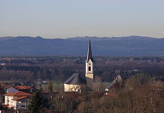
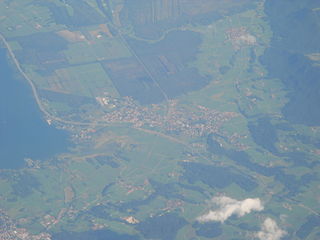
Prien am Chiemsee is a municipality in the Upper Bavarian district of Rosenheim in Germany. The town is a certified air and Kneipp spa on the western shore of the lake of Chiemsee, 16 km (9.3 mi) east of Rosenheim.

Neuötting is a town in the district of Altötting, in Bavaria, Germany. It is situated on the river Inn, 2 km north of Altötting, about 70 km north of Salzburg, 80 southwest of Passau and almost 100 km east of Munich. It is a stop on the railway line between Munich and Simbach.

Gstadt am Chiemsee is a municipality in the district of Rosenheim, Bavaria, Germany. It is located on lake Chiemsee.

Aschau im Chiemgau is a municipality in the district of Rosenheim in Bavaria in Germany.
Bernau am Chiemsee is a municipality in the district of Rosenheim in Germany on the Lake Chiemsee, and a Luftkurort.

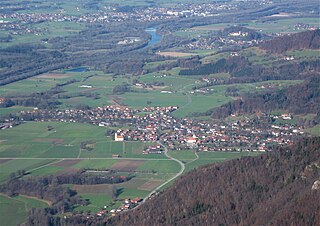
Griesstätt is a municipality in the district of Rosenheim in Bavaria, Germany. It lies on the river Inn.

Kiefersfelden is a municipality with about 7000 inhabitants located in the district of Rosenheim in Bavaria in Germany on the border with Tyrol, Austria.
Nußdorf am Inn is a municipality in the district of Rosenheim in the state of Bavaria in Germany. Nußdorf consists of 23 boroughs and is a tourist destination in the Inn Valley between the Heuberg Wendelstein mountains on the Tyrol border. Nußdorf town center has Baroque churches and traditional farm houses.

Söchtenau is a municipality in the district of Rosenheim in Bavaria in Germany.

Albaching is a municipality in the district of Rosenheim in Bavaria in Germany.

Bad Endorf is a municipality in the district of Rosenheim in Bavaria in Germany. The relatively small town is located about 15 km outside of Rosenheim and is in close proximity to the Chiemsee lake and its larger shore towns, Prien, Gstadt, and Seebruck.

Höslwang is a municipality in the district of Rosenheim in Bavaria in Germany.

Edling is a village and a municipality in the district of Rosenheim in Bavaria in Germany.