Bad Feilnbach

Last updated
Bad Feilnbach
Lippertskirchen bei Bad Feilnbach-1.jpg
Church in the village of Lippertskirchen, part of Bad Feilnbach municipality
Wappen von Bad Feilnbach.svg
Location of Bad Feilnbach within Rosenheim district
Bad Feilnbach in RO.svgRotter Forst-SüdRotter Forst-NordEdlingRohrdorf
Germany adm location map.svg
Red pog.svg
Bad Feilnbach
Bavaria location map.svg
Red pog.svg
Bad Feilnbach
Coordinates: 47°47′N12°1′E / 47.783°N 12.017°E / 47.783; 12.017
Country Germany
State Bavaria
Admin. region Oberbayern
District Rosenheim
Government
   Mayor (202430) Max Singer [1]
Area
  Total57.48 km2 (22.19 sq mi)
Elevation
512 m (1,680 ft)
Population
 (2022-12-31) [2]
  Total8,389
  Density150/km2 (380/sq mi)
Time zone UTC+01:00 (CET)
  Summer (DST) UTC+02:00 (CEST)
Postal codes
83075
Dialling codes 08066, 08064 (Au b. Bad Aibling)
Vehicle registration RO
Website Bad Feilnbach

Bad Feilnbach is a municipality in the Upper Bavarian district of Rosenheim at the foot of Wendelstein Mountain in Germany. As a famous 'Moorheilbad' (moor healing spa) the municipality was awarded in 1973 the title "Bad". Since the 19th century the peat deposits were the basis for a continued expansion of the spa and health facilities. The recognized healing success of "black gold" on a variety of diseases were the basis for the development of a well-known spa and tourist community. Due to its wooded surroundings and the mild climate Feilnbach is called the "Bavarian Meran". The entire municipality is recognized as a healing spa resort except for parts of the former municipality Dettendorf.

Contents

Geography

Bad Feilnbach is located directly on the northern edge of the Bavarian Alps, at the foot of the 1,838 m high Wendelstein. The village is located 17 km east of Miesbach, 10 km south of Bad Aibling, 15 km southwest of Rosenheim and 33 km from Kufstein. The Autobahn A8 (junction Bad Aibling) is 5 km away, German federal highway B93 (exit Reischenhart) 9 km, and the nearest railway stations in Bad Aibling and Raubling are 10 km.

Constituent communities

The municipality Bad Feilnbach has 77 officially designated districts: [3]

History

Feilnbach became an independent municipality in 1818, following administrative reform in Bavaria.

From 27 May 1897 until 1973 Feilnbach was at the end of the local railway Bad Aibling-Feilnbach.

On 1 January 1966, the municipalities Feilnbach and Wiechs were merged to form the new community Feilnbach-Wiechs whose name was changed on 28 December 1971 in Feilnbach. [4] Following municipal reform, on 1 January 1972 Bad Aibling was incorporated into the municipality. Dettendorf followed on 1 February 1972. [4] On October 22, 1973, the community received the additional title Bad (bath). Finally, the community Litzldorf was incorporated into Bad Feilnbach on May 1, 1978. [5]

On July 1, 1972, Bad Feilnbach, which was previously part of the district of Bad Aibling, was made part of the Rosenheim district.

The individual settlements were probably formed in Roman times and Feilnbach is first mentioned in 980 as "Fulinpah", which is derived from the name for a sluggish or slow flowing brook (Bach). The municipality extends from the foothills of Wendelstein far into the moorland of Rosenheim Basin, covering approximately 5,800 ha.

Crest History

The silver wave bar is a symbol of Bach (brook) and represents the main town Feilnbach, whose name was derived from "Faulenbach" (Fulinpah). The Silver Church was originally taken from the coat of arms of the nobles of Diepertskirchen. These gentlemen held the seat in Lippertskirchen from the beginning of the 11th to the late 15th century. The coat of arms was adopted in 1957 by Feilnbach and amended in 1966. In 1973 the town was awarded the title "Bad" and since then bears the name of Bad Feilnbach. Thus the place underlines its importance as a mud spa and natural healing village. (See. House of Bavarian History)

Population development (at December 31)

Historical population
YearPop.±% p.a.
20017,096    
20027,205+1.54%
20037,203−0.03%
20047,187−0.22%
20057,224+0.51%
20067,262+0.53%
20077,359+1.34%
YearPop.±% p.a.
20087,435+1.03%
20097,450+0.20%
20107,535+1.14%
20117,597+0.82%
20127,749+2.00%
20137,734−0.19%

Source: Municipality Bad Feilnbach

Business, tourism and infrastructure

Several large spa and rehabilitation facilities are located in Bad Feilnbach. The treatments in these facilities are based on "Badetorf" traditional spa therapy. As the town of Bad Feilnbach has been a recognised Spa since 1973, several alternative healing method 'bathing' doctors and medical practitioners have settled in Bad Feilnbach. (TCM, homeopathy, herbal medicine, Ayurveda, Naturopathy...). The 4 star Bad Feilnbach Imperial Camping Outdoor Resort, with 800 parking spaces, is an integral part of the tourist offer of Bad Feilnbach since 1968.

Education and social services

Public institutions

Spa and Health

Nature experiences and leisure experience facilities

Parks

Bad Feilnbach has several "nature" parks in the municipal area and along the Jenbachtal. In the upper part of the Jenbachtal, an adventure trail, the "Jenbachwasser", follows the waterfalls and cataracts from the upper car park and the mountain pastures in Jenbachtal to the outskirts of the town. Later the adventure trail leads to the nature park along the lower Jenbach. There is the theme "On Traces of God" and the water experience "Jenbachparadies" with the water playground. Next to the City Hall and "Haus des Gastes" is a small spa with pavilion for spa concerts and events as well as a natural pool. The theme trails "On Traces of God", the "Moorerlebnis Sterntaler felts" and the "Jenbachparadies" were all funded by the EU LEADER program.

Politics

Council

Election of March 16, 2014 : Tenure from 1 May 2014 to 30 April 2020

Mayor

The Mayor of Bad Feilnbach is Max Singer (independent), elected in 2024.

Sports

Regular events

Sons and daughters of the town

Bad Feilnbacher churches

Related Research Articles

Rosenheim is a Landkreis (district) in the south of Bavaria, Germany. Neighboring districts are, clockwise from the west, Miesbach, Munich, Ebersberg, Mühldorf, and Traunstein, with the Austrian province Tirol across the southern border. The district entirely surrounds the city of Rosenheim, which is independently administered but hosts the district's administration; both the city and the district share the "RO" designation for their license plates.

Miesbach is a Landkreis (district) in Bavaria, Germany. It is bounded by the districts of Bad Tölz-Wolfratshausen, Munich and Rosenheim, and by the Austrian state of Tyrol.

<span class="mw-page-title-main">Holzkirchen, Upper Bavaria</span> Municipality in Bavaria, Germany

Holzkirchen is a market town in Bavaria, Germany. With a population of over 16,000 (2008) it is the largest town in the Miesbach district.

<span class="mw-page-title-main">Wasserburg am Inn</span> Town in Bavaria, Germany

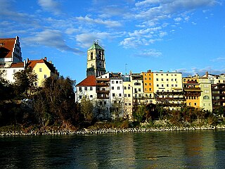
Wasserburg am Inn is a town in Rosenheim district in Upper Bavaria, Germany. The historic centre is a peninsula formed by the meandering river Inn. Many Medieval structures remain intact, giving the city a unique view.

<span class="mw-page-title-main">Bad Wiessee</span> Municipality in Bavaria, Germany

Bad Wiessee is a municipality in the district of Miesbach in Upper Bavaria in Germany. Since 1922, it has been a spa town and located on the western shore of the Tegernsee Lake. It had a population of around 4800 inhabitants in 2014. The word "Bad" means "spa" or "baths", while "Wiessee" derives from "Westsee", meaning "western part of the lake". Bad Wiessee was first documented in 1017 in the tax book of the Tegernsee Abbey, encouraged to pay goods to the abbey.

<span class="mw-page-title-main">Kolbermoor</span> Town in Bavaria, Germany

Kolbermoor is a town in the district of Rosenheim, in Bavaria, Germany.

<span class="mw-page-title-main">Bruckmühl</span> Municipality in Bavaria, Germany

Bruckmühl is a market town in the district of Rosenheim, in Bavaria, Germany. It is situated on the river Mangfall, 16 km west of Rosenheim.

<span class="mw-page-title-main">Eckental</span> Municipality in Bavaria, Germany

Eckental is a municipality in the district of Erlangen-Höchstadt, in Bavaria, Germany. It is situated 14 km east of Erlangen, and 16 km northeast of Nuremberg. It contains 17 districts: Benzendorf, Brand, Brandermühle, Büg, Ebach, Eckenhaid, Eckenmühle, Eschenau, Forth, Frohnhof, Herpersdorf, Illhof, Marquardsburg, Mausgesees, Oberschöllenbach, Oedhof, and Unterschöllenbach.

<span class="mw-page-title-main">Prien am Chiemsee</span> Municipality in Bavaria, Germany

Prien am Chiemsee is a municipality in the Upper Bavarian district of Rosenheim in Germany. The town is a certified air and Kneipp spa on the western shore of the lake of Chiemsee, 16 kilometres (9.9 mi) east of Rosenheim.

<span class="mw-page-title-main">Feldkirchen-Westerham</span> Municipality in Bavaria, Germany

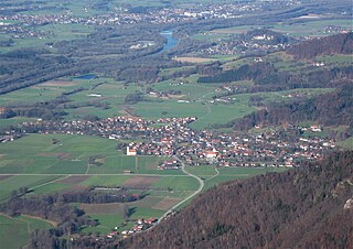
Feldkirchen-Westerham is a municipality in the district of Rosenheim, in Bavaria, Germany. It is situated 22 km west of Rosenheim.

<span class="mw-page-title-main">Bad Kötzting</span> Town in Bavaria, Germany

Bad Kötzting is a town in the district of Cham, in Bavaria, Germany, near the Czech border. It is situated in the Bavarian Forest, 15 km (9.3 mi) southeast of Cham.

<span class="mw-page-title-main">Röhrmoos</span> Municipality in Bavaria, Germany

Röhrmoos is a municipality in the district of Dachau in Bavaria in Germany. It is located ca. 25 km northwest of München. The community is located between the Amper and Glonn valleys.

<span class="mw-page-title-main">Bad Füssing</span> Municipality in Bavaria, Germany

Bad Füssing is a municipality in the district of Passau in Bavaria in Germany. Located some 3 km from the river Inn, which creates a border to Austria.

<span class="mw-page-title-main">Flintsbach</span> Municipality in Bavaria, Germany

Flintsbach is a municipality in the district of Rosenheim in Bavaria in Germany, on the river Inn.

<span class="mw-page-title-main">Griesstätt</span> Municipality in Bavaria, Germany

Griesstätt is a municipality in the district of Rosenheim in Bavaria, Germany. It lies on the river Inn.

<span class="mw-page-title-main">Kiefersfelden</span> Municipality in Bavaria, Germany

Kiefersfelden is a municipality with about 7000 inhabitants located in the district of Rosenheim in Bavaria, Germany, on the border with Tyrol, Austria.

<span class="mw-page-title-main">Nußdorf am Inn</span> Municipality in Bavaria, Germany

Nußdorf am Inn is a municipality in the district of Rosenheim in the state of Bavaria in Germany. Nußdorf consists of 23 boroughs and is a tourist destination in the Inn Valley between the Heuberg Wendelstein mountains on the Tyrol border. Nußdorf town center has Baroque churches and traditional farm houses.
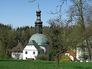
<span class="mw-page-title-main">Vogtareuth</span> Municipality in Bavaria, Germany

Vogtareuth is a municipality in the district of Rosenheim in Bavaria in Germany. It lies on the river Inn.

<span class="mw-page-title-main">Bad Endorf</span> Municipality in Bavaria, Germany

Bad Endorf is a municipality and a village in the district of Rosenheim in Bavaria in Germany. The market town is located about 15 km outside of Rosenheim and is in close proximity to Lake Simssee and Chiemsee lake and its larger shore towns, Prien, Gstadt, and Seebruck.

<span class="mw-page-title-main">Bad Aibling station</span> Railway station in Bad Aibling

Bad Aibling station is a railway station in the city of Bad Aibling, located in the Rosenheim district in Upper Bavaria, Germany.

References

  1. Liste der ersten Bürgermeister/Oberbürgermeister in kreisangehörigen Gemeinden, Bayerisches Landesamt für Statistik. Retrieved 13 June 2024.
  2. Genesis Online-Datenbank des Bayerischen Landesamtes für Statistik Tabelle 12411-003r Fortschreibung des Bevölkerungsstandes: Gemeinden, Stichtag (Einwohnerzahlen auf Grundlage des Zensus 2011).
  3. "Bad Feilnbach | bavarikon".
  4. 1 2 Wilhelm Volkert (Hrsg.) (1983), Handbuch der bayerischen Ämter, Gemeinden und Gerichte 1799–1980 (in German), München: C.H.Beck’sche Verlagsbuchhandlung, p. 425, ISBN   3-406-09669-7
  5. Statistisches Bundesamt, ed. (1983), Historisches Gemeindeverzeichnis für die Bundesrepublik Deutschland. Namens-, Grenz- und Schlüsselnummernänderungen bei Gemeinden, Kreisen und Regierungsbezirken vom 27. 5. 1970 bis 31. 12. 1982 (in German), Stuttgart und Mainz: Kohlhammer Verlag, p. 588, ISBN   3-17-003263-1