Schonstett

Last updated
Schonstett
Schonstett.jpg
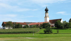
Church of Saint John the Baptist
DEU Schonstett COA.svg
Coat of arms
Location of Schonstett within Rosenheim district
Schonstett in RO.svg
Germany adm location map.svg
Red pog.svg
Schonstett
Bavaria location map.svg
Red pog.svg
Schonstett
Coordinates: 47°59′N12°15′E / 47.983°N 12.250°E / 47.983; 12.250 Coordinates: 47°59′N12°15′E / 47.983°N 12.250°E / 47.983; 12.250
Country Germany
State Bavaria
Admin. region Oberbayern
District Rosenheim
Municipal assoc. Halfing
Government
   Mayor (202026) Paul Dirnecker [1]
Area
  Total13.60 km2 (5.25 sq mi)
Elevation
492 m (1,614 ft)
Population
 (2020-12-31) [2]
  Total1,388
  Density100/km2 (260/sq mi)
Time zone UTC+01:00 (CET)
  Summer (DST) UTC+02:00 (CEST)
Postal codes
83137
Dialling codes 08055
Vehicle registration RO
Website www.schonstett.de

Schonstett is a municipality in the district of Rosenheim in Bavaria in Germany.

Contents

History

In the Middle Ages, Schonstett was the capital of the dominion of the Baron of Schleich. In the course of the 1818 administrative reform in Bavaria Schonstett became an independent municipality.

Culture and sights

Sports

Education

Youth

Related Research Articles

Mantel Place in Bavaria, Germany

Mantel is a municipality located in the district of Neustadt an der Waldnaab in Bavaria, Germany. It is known as a Markt, a town that was historically granted 'market rights'. The town was first mentioned in official documents in 1212, and in 1945 it was incorporated into the municipality of Rupprechtsreuth. As part of the regional reform in Bavaria, parts of the dissolved municipality of Hütten were added to it in 1972. The town's population fell by 77 people, 2.8%, to 2728 between 1988 and 2018. Mantel is best known for its nature preserve, Naturwaldreservat Gscheibte Loh, as well as its castle, Schloss Steinfels.

Grünwald, Bavaria Place in Bavaria, Germany

Grünwald is a municipality in the district of Munich, in the state of Bavaria, Germany. It is located on the right bank of the Isar, 12 km southwest of Munich (centre). As of 31 December 2011 it had a population of 11,109.

Mönchsroth Place in Bavaria, Germany

Mönchsroth is a municipality in the district of Ansbach in Bavaria in Germany.

Gessertshausen Place in Bavaria, Germany

Gessertshausen is a municipality in the district of Augsburg in Bavaria in Germany. It lies on the Schmutter River.

Bischofswiesen Place in Bavaria, Germany

Bischofswiesen is a municipality in the district of Berchtesgadener Land in Bavaria in Germany.

Kipfenberg Place in Bavaria, Germany

Kipfenberg is a town and municipality in the district of Eichstätt in Bavaria, Germany. It is known for its hillside castle and fortress, and for being the geographical centre of Bavaria. The river Altmühl flows through the municipality and its market town of Kipfenberg.

Taufkirchen (Vils) Place in Bavaria, Germany

Taufkirchen is a municipality in the district of Erding in Bavaria in Germany.

Stockheim Place in Bavaria, Germany

Stockheim is a municipality in the district of Kronach in Bavaria in Germany. It is located on Bundesstraße 85, and on the touristic route Bier- und Burgenstraße.

Igling Place in Bavaria, Germany

Igling is a municipality in the district of Landsberg in Bavaria in Germany.

Valley, Bavaria Place in Bavaria, Germany

Valley is a municipality in the district of Miesbach in Bavaria in Germany. The municipality of Valley holds, as of 2006, 2949 inhabitants.

Kreuth Place in Bavaria, Germany

Kreuth is a municipality in the district of Miesbach in Bavaria in Germany.

Schönberg, Upper Bavaria Place in Bavaria, Germany

Schönberg is a municipality in the district of Mühldorf in the Upper Bavaria region of Bavaria, Germany.

Burghaslach Place in Bavaria, Germany

Burghaslach is a municipality and a market town in the district of Neustadt (Aisch)-Bad Windsheim in Franconia in Bavaria, Germany.

Kallmünz Place in Bavaria, Germany

Kallmünz is a municipality in the district of Regensburg in Bavaria, Germany. Situated at the river Naab about 25 km north of Regensburg Kallmünz has conserved a beautiful medieval center. The main attractions are the ruins of the Kallmünz Castle above the town on a cliff and the old stone bridge over the Naab River. It was in Kallmünz that the Russian painter Wassily Kandinsky and the German expressionist painter Gabriele Münter met during the summer of 1903. Since then Kallmünz has been the constant home to a small art colony.

Amerang Place in Bavaria, Germany

Amerang is a municipality in the district of Rosenheim in Bavaria in Germany.

Brannenburg Place in Bavaria, Germany

Brannenburg is a municipality in the district of Rosenheim in Bavaria in Germany. There is a train station is located in Brannenburg.

Frasdorf Place in Bavaria, Germany

Frasdorf is a municipality in the district of Rosenheim in Bavaria in Germany.

Pfaffenhausen Place in Bavaria, Germany

Pfaffenhausen is a municipality in the district of Unterallgäu in Bavaria, Germany. The town is seat of a municipal association with Breitenbrunn, Swabia, Oberrieden, Bavaria and Salgen.

Güntersleben Place in Bavaria, Germany

Güntersleben is a municipality in the district of Würzburg in Bavaria in Germany.

Neubeuern Town in Bavaria, Germany

Neubeuern is a municipality in the district of Rosenheim in Bavaria in Germany. It lies on the inn river.

References

  1. Liste der ersten Bürgermeister/Oberbürgermeister in kreisangehörigen Gemeinden, Bayerisches Landesamt für Statistik, 15 July 2021.
  2. "Tabellenblatt "Daten 2", Statistischer Bericht A1200C 202041 Einwohnerzahlen der Gemeinden, Kreise und Regierungsbezirke". Bayerisches Landesamt für Statistik und Datenverarbeitung (in German). June 2021.