Wasserburg am Inn

Last updated
Wasserburg am Inn
Wasserburg3.jpg
Wasserburg am Inn
DEU Wasserburg am Inn COA.svg
Location of Wasserburg am Inn within Rosenheim district
Wasserburg am Inn in RO.svgRotter Forst-SüdRotter Forst-NordEdlingRohrdorf
Germany adm location map.svg
Red pog.svg
Wasserburg am Inn
Bavaria location map.svg
Red pog.svg
Wasserburg am Inn
Coordinates: 48°03.7′N12°14.0′E / 48.0617°N 12.2333°E / 48.0617; 12.2333
Country Germany
State Bavaria
Admin. region Oberbayern
District Rosenheim
Government
   Mayor (202026) Michael Kölbl [1] (SPD)
Area
  Total18.80 km2 (7.26 sq mi)
Elevation
427 m (1,401 ft)
Population
 (2023-12-31) [2]
  Total13,112
  Density700/km2 (1,800/sq mi)
Time zone UTC+01:00 (CET)
  Summer (DST) UTC+02:00 (CEST)
Postal codes
83512
Dialling codes 08071
Vehicle registration RO, AIB, WS
Website www.wasserburg.de
Aerial image of Wasserburg am Inn Aerial image of Wasserburg am Inn.jpg
Aerial image of Wasserburg am Inn

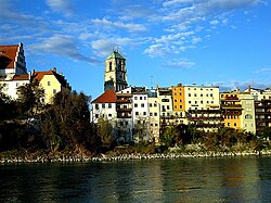
Wasserburg am Inn (Central Bavarian: Wassabuag am Inn) is a town in Rosenheim district in Upper Bavaria, Germany. The historic centre is a peninsula formed by the meandering river Inn. Many Medieval structures remain intact, giving the city a unique view.

Contents

Villages

Wasserburg consists of 22 Ortsteile:

History

Engraving by Michael Wening in Topographia Bavariae around 1700 Wening wasserburg.png
Engraving by Michael Wening in Topographia Bavariae around 1700

The town was first mentioned in a document (now considered to be a fake) in 1137, when Hallgraf Engelbert moved his residence from the nearby castle Limburg to his "Wasserburg" (Water Castle). It is one of the most historic towns of Old Bavaria – somewhat older than Munich, continually fought over by the Bavarian nobility and, up to the 16th century, on an equal footing with larger cities. The privileges afforded by this enabled the salt trade to flourish right into the 19th century. At the junction of the main overland route with the main water route, Wasserburg became the most important trade centre with the Balkans, Austria and Italy, a means of attaining power and wealth for the shipping owners and merchants.

In the early days, Wasserburg was an important hub in the salt trade. Its bridge was the only possibility to cross the river Inn for 30 km in both directions. On its shore the salt, mined in Berchtesgaden or produced in the Saline (saltern) at Bad Reichenhall and shipped from there by cart, could be loaded on ships travelling on the Inn River. Up to the 17th century Wasserburg was used as the port of the capital Munich.

Up until 1972, when it was merged with the district Rosenheim, Wasserburg was a district capital on its own.

Historical population
YearPop.±%
1 December 18402,782    
1 December 18713,852+38.5%
1 December 19005,146+33.6%
16 June 19256,287+22.2%
17 May 19396,900+9.8%
13 September 7,930+14.9%
6 June 19619,388+18.4%
27 May 197010,087+7.4%
25 May 19879,067−10.1%
9 May 201112,127+33.7%
Source: [3]

In literature

Gustav Meyrink's most esoteric novel The White Dominican (German : Der weiße Dominikaner) is set in a mystical version of the town of Wasserburg.

Related Research Articles

Rosenheim is a Landkreis (district) in the south of Bavaria, Germany. Neighboring districts are, clockwise from the west, Miesbach, Munich, Ebersberg, Mühldorf, and Traunstein, with the Austrian province Tirol across the southern border. The district entirely surrounds the city of Rosenheim, which is independently administered but hosts the district's administration; both the city and the district share the "RO" designation for their license plates.
<span class="mw-page-title-main">Upper Bavaria</span> Regierungsbezirk in Bavaria, Germany

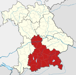
Upper Bavaria is one of the seven administrative regions of Bavaria, Germany.

<span class="mw-page-title-main">Rosenheim</span> Town in Bavaria, Germany

Rosenheim is a city in Bavaria, Germany. It is an independent city located in the centre of the district of Rosenheim, and is also the seat of its administration. It is located on the west bank of the Inn at the confluence of the rivers Inn and Mangfall, in the Bavarian Alpine Foreland. It is the third largest city in Upper Bavaria with over 64,000 inhabitants. Rosenheim is the economic centre and the busiest place in the region.
<span class="mw-page-title-main">Mühldorf</span> Town in Bavaria, Germany

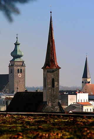
Mühldorf am Inn is a town in Bavaria, Germany, and the capital of the district Mühldorf on the river Inn. It is located at 48°14′30″N12°31′30″E, and had a population of about 17,808 in 2005.

<span class="mw-page-title-main">Ebersberg</span> Town in Bavaria, Germany

Ebersberg is the seat of the similarly named Ebersberg Landkreis (district) in the Oberbayern Regierungsbezirk in Bavaria, southern Germany. The Ebersberger Forst (forest) is one of Germany’s largest continuous area of woodlands.

<span class="mw-page-title-main">Marktl</span> Municipality in Bavaria, Germany

Marktl, or often unofficially called Marktl am Inn, is a village and historic market municipality in the state of Bavaria, Germany, near the Austrian border, in the Altötting district of Upper Bavaria. The most notable neighbouring town is Altötting. Marktl has approximately 2,800 inhabitants.
<span class="mw-page-title-main">Burghausen, Altötting</span> Town in Bavaria, Germany

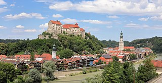
Burghausen is the largest town in the Altötting district of Upper Bavaria in Germany. It is situated on the Salzach river, near the border with Austria. Burghausen Castle rests along a ridgeline, and is the longest castle in the world.

<span class="mw-page-title-main">Waldkirchen</span> Town in Bavaria, Germany

Waldkirchen is the biggest town in the district of Freyung-Grafenau in Germany.

<span class="mw-page-title-main">Grafing</span> Town in Bavaria, Germany

Grafing bei München is a town in the district of Ebersberg, Upper Bavaria, Germany.

<span class="mw-page-title-main">Prien am Chiemsee</span> Municipality in Bavaria, Germany

Prien am Chiemsee is a municipality in the Upper Bavarian district of Rosenheim in Germany. The town is a certified air and Kneipp spa on the western shore of the lake of Chiemsee, 16 kilometres (9.9 mi) east of Rosenheim.
<span class="mw-page-title-main">Neuötting</span> Town in Bavaria, Germany

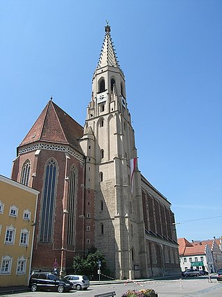
Neuötting is a town in the district of Altötting, in Bavaria, Germany. It is situated on the river Inn, 2 km north of Altötting, about 70 km north of Salzburg, 80 southwest of Passau and almost 100 km east of Munich. It is a stop on the railway line between Munich and Simbach.

<span class="mw-page-title-main">Gstadt am Chiemsee</span> Municipality in Bavaria, Germany

Gstadt am Chiemsee is a municipality and a village in the district of Rosenheim, Bavaria, Germany. It is located on Lake Chiemsee.
<span class="mw-page-title-main">Kirchseeon</span> Municipality in Bavaria, Germany

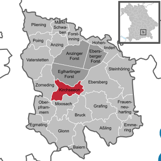
Kirchseeon is a market town in the Upper Bavarian district of Ebersberg and lies 15 km east of Munich city limits.

<span class="mw-page-title-main">Haag in Oberbayern</span> Municipality in Bavaria, Germany

Haag in Oberbayern is a municipality in the district of Mühldorf in Bavaria in Germany, in December 2013 the municipality had a population of 6359.

<span class="mw-page-title-main">Neuburg am Inn</span> Municipality in Bavaria, Germany

Neuburg am Inn is a municipality in the district of Passau in Bavaria in Germany.

<span class="mw-page-title-main">Amerang</span> Municipality in Bavaria, Germany

Amerang is a municipality and a village in the Rosenheim district in Bavaria, Germany.
<span class="mw-page-title-main">Bernau am Chiemsee</span> Municipality in Bavaria, Germany

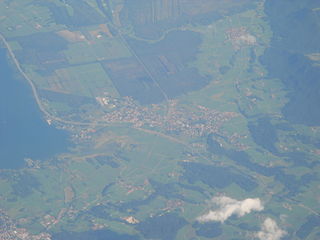
Bernau am Chiemsee is a municipality in the district of Rosenheim in Germany on the Lake Chiemsee, and a Luftkurort.

<span class="mw-page-title-main">Flintsbach</span> Municipality in Bavaria, Germany

Flintsbach is a municipality in the district of Rosenheim in Bavaria in Germany, on the river Inn.

<span class="mw-page-title-main">Albaching</span> Municipality in Bavaria, Germany

Albaching is a municipality in the district of Rosenheim in Bavaria in Germany.

<span class="mw-page-title-main">Halfing</span> Municipality in Bavaria, Germany

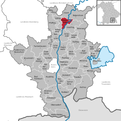
Halfing is a municipality in the district of Rosenheim in Bavaria in Germany. It is located in the western part of the Chiemgau area, half-way between Chiemsee and Wasserburg am Inn.
References

  1. Liste der ersten Bürgermeister/Oberbürgermeister in kreisangehörigen Gemeinden, Bayerisches Landesamt für Statistik, 15 July 2021.
  2. Genesis Online-Datenbank des Bayerischen Landesamtes für Statistik Tabelle 12411-003r Fortschreibung des Bevölkerungsstandes: Gemeinden, Stichtag (Einwohnerzahlen auf Grundlage des Zensus 2011).
  3. "Statistil kommunal 2023: Stadt Wasserbung a.Inn" (PDF). bayern.de.

Historical Lexicon of Wasserburg (in German)

Commons-logo.svg Media related to Wasserburg am Inn at Wikimedia Commons