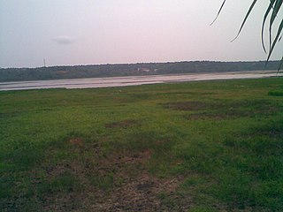
Anavoor

Last updated
Anavoor
village
India Kerala location map.svg
Red pog.svg
Anavoor
Location in Kerala, India
India location map.svg
Red pog.svg
Anavoor
Anavoor (India)
Coordinates: 8°25′0″N77°5′0″E / 8.41667°N 77.08333°E / 8.41667; 77.08333 Coordinates: 8°25′0″N77°5′0″E / 8.41667°N 77.08333°E / 8.41667; 77.08333
CountryFlag of India.svg  India
State Kerala
District Thiruvananthapuram
Talukas Neyyattinkara
Government
  Body Gram panchayat
Population (2001)
  Total 14,618
Languages
  Official Malayalam, English
Time zone IST (UTC+5:30)
PIN 695124 [1]
Vehicle registration KL-

Anavoor is a village in Thiruvananthapuram district in the state of Kerala, India. [2]

Thiruvananthapuram district District of Kerala in India

Thiruvananthapuram District is the southernmost district of the coastal state of Kerala. The district was created 1957, with its headquarters in the city of Thiruvananthapuram (Trivandrum), which is also Kerala's capital.

Kerala State in southern India

Kerala is a state on the southwestern, Malabar Coast of India. It was formed on 1 November 1956, following passage of the States Reorganisation Act, by combining Malayalam-speaking regions. Spread over 38,863 km2 (15,005 sq mi), Kerala is the twenty second largest Indian state by area. It is bordered by Karnataka to the north and northeast, Tamil Nadu to the east and south, and the Lakshadweep Sea and Arabian Sea to the west. With 33,387,677 inhabitants as per the 2011 Census, Kerala is the thirteenth-largest Indian state by population. It is divided into 14 districts with the capital being Thiruvananthapuram. Malayalam is the most widely spoken language and is also the official language of the state.

India Country in South Asia

India, also known as the Republic of India, is a country in South Asia. It is the seventh largest country by area and with more than 1.3 billion people, it is the second most populous country and the most populous democracy in the world. Bounded by the Indian Ocean on the south, the Arabian Sea on the southwest, and the Bay of Bengal on the southeast, it shares land borders with Pakistan to the west; China, Nepal, and Bhutan to the northeast; and Bangladesh and Myanmar to the east. In the Indian Ocean, India is in the vicinity of Sri Lanka and the Maldives, while its Andaman and Nicobar Islands share a maritime border with Thailand and Indonesia.

Demographics

As of 2001 India census, Anavoor had a population of 14618 with 7224 males and 7394 females. [2] Anavoor village-kunnathukal panchayath-neyyattinkara taluk-trivandrum district. Ghss Anavoor is the popular school. Agriculture is the main occupation of the people.

Census Acquiring and recording information about the members of a given population

A census is the procedure of systematically acquiring and recording information about the members of a given population. The term is used mostly in connection with national population and housing censuses; other common censuses include agriculture, business, and traffic censuses. The United Nations defines the essential features of population and housing censuses as "individual enumeration, universality within a defined territory, simultaneity and defined periodicity", and recommends that population censuses be taken at least every 10 years. United Nations recommendations also cover census topics to be collected, official definitions, classifications and other useful information to co-ordinate international practice.

Related Research Articles

Aryanadu town in Kerala, India

Aryanadu is an Indian village town lying under the foothills of the Agastyarkoodam of the Sahya mountains, in the state of Kerala. The village is spread along the sides of Karamana River in the western ghats of Agasthya Mountains. The Aryanad Panchayath has border with Uzhamalakkal, Vellanad, Poovachal, Kuttichal, Vithura, Tholickode panchayaths and Thiruneveli District of Tamil Nadu India. Aryanad is residing Nedumangad Taluk and Aruvikkara Legislative Assembly. It is situated around 25 km from Thiruvananthapuram. K.S. Sabarinath is the current sitting MLA of Aryanad.

Choornikkara village in Kerala, India

Choornikkara is a census town in Aluva in Ernakulam District in Kerala, India.

Mallappuzhassery village in Kerala, India

Mallappuzhassery is a village situated in the Greater Kozhencherry region near the Aranmula Parthasarathy Temple, in the Pathanamthitta district in Kerala, India. Its border starts in the middle of the temple grounds running north–south: the eastern part is Mallappuzhassery and the western part is Edasserimala. Edasserimala is part of Aranmula Panchayath and Mallappuzhassery is of Mallappuzhassery Panchayath. The northern border of this village is the Pamba River.

Kannamangalam (Alappuzha) Temble in Kerala, India

Kannamangalam is a village in Mavelikkara Taluk in Alappuzha district in the Indian state of Kerala. It lies in Chettikulangara Grama Panchayath. Kannamangalam Mahadeva temple is the main landmark of the village. The deity of the temple is Lord Shiva.The temple is believed to be build by kanvamahirshi.Kannamangalam Mahadevar is believed to be the father of Chettikulangara Devi.On the day of Shivarathri Devi comes to meet her father and her devotees.

Marady village in Kerala, India

Marady is a village in Ernakulam district in the Indian state of Kerala.

Parakkadavu village in Kerala, India

Parakkadavu (English: The ferry of rock) is a village situated along the banks of the chalakkudi river in Ernakulam district in the Indian state of Kerala. Local paddy fields are fed by the chalakkudi river. Parakkadavu is a grama panchayath and a block panchayath. The Moozhikkulam Lakshmana Temple is a short distance from Parakkadavu.

Thrikkariyoor village in Kerala, India

Thrikariyoor is a village in Nellikuzhi panchayath in Ernakulam district in the Indian state of Kerala. Thrikkariyoor Mahadeva Temple is nearby.

Adinad village in Kerala, India

Adinadu is a village in Kollam district in the state of Kerala, India.Adinadu included in Kulasekharapuram panchayath.

Chirakkara village chirakkara in Kerala, India

Chirakkara is a village in Kollam district in the state of Kerala, India. Chirakkara is 16 km away from the City of Kollam and 8 km away from Paravur Town, which is famous for festivals, estuary, backwaters and beaches.

Kottukkal Village in Kerala, India

Kottukkal is a village in Kollam district of Kerala, India. The historical importance of the village is linked to Kottukal cave temple, built before 800 CE. The village comes under Ittiva panchayath and it is the most prominent town in this panchayath. The village has many libraries such as Safder Hashmi library and Kairaly library. Attractions include the district agricultural farm. Ancient temples here include more than 6 temples surrendered in 3 kilometers of Kottukkal, such as the Cave temple.

Kulakkada village in Kerala, India

Kulakkada is a village in Kollam district in the state of Kerala, India.

Kallikkad village in Kerala, India

Kallikkad is a village in Thiruvananthapuram District in the southern Indian state of Kerala. The village is one of the 11 census villages in the Neyyattinkara taluka of Thiruvananthapuram district.As per the 2001 Census of India, Kallikkad has a population of 9,515. Males number 4,705 and females number 4,810. Neyyar dam is situated in this panchayath. there are so meny Kani settlements in this panchayath. vlavetti is one of them. this panchayath have prominent historical and cultural backgrounds. the travancore king, Marthanda varma's plight against Ettuveetil pillas were through the mountain paths of kallikkadu.

Peringamala village in Kerala, India

Peringammala is the first largest panchayat in Thiruvananthapuram district in the state of Kerala, India. There are two places named Peringammala, the other one is between balaramapuram and venganoor which is on the southern side of the Thiruvananthapuram district.There is two villages peringammala and thennoor. Beautiful tourist place in there including ponmudi, mankayam, brimore, etc. Festival palod mela also there.

Examba Town in Karnataka, India

Examba is a large village located in Chikodi sub-district (taluka) of Belgaum district, Karnataka in India.

Managuli village in Karnataka, India

Managuli , sometimes also called Mangoli and Managoliis a village in the southern state of Karnataka, India. It is located in the Basavana Bagevadi taluk of Bijapur district in Karnataka.

Karimba, Palakkad human settlement in India

Karimba is a gram panchayat in the Palakkad district, state of Kerala, India, near the National Highway 213. The largest town in Karimba panchayath is Kalladikode. It borders with Thachampara, Kongad and Mundur. Recently, it was awarded the Nirmal Gram Title (sanitation). It is the local government organisation that serves the villages of Karimba-I and Karimba-II.

Karimpuzha is a gram panchayat in the Palakkad district, state of Kerala, India. It is a local government organisation that serves the villages of Karimpuzha-I and Karimpuzha-II.

Chapparapadavu village in India

Chapparapadavu is a village (panchayath) in Kannur district in the Indian state of Kerala. The villages of Koovery, Kottakkanam, and Therandi are part of the panchayath. Chapparapadavu has 14,883 people. Board of Members of the Grama Panchayat, Chapparapadava during 1987-95 Ward 1 Kariyil Narayanan Ward 2. I Damodaran Master 3. M Assainar Haji 4. C P Safiya 5. P Kunhiraman 6. V P Kunhiraman 7. E Kunhiraman 8. Mary Thomas Poovanpuzha 9.V J Chacko Master 10.K Madhavan Master 11. T.C Sebastian.

Kolachery is a Grama panchayath situated in Kannur District of Kerala state, India.

Korahalli Village in Karnataka, India

Korhalli is a large village located in Sindagi Taluk in Bijapur District of Karnataka State, India.

References

  1. "India Post :Pincode Search". Archived from the original on 15 December 2008. Retrieved 2008-12-16.
  2. 1 2 "Census of India: Villages with population 5000 & above". Registrar General & Census Commissioner, India. Archived from the original on 8 December 2008. Retrieved 2008-12-10.

Remani P Nair is the District Panchayath President. Not Anaavoor Nagappan