Anderson, Iron County, Wisconsin

Last updated
Anderson, Wisconsin
Iron County Wisconsin incorporated and unincorporated areas Anderson highlighted.svg
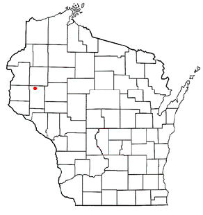
Location in Iron County and the state of Wisconsin.
Coordinates: 46°21′55″N90°26′32″W / 46.36528°N 90.44222°W / 46.36528; -90.44222 Coordinates: 46°21′55″N90°26′32″W / 46.36528°N 90.44222°W / 46.36528; -90.44222
Country Flag of the United States.svg  United States
State Flag of Wisconsin.svg  Wisconsin
County Iron
Area
  Total83.6 sq mi (216.5 km2)
  Land83.2 sq mi (215.4 km2)
  Water0.4 sq mi (1.1 km2)
Elevation
[1]
1,726 ft (526 m)
Population
 (2000)
  Total61
  Density0.7/sq mi (0.3/km2)
Time zone UTC-6 (Central (CST))
  Summer (DST) UTC-5 (CDT)
Area codes 715 & 534
FIPS code 55-01925 [2]
GNIS feature ID1582694 [1]

Anderson is a town in Iron County, Wisconsin, United States. The population was 61 at the 2000 census. The unincorporated communities of Rouse, Tyler Forks, and Upson are located in the town.

Contents

History

It was created from the Town of Knight on March 14, 1900, as the Town of Vogel and renamed in 1903 to honor local pioneer and first Town Chair J.P. Anderson. [3]

Geography

According to the United States Census Bureau, the town has a total area of 83.6 square miles (216.5 km2), of which 83.2 square miles (215.5 km2) is land and 0.4 square mile (1.1 km2) (0.50%) is water.

Demographics

As of the census [2] of 2000, there were 61 people, 28 households, and 16 families residing in the town. The population density was 0.7 people per square mile (0.3/km2). There were 118 housing units at an average density of 1.4 per square mile (0.5/km2). The racial makeup of the town was 98.36% White, and 1.64% from two or more races.

There were 28 households, out of which 25.0% had children under the age of 18 living with them, 60.7% were married couples living together, and 39.3% were non-families. 35.7% of all households were made up of individuals, and 14.3% had someone living alone who was 65 years of age or older. The average household size was 2.18 and the average family size was 2.88.

In the town, the population was spread out, with 21.3% under the age of 18, 3.3% from 18 to 24, 32.8% from 25 to 44, 24.6% from 45 to 64, and 18.0% who were 65 years of age or older. The median age was 43 years. For every 100 females, there were 103.3 males. For every 100 females age 18 and over, there were 100.0 males.

The median income for a household in the town was $15,417, and the median income for a family was $32,500. Males had a median income of $39,375 versus $19,167 for females. The per capita income for the town was $17,611. There were no families and 10.9% of the population living below the poverty line, including no under eighteens and 21.4% of those over 64.

Related Research Articles

Hammond, Maine Town in Maine, United States

Hammond is a town in Aroostook County, Maine, United States. The population was 118 at the 2010 census.

Roque Bluffs, Maine Town in Maine, United States

Roque Bluffs is a town in Washington County, Maine, United States. The population was 303 at the 2010 census. The town is home to Roque Bluffs State Park.

Lemington, Vermont Town in Vermont, United States

Lemington is a town in Essex County, Vermont, United States. The population was 87 as of the 2020 census. It is part of the Berlin, NH–VT Micropolitan Statistical Area.

Quinwood, West Virginia Town in West Virginia, United States

Quinwood is a town and former coal town in Greenbrier County, West Virginia, United States. The population was 290 at the 2010 census.

Belle, West Virginia Town in West Virginia, United States

Belle is a town in Kanawha County, West Virginia, United States, situated along the Kanawha River. The population was 1,260 at the 2010 census. Belle was incorporated on December 13, 1958 by the Kanawha County Circuit Court. It is the home of the Belle Bulldogs Elementary School.

Carpendale, West Virginia Town in West Virginia, United States

Carpendale is a town in Mineral County, West Virginia, United States, and part of the Cumberland, MD-WV Metropolitan Statistical Area'. The population was 977 at the 2010 census. Carpendale was incorporated on January 2, 1990, by the Circuit Court. The town is a combination of three subdivisions of which its name reflects: Carpenters Addition, Millerdale I, and Millerdale II. There are no stores in Carpendale and there is only one road in and out of the town.

Lincoln, Bayfield County, Wisconsin Town in Wisconsin, United States

Lincoln is a town in Bayfield County, Wisconsin, United States. The population was 287 at the 2010 census.

Hendren, Wisconsin Town in Wisconsin, United States

Hendren is a town in Clark County in the U.S. state of Wisconsin. The population was 499 at the 2010 census. The unincorporated communities of Tioga and Willard are located in the town.
Waterloo, Grant County, Wisconsin Town in Wisconsin, United States

Waterloo is a town in Grant County in the U.S. state of Wisconsin. The population was 557 at the 2000 census. The unincorporated communities of Burton and McCartney is located in the town.

Sherman, Iron County, Wisconsin Town in Wisconsin, United States

Sherman is a town in Iron County, Wisconsin, United States. The population was 336 at the 2000 census. The unincorporated communities of Powell and Springstead are located in the town. The Lac du Flambeau Band of Lake Superior Chippewa is located partially in the town.

Albion, Jackson County, Wisconsin Town in Wisconsin, United States

Albion is a town in Jackson County, Wisconsin, United States. The population was 1,093 at the 2000 census. The unincorporated community of Disco is located in the town.

Seymour, Lafayette County, Wisconsin Town in Wisconsin, United States

Seymour is a town in Lafayette County, Wisconsin, United States. The population was 446 at the 2010 census, up from 363 at the 2000 census. The unincorporated community of Seymour Corners is located in the town.

White Oak Springs, Wisconsin Town in Wisconsin, United States

White Oak Springs is a town in Lafayette County, Wisconsin, United States. The population was 118 at the 2010 census, up from 97 at the 2000 census. The unincorporated community of White Oak is located in the town.

Frankfort, Pepin County, Wisconsin Town in Wisconsin, United States

Frankfort is a town in Pepin County, Wisconsin, United States. The population was 362 at the 2000 census. The unincorporated communities of Ella, and Porcupine are located in the town.

Hubbard, Rusk County, Wisconsin Town in Wisconsin, United States

Hubbard is a town in Rusk County, Wisconsin, United States. The population was 168 at the 2000 census. The town was likely named for Arthur O. Hubbard, a manufacturer based in Minnesota.

Unity, Trempealeau County, Wisconsin Town in Wisconsin, United States

Unity is a town in Trempealeau County, Wisconsin, United States. The population was 556 at the 2000 census.

Black Earth (town), Wisconsin

Black Earth is a town in Dane County, Wisconsin, United States. The population was 449 at the 2000 census.

Rib Mountain (town), Wisconsin Town in Wisconsin, United States

Rib Mountain is a town in Marathon County, Wisconsin, United States. The population was 6,825 at the 2010 census. A suburb of Wausau, it is part of the Wausau Metropolitan Statistical Area. The census-designated place of Rib Mountain is located in the town.

Star Prairie is a town in St. Croix County, Wisconsin, United States. The population was 2,944 at the 2000 census. The Village of Star Prairie is located on the eastern boundary of the town. The unincorporated communities of Huntington and Johannesburg are located in the town.

Coloma is a town in Waushara County, Wisconsin, United States. The population was 748 at the 2000 census. The Village of Coloma is located within the town.

References

  1. 1 2 "US Board on Geographic Names". United States Geological Survey. 2007-10-25. Retrieved 2008-01-31.
  2. 1 2 "U.S. Census website". United States Census Bureau . Retrieved 2008-01-31.
  3. Techtmann, Catherine (1993). Rooted in Resources: Iron County, Wisconsin 1893-1993. p. 118.