
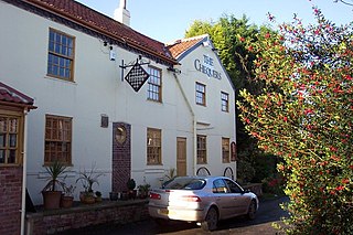
Kirkham is a village in the civil parish of Westow, in North Yorkshire, England, close to Malton, situated in the Howardian Hills alongside the River Derwent, and is notable for the nearby ruins of Kirkham Priory, an Augustinian establishment.
Bilton-in-Ainsty is a village in the civil parish of Bilton-in-Ainsty with Bickerton, in North Yorkshire, England. It lies about 4 miles (6 km) east of Wetherby and 8 miles (13 km) west of York. Bilton had a population of 147 in 2006.

Hetton is a small Dales village in the civil parish of Hetton-cum-Bordley, in the North Yorkshire district of North Yorkshire, England, situated 5.75 miles north of Skipton by the B6265 road. It is the largest settlement in the parish of Hetton-cum-Bordley. The population of the former civil parish of Hetton taken at the 2011 Census was 155.
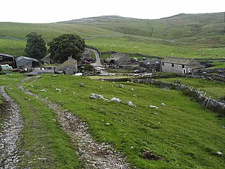
Bordley is a village in the civil parish of Hetton-cum-Bordley, in North Yorkshire, England, within the Yorkshire Dales National Park and 12 miles (19 km) north of Skipton. According to the 2001 census the parish had a population of 23.

Speeton is a village in the civil parish of Reighton, in North Yorkshire, England. It lies near the edge of the coastal cliffs midway between Filey and Bridlington. It is North Yorkshire's easternmost settlement, but historically lay in the East Riding of Yorkshire until local government re-organisation in 1974. It was part of the Borough of Scarborough from 1974 until 2023.

Wass is a village in the civil parish of Byland with Wass, in North Yorkshire, England, in the North York Moors National Park. A short distance from the village lie the ruins of Byland Abbey. Despite the small size of the village there is a pub, the Stapylton Arms. It is at the foot of Wass Bank and has views of the surrounding countryside. From 1974 to 2023 it was in the Ryedale district.

High Ellington is a village in lower Wensleydale in North Yorkshire, England, about 2.5 miles (4 km) north-west of Masham. The smaller village of Low Ellington is 0.6 miles (0.97 km) to the east. High Ellington is in Harrogate district, and is the largest settlement in the civil parish of Ellington High and Low, which also includes Low Ellington and the scattered settlement of Sutton. The population of the parish was estimated at 60 in 2013.
Conistone with Kilnsey is a civil parish in Wharfedale in the district of Craven, North Yorkshire, England. It contains the villages of Kilnsey and Conistone. The population of this civil parish at the 2011 Census was 124 with an estimated population of 110 in 2015.

Minskip is a village in the civil parish of Boroughbridge, in North Yorkshire, England. It is on the A6055 road and 1 mile south-west of Boroughbridge. Minskip appears in the Domesday Book as Minescip, a name derived from the Old English gemaenscipe meaning a community or communal holding.
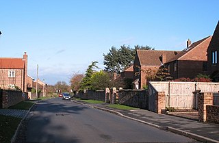
Long Marston is a village and civil parish in the Harrogate district of North Yorkshire, England. Historically part of the West Riding of Yorkshire, it is situated on the B1224 road from Wetherby to York, 7 miles (11 km) west of York. The civil parish includes the hamlets of Hutton Wandesley, immediately south of the village of Long Marston, and Angram, 1.5 miles (2.4 km) south east of Hutton Wandesley.

Bickerton is a village on the B1224 road, in the civil parish of Bilton-in-Ainsty with Bickerton, in North Yorkshire, England. The nearest town is Wetherby. There is a plantation nearby called Bickerton Plantation.
Knapton is a village in the civil parish of Rufforth with Knapton, in the City of York unitary authority area and ceremonial county of North Yorkshire, England. It is 3 miles (5 km) west of York and is bounded by the village of Acomb to the east, the B1224 to the south, the A59 to the north and the A1237 York Outer Ring Road to the west.

Wath is a small hamlet in the civil parish of Hovingham, in North Yorkshire, England. It is situated at the northern edge of the Howardian Hills AONB, about 0.6 miles (1 km) east of Hovingham on the B1257 road which crosses here over Wath Beck. Limestone is quarried here which in the 1950s was in demand by the steel industry for lining the furnaces.

Lower Dunsforth is a village in the civil parish of Dunsforths, in North Yorkshire, England. It was recorded in the Domesday Book (1086) as Doneforde/Dunesford/Dunesforde. St Mary's church was rebuilt in the 1860s with a buttressed spire.

Ryton is a hamlet and former civil parish 19 miles (31 km) from York, now in the parish of Habton, in the Ryedale district, in the county of North Yorkshire, England. In 1961 the parish had a population of 124.

Butterwick is a village and former civil parish about 6 miles from Pickering, now in the parish of Barton-le-Street, in North Yorkshire, England. In 1961 the parish had a population of 41. Butterwick has a church called Holy Epiphany.

Great Habton is a village and former civil parish about 18 miles from York, now in the parish of Habton, in the Ryedale district, in the county of North Yorkshire, England. In 1961 the parish had a population of 103.
South Holme is a settlement and civil parish about 17 miles from York, in the Ryedale district, in the county of North Yorkshire, England. In 2001 the parish had a population of 31. The parish touches Barton-le-Street, Fryton, Hovingham, Nunnington and Slingsby. South Holme shares a parish council with Slingsby and Fryton.
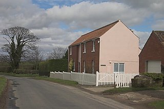
Wilstrop is a civil parish about 8 miles (13 km) west of York, in the Harrogate district, in the county of North Yorkshire, England. In 2001 the parish had a population of 44, and in 2015 the population was estimated at 60. There is no modern village in the parish. The site of the deserted medieval village of Wilstrop lies near the River Nidd on the northern boundary of the parish.

Menethorpe is a hamlet and former civil parish, now in the parish of Burythorpe, in North Yorkshire, England. In 1931 the parish had a population of 68. It is about 2.5 miles (4 km) from Malton.

