Nauru, officially the Republic of Nauru and formerly known as Pleasant Island, is an island country and microstate in Micronesia, part of Oceania in the Central Pacific. Its nearest neighbour is Banaba of Kiribati, about 300 km (190 mi) to the east.
Nauru is a tiny phosphate rock island nation located in the South Pacific Ocean south of the Marshall Islands in Oceania. It is only 53 kilometres (33 mi) south of the Equator at coordinates 0°32′S166°55′E. Nauru is one of the three great phosphate rock islands in the Pacific Ocean—the others are Banaba in Kiribati and Makatea in French Polynesia.

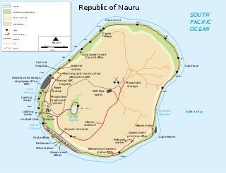
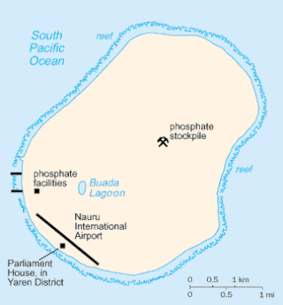
Yaren is a district of the Pacific island country of Nauru. It is the de facto capital of Nauru and is coextensive with Yaren Constituency.
Uaboe is a district in the island nation of Nauru, located in the northwest of the island.
Meneng is a district located in the Meneng Constituency in the country of Nauru. The constituency elects 2 members to the Parliament of Nauru in Yaren.

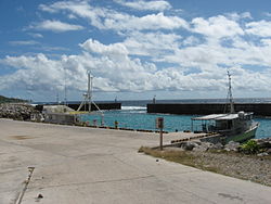
Aiwo is a district in the Pacific country of Nauru. Jarrit Morpak is the city's mayor, elected in 2008. It belongs to Aiwo Constituency.

Anetan is a district in the Pacific island nation of Nauru. It lies in Anetan Constituency.

Nibok is a district in the island nation of Nauru in the Micronesian South Pacific. It is located in the west of the island and covers an area of 1.6 square kilometres. Nibok is a part of the Ubenide Constituency. As of 2011, the population was 484.

Ijuw is a district in the country of Nauru, located in the northeast of the island. The area covers 1.1 km2 and has a population of 180, making Ijuw the least populated district in the country.

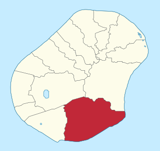
Boe is a district in the country of Nauru. It is the only district of Boe Constituency.
Denigomodu is a district in the western part of the island of Nauru. It is the most populous district in Nauru.

Anabar is a district in the Pacific country of Nauru.
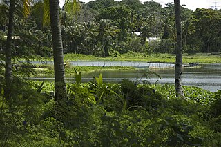
Buada is a district in the Pacific nation of Nauru. It is the only district in Buada Constituency. It has a population of 739 (2011).

Ewa is a district in the Pacific nation of the Republic of Nauru, located in the north of island.

Nauru is positioned in the Nauru Basin of the Pacific Ocean, on a part of the Pacific Plate that formed at a mid oceanic ridge at 132 Ma. From mid Eocene (35 Ma) to Oligocene times a submarine volcano built up over a hotspot, and formed a seamount composed of basalt. The seamount rises over 4300 m above the ocean floor. This hotspot developed simultaneously with a major Pacific Plate reorganisation.
Nauru is a small, isolated western Pacific island, which lacks many of the tourist facilities of some of its larger neighbours, such as Fiji, the Cook Islands, or even New Caledonia. Tourism is not a major contributor to the economy, with more than 200 tourists a year visiting the island.

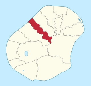
Anabar Constituency is one of the constituencies of Nauru and is made up of three districts: Anabar, Anibare, and Ijuw. It covers an area of 5.1 km², and has a population of 1,240. It returns two members to the Parliament of Nauru in Yaren.
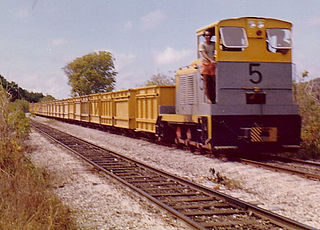
In Nauru, rail transport is used for moving calcium pyrophosphate from the island's interior to the cantilever jetties on the island's western coast. For this purpose, a 3.9 km (2.4 mi) long, 610 mm gauge was built by the Pacific Phosphate Company in 1907. The line passes through the districts of Aiwo, Buada, Denigomodu, Nibok, Uaboe and Anibare.
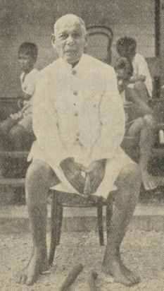
Daimon was Head Chief of Nauru from 1920 until 1930. His 42 years as a chief was a record length of service.

Chitra Talatoka Jeremiah is a Nauruan diplomat.