Antrim Township, Watonwan County, Minnesota

Last updated

Antrim Township, Minnesota
USA Minnesota location map.svg
Red pog.svg
Antrim Township, Minnesota
Location within the state of Minnesota
Usa edcp location map.svg
Red pog.svg
Antrim Township, Minnesota
Antrim Township, Minnesota (the United States)
Coordinates: 43°53′3″N94°25′9″W / 43.88417°N 94.41917°W / 43.88417; -94.41917
Country United States
State Minnesota
County Watonwan
Area
  Total35.8 sq mi (92.7 km2)
  Land35.7 sq mi (92.4 km2)
  Water0.1 sq mi (0.3 km2)
Elevation
1,070 ft (326 m)
Population
 (2000)
  Total291
  Density8.2/sq mi (3.1/km2)
Time zone UTC-6 (Central (CST))
  Summer (DST) UTC-5 (CDT)
FIPS code 27-01810 [1]
GNIS feature ID0663443 [2]

Antrim Township is a township in Watonwan County, Minnesota, United States. The population was 291 at the 2000 census.

Contents

Antrim Township was organized in 1867. [3]

Geography

According to the United States Census Bureau, the township has a total area of 35.8 square miles (93 km2), of which 35.7 square miles (92 km2) is land and 0.1 square miles (0.26 km2) (0.34%) is water.

Demographics

As of the census [1] of 2000, there were 291 people, 115 households, and 81 families residing in the township. The population density was 8.2 inhabitants per square mile (3.2/km2). There were 124 housing units at an average density of 3.5 per square mile (1.4/km2). The racial makeup of the township was 94.50% White, 1.72% African American, 3.09% from other races, and 0.69% from two or more races. Hispanic or Latino of any race were 3.78% of the population.

There were 115 households, out of which 27.0% had children under the age of 18 living with them, 70.4% were married couples living together, and 28.7% were non-families. 25.2% of all households were made up of individuals, and 13.9% had someone living alone who was 65 years of age or older. The average household size was 2.53 and the average family size was 3.04.

In the township the population was spread out, with 27.8% under the age of 18, 3.8% from 18 to 24, 21.3% from 25 to 44, 27.8% from 45 to 64, and 19.2% who were 65 years of age or older. The median age was 44 years. For every 100 females, there were 117.2 males. For every 100 females age 18 and over, there were 101.9 males.

The median income for a household in the township was $35,625, and the median income for a family was $41,250. Males had a median income of $23,750 versus $18,333 for females. The per capita income for the township was $21,739. About 6.6% of families and 12.2% of the population were below the poverty line, including 25.6% of those under the age of eighteen and none of those 65 or over.

Related Research Articles

<span class="mw-page-title-main">Central Lake Township, Michigan</span> Civil township in Michigan, United States

Central Lake Township is a civil township of Antrim County in the U.S. state of Michigan. The population was 2,198 at the 2010 census. The village of Central Lake is located within the township.

<span class="mw-page-title-main">Custer Township, Antrim County, Michigan</span> Civil township in Michigan, United States

Custer Township is a civil township of Antrim County in the U.S. state of Michigan. The population was 1,136 at the 2010 census.

<span class="mw-page-title-main">Kearney Township, Michigan</span> Civil township in Michigan, United States

Kearney Township is a civil township of Antrim County in the U.S. state of Michigan. The population was 1,765 at the 2010 census. A portion of the village of Bellaire is located within the township.

<span class="mw-page-title-main">Warner Township, Michigan</span> Civil township in Michigan, United States

Warner Township is a civil township of Antrim County in the U.S. state of Michigan. The population was 416 at the 2010 census.

Langola Township is a township in Benton County, Minnesota, United States. The population was 906 as of the 2010 census. Langola Township was organized in 1858.

Ceresco Township is a township in Blue Earth County, Minnesota, United States. The population was 255 as of the 2000 census.

Pleasant Mound Township is a township in Blue Earth County, Minnesota, United States. The population was 235 as of the 2000 census.

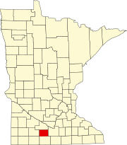
Verona Township is a township in Faribault County, Minnesota, United States. The population was 391 at the 2000 census.

Mehurin Township is a township in Lac qui Parle County, Minnesota, United States. The population was 103 at the 2000 census.

Perry Township is a township in Lac qui Parle County, Minnesota, United States. The population was 137 at the 2000 census.

Riverside Township is a township in Lac qui Parle County, Minnesota, United States. The population was 301 at the 2000 census.

Ten Mile Lake Township is a township in Lac qui Parle County, Minnesota, United States. The population was 195 at the 2000 census.

Yellow Bank Township is a township in Lac qui Parle County, Minnesota, United States. The population was 177 at the 2000 census.

Wabanica Township is a township in Lake of the Woods County, Minnesota, United States. The population was 291 at the 2000 census.

Elmdale Township is a township in Morrison County, Minnesota, United States. The population was 904 at the 2000 census.

Dewald Township is a township in Nobles County, Minnesota, United States. The population was 291 at the 2000 census.

Hobart Township is a township in Otter Tail County, Minnesota, United States. The population was 733 at the 2000 census.

Godfrey Township is a township in Polk County, Minnesota, United States. It is part of the Grand Forks-ND-MN Metropolitan Statistical Area. The population was 327 at the 2000 census.

Norman Township is a township in Yellow Medicine County, Minnesota, United States. The population was 291 at the 2000 census.

Maple Township is a township in Cass County, Minnesota, United States. The population was 291 as of the 2000 census. Maple Township was named from the groves of sugar maple trees within its borders.

References

  1. 1 2 "U.S. Census website". United States Census Bureau . Retrieved January 31, 2008.
  2. "US Board on Geographic Names". United States Geological Survey. October 25, 2007. Retrieved January 31, 2008.
  3. Upham, Warren (1920). Minnesota Geographic Names: Their Origin and Historic Significance. Minnesota Historical Society. p.  574.