South Branch Township, Watonwan County, Minnesota

Last updated
South Branch Township, Minnesota
USA Minnesota location map.svg
Red pog.svg
South Branch Township, Minnesota
Location within the state of Minnesota
Usa edcp location map.svg
Red pog.svg
South Branch Township, Minnesota
South Branch Township, Minnesota (the United States)
Coordinates: 43°53′42″N94°33′33″W / 43.89500°N 94.55917°W / 43.89500; -94.55917 Coordinates: 43°53′42″N94°33′33″W / 43.89500°N 94.55917°W / 43.89500; -94.55917
Country United States
State Minnesota
County Watonwan
Area
  Total39.1 sq mi (101.2 km2)
  Land39.1 sq mi (101.2 km2)
  Water0.0 sq mi (0.0 km2)
Elevation
1,109 ft (338 m)
Population
 (2000)
  Total303
  Density7.8/sq mi (3.0/km2)
Time zone UTC-6 (Central (CST))
  Summer (DST) UTC-5 (CDT)
FIPS code 27-61276 [1]
GNIS feature ID0665645 [2]

South Branch Township is a township in Watonwan County, Minnesota, United States. The population was 303 at the 2000 census.

Contents

History

South Branch Township was organized in 1869, and named after the South Fork Watonwan River. [3]

Geography

According to the United States Census Bureau, the township has a total area of 39.1 square miles (101.2 km2), all land.

Demographics

As of the census [1] of 2000, there were 303 people, 112 households, and 86 families residing in the township. The population density was 7.8 people per square mile (3.0/km2). There were 117 housing units at an average density of 3.0/sq mi (1.2/km2). The racial makeup of the township was 96.04% White, 0.99% Black or African American, none Native American, none Asian, none Pacific Islander, 2.97% from other races. Hispanic or Latino of any race were 3.30% of the population.

There were 112 households, out of which 33.0% had children under the age of 18 living with them, 75.0% were married couples living together, 0.9% had a female householder with no husband present, and 23.2% were non-families. 18.8% of all households were made up of individuals, and 9.8% had someone living alone who was 65 years of age or older. The average household size was 2.71 and the average family size was 3.13.

In the township the population was spread out, with 30.0% under the age of 18, 3.6% from 18 to 24, 25.7% from 25 to 44, 22.4% from 45 to 64, and 18.2% who were 65 years of age or older. The median age was 39 years. For every 100 females, there were 103.4 males. For every 100 females age 18 and over, there were 107.8 males.

The median income for a household in the township was $35,625, and the median income for a family was $39,205. Males had a median income of $25,357 versus $18,438 for females. The per capita income for the township was $13,449. About 13.9% of families and 10.7% of the population were below the poverty line, including 4.1% of those under the age of eighteen and 8.9% of those 65 or over.

Related Research Articles

Ceresco Township, Blue Earth County, Minnesota Township in Minnesota, United States

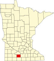
Ceresco Township is a township in Blue Earth County, Minnesota, United States. The population was 255 as of the 2000 census.

Lincoln Township, Blue Earth County, Minnesota Township in Minnesota, United States

Lincoln Township is a township in Blue Earth County, Minnesota, United States. The population was 227 as of the 2000 census.

Pleasant Mound Township, Blue Earth County, Minnesota Township in Minnesota, United States

Pleasant Mound Township is a township in Blue Earth County, Minnesota, United States. The population was 235 as of the 2000 census.

Albin Township, Brown County, Minnesota Township in Minnesota, United States

Albin Township is a township in Brown County, Minnesota, United States. The population was 329 at the 2000 census. Albin Township was organized in 1870.

Bashaw Township, Brown County, Minnesota Township in Minnesota, United States

Bashaw Township is a township in Brown County, Minnesota, United States. The population was 243 as of the 2010 census.

Lake Hanska Township, Brown County, Minnesota Township in Minnesota, United States

Lake Hanska Township is a township in Brown County, Minnesota, United States. The population was 322 as of the 2000 census. Lake Hanska Township was organized in 1870.

Linden Township, Brown County, Minnesota Township in Minnesota, United States

Linden Township is a township in Brown County, Minnesota, United States. The population was 343 as of the 2000 census.

Mulligan Township, Brown County, Minnesota Township in Minnesota, United States

Mulligan Township is a township in Brown County, Minnesota, United States. The population was 245 as of the 2000 census. Mulligan Township was organized in 1871.

Humboldt Township, Clay County, Minnesota Township in Minnesota, United States

Humboldt Township is a township in Clay County, Minnesota, United States. The population was 239 at the 2000 census.

Washington Township, Le Sueur County, Minnesota Township in Minnesota, United States

Washington Township is a township in Le Sueur County, Minnesota, United States. The population was 797 at the 2000 census.

Antrim Township, Watonwan County, Minnesota Township in Minnesota, United States

Antrim Township is a township in Watonwan County, Minnesota, United States. The population was 291 at the 2000 census.

Butterfield Township, Watonwan County, Minnesota Township in Minnesota, United States

Butterfield Township is a township in Watonwan County, Minnesota, United States. The population was 297 at the 2000 census.

Fieldon Township, Watonwan County, Minnesota Township in Minnesota, United States

Fieldon Township is a township in Watonwan County, Minnesota, United States. The population was 246 at the 2000 census.

Madelia Township, Watonwan County, Minnesota Township in Minnesota, United States

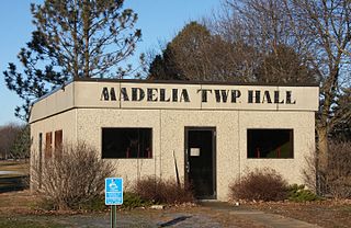
Madelia Township is a township in Watonwan County, Minnesota, United States. The population was 393 at the 2000 census.

Nelson Township, Watonwan County, Minnesota Township in Minnesota, United States

Nelson Township is a township in Watonwan County, Minnesota, United States. The population was 309 at the 2000 census.

Odin Township, Watonwan County, Minnesota Township in Minnesota, United States

Odin Township is a township in Watonwan County, Minnesota, United States. The population was 206 at the 2000 census.

Riverdale Township, Watonwan County, Minnesota Township in Minnesota, United States

Riverdale Township is a township in Watonwan County, Minnesota, United States. The population was 338 at the 2000 census.

Rosendale Township, Watonwan County, Minnesota Township in Minnesota, United States

Rosendale Township is a township in Watonwan County, Minnesota, United States. The population was 357 at the 2000 census.

St. James Township, Watonwan County, Minnesota Township in Minnesota, United States

St. James Township is a township in Watonwan County, Minnesota, United States. The population was 294 as of the 2000 census.

Meadows Township, Wilkin County, Minnesota Township in Minnesota, United States

Meadows Township is a township in Wilkin County, Minnesota, United States. The population was 65 at the 2000 census.

References

  1. 1 2 "U.S. Census website". United States Census Bureau . Retrieved 2008-01-31.
  2. "US Board on Geographic Names". United States Geological Survey. 2007-10-25. Retrieved 2008-01-31.
  3. Upham, Warren (1920). Minnesota Geographic Names: Their Origin and Historic Significance. Minnesota Historical Society. p.  576.