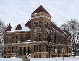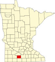
Watonwan County is a county in the U.S. state of Minnesota. As of the 2010 United States Census, the population was 11,211. Its county seat is St. James.

Ceresco Township is a township in Blue Earth County, Minnesota, United States. The population was 255 as of the 2000 census.

Lincoln Township is a township in Blue Earth County, Minnesota, United States. The population was 227 as of the 2000 census.

Pleasant Mound Township is a township in Blue Earth County, Minnesota, United States. The population was 235 as of the 2000 census.

Albin Township is a township in Brown County, Minnesota, United States. The population was 329 at the 2000 census. Albin Township was organized in 1870.

Lake Hanska Township is a township in Brown County, Minnesota, United States. The population was 322 as of the 2000 census. Lake Hanska Township was organized in 1870.

Linden Township is a township in Brown County, Minnesota, United States. The population was 343 as of the 2000 census.

Mulligan Township is a township in Brown County, Minnesota, United States. The population was 245 as of the 2000 census. Mulligan Township was organized in 1871.

Wasioja Township is a township in Dodge County, Minnesota, United States. The population was 963 at the 2000 census. The unincorporated community of Wasioja is located within the township.

Acton Township is a township in Meeker County, Minnesota, United States. The population was 381 at the 2000 census. The township includes almost all of Grove City.

Adrian Township is a township in Watonwan County, Minnesota, United States. The population was 173 at the 2000 census.

Antrim Township is a township in Watonwan County, Minnesota, United States. The population was 291 at the 2000 census.

Butterfield Township is a township in Watonwan County, Minnesota, United States. The population was 297 at the 2000 census.

Fieldon Township is a township in Watonwan County, Minnesota, United States. The population was 246 at the 2000 census.

Long Lake Township is a township in Watonwan County, Minnesota, United States. The population was 346 at the 2000 census.

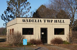
Madelia Township is a township in Watonwan County, Minnesota, United States. The population was 393 at the 2000 census.

Odin Township is a township in Watonwan County, Minnesota, United States. The population was 206 at the 2000 census.

Rosendale Township is a township in Watonwan County, Minnesota, United States. The population was 357 at the 2000 census.

South Branch Township is a township in Watonwan County, Minnesota, United States. The population was 303 at the 2000 census.

St. James Township is a township in Watonwan County, Minnesota, United States. The population was 294 as of the 2000 census.


