Aracataca's climate is tropical: warm and humid year-round.
History
Aracataca was founded in 1885. It achieved the status of municipality on 28 April 1915, when it separated from the municipality of Pueblo Viejo. In the late 19th century, companies that would later merge into the United Fruit Company colonized the land and started to cultivate bananas in the wide region. After some decades, the downfall of the company initiated and completed soon after, partly because of the worldwide recession and the war soon after.
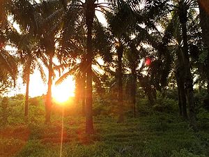
Aracataca relies heavily on agriculture, mainly producing Oil palm, rice, cotton, sugar cane, common bean, plantain, bananas, yuca, tomato and on livestock raising like cattle, equines, mules, donkeys, domesticatedbirds, goats and pigs. Commerce represents another form of income and is mostly done informally, especially along the main highway to Santa Marta where large lines of stands selling beach towels are placed.
Transportation
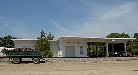
There are several companies that offer inter-municipal and inter-departmental transportation on medium-size buses, minivans and taxi cabs. Most tourists and locals use Berlinas del Fonce which has busses leaving the Santa Marta terminal every 30minutes between 5am and 6pm. $9.000 p.p. From the transportation office in Aracataca you can get almost everywhere using a ciclotaxi for just $1.000 p.p. The rivers are not navigable and there are a few small rudimentary airfields used by small aircraft for agricultural fumigation. The municipality and town are crossed by the Highway 45 that extends from Santa Marta, crosses Aracataca, Fundación, El Copey, Bosconia, Curumani into the Cesar Department and turns south towards the Colombian Andean Region. The railway no longer works for public transportation, it is used almost exclusively to transport coal from the region of La Loma Calentura in the Cesar Department to the Port of Santa Marta.
Notable People
Gabriel Garcia Márquez
Gabriel José de la Concordia García Márquez, affectionately known as Gabo or Gabito throughout Latin America, was a Colombian novelist, short-story writer, screenwriter, and journalist. Born on March 6, 1927, in Aracataca, Colombia, he is considered one of the most significant authors of the 20th century, particularly in the Spanish language. García Márquez received the 1972 Neustadt International Prize for Literature and the 1982 Nobel Prize in Literature. His acclaimed works include “One Hundred Years of Solitude” (1967), which sold over fifty million copies, “Chronicle of a Death Foretold” (1981), and “Love in the Time of Cholera” (1985). He popularized the literary style known as magic realism, blending magical elements with otherwise ordinary situations. García Márquez’s legacy endures as the most-translated Spanish-language author. Upon his death in April 2014, he was hailed by the president of Colombia as “the greatest Colombian who ever lived".
B Leo Matiz
Leo Matiz (1917–1998) was a Colombian photographer, caricaturist, newspaper publisher, painter, and gallery owner. Born in the small village of Aracataca, Colombia, he shared his hometown with the author Gabriel García Márquez. Matiz traveled extensively, selling caricatures and illustrations to support himself. His gallery hosted the first exhibition of Colombian artist Fernando Botero in 1951. Known for his distinctive style, including long hair, colored jackets, and a gangster-style mustache, Matiz photographed notable figures such as Frida Kahlo, Diego Rivera, and Louis Armstrong. His work appeared in publications like Life, Reader’s Digest, and Harper Magazine. Despite losing an eye due to a robbery, Matiz continued photographing with an eye patch until his death in Bogotá in 1998. The Foundation Leo Matiz was established to preserve his legacy
Antonio Jaramillo
Antonio Jaramillo, affectionately known as “El Perro Negro”, was a Colombian musician and composer who left an indelible mark on the folklore of his hometown, Aracataca. His life story is intertwined with the soulful rhythms of Colombian folk music, particularly the guaracha style. Let me share a glimpse of his fascinating journey:
Early Years and Musical Passion: Antonio Jaramillo, nicknamed “El Perro Negro,” discovered his love for music at an early age. By the tender age of four, he had already picked up an accordion and held onto it tightly, setting the stage for a lifelong musical journey.
The Acordeón del Diablo: Jaramillo’s life became the subject of a captivating documentary titled “El Acordeón del Diablo”, directed by Stefan Schwietert. This 90-minute masterpiece delves into the life of Pacho Rada, a master accordionist from Aracataca. Rada’s music resonated with the soul of the Colombian people, and his legacy endures.
A Crowded Farewell: When Antonio Jaramillo passed away on March 20, 2012, Aracataca mourned him like no other. His funeral drew a massive crowd, filling both the church and the town square. People dressed in mourning attire, tears flowing under the intense sun. Jaramillo’s music, reminiscent of Guillermo Buitrago’s style, had touched countless lives.
Culture
Festivities
Aracatacans celebrate the Roman Catholic tradition of Three Kings on January 6 of every year, Carnivals and the Holy Week between February and March, a cultural week, The Festival of the Unedited Song (Festival de la Canción Inédita), The municipality's anniversary in April and the River Festival (Festival del Río). The Fiestas Patronales which consist of large outdoor concerts and semi bullfights this year is being held from 15 July till the 24th.
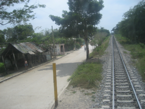
Aracataca train station, one of the literary settings of Gabriel Garcia Márquez's novel.
Tourism
Tourism in Aracataca is growing, but still at a low level. The most famous attraction is the house in which Gabriel García Márquez grew up, now the Casa Museo (Museum House). Another museum, Casa del Telegrafista, is also popular. In addition, the recently renovated train station will serve as an exhibition hall for photographs by Leo Matiz, a native of Aracataca.[citation needed]
Places of Interest
1. Aracataca Train Station: The Aracataca Train Station holds significant cultural and historical importance, particularly because Gabriel García Márquez wrote about it in his novels and visited many times when he was little. The train station is often visited by literature enthusiasts and fans of García Márquez's work, as it's a tangible connection to the setting that shaped his storytelling. While it may not be a bustling transportation hub, its allure lies in its literary significance and its role in preserving the memory of one of Colombia's most celebrated authors.
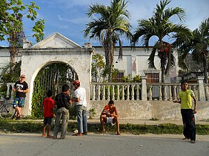
2. Plaza de Bolivar: This central square features a statue of Simón Bolívar, the prominent leader in the South American independence movement, as is common in many towns and cities throughout Colombia and other Latin American countries. The park hosts a coffee shop, a playground, and is surrounded by the central church, billiards' establishments and stores.
3. García Márquez House Museum: The García Márquez House Museum, located in Aracataca, Colombia, is a significant cultural landmark dedicated to honoring the life and work of Gabriel García Márquez, one of Latin America's most celebrated authors. The museum is housed in the author's childhood home, where he spent his early years and was deeply influenced by the stories, people, and landscapes of the region. Visitors to the museum can explore the rooms of the house, which have been preserved to reflect the period when García Márquez lived there. Exhibits include personal belongings, photographs, manuscripts, and other memorabilia associated with the author's life and literary career. The museum offers insight into García Márquez's upbringing and the real-life experiences that inspired his iconic novels, including "One Hundred Years of Solitude.
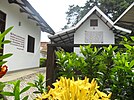
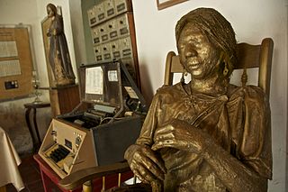
4. Casa del Telegrafista: The Casa del Telegrafista, or Telegraph Operator's House, is a historic site located in Aracataca, Colombia. This house holds significance as it is where Gabriel García Márquez, the Nobel Prize-winning author, spent part of his childhood. García Márquez often referenced this house in his works, including his masterpiece "One Hundred Years of Solitude," where it served as inspiration for the Buendía family home. Today, the Casa del Telegrafista has been restored and transformed into a museum dedicated to García Márquez and his literary legacy. Visitors can explore the house and learn about the author's early life, his connections to Aracataca, and the influences that shaped his writing. The museum provides a glimpse into García Márquez's upbringing and the magical realism that permeates his novels, making it a must-visit destination for fans of his work and literature enthusiasts alike.
5. Melquiades Tombstone: In Gabriel García Márquez's "One Hundred Years of Solitude," Melquiades is a mysterious and enigmatic character who plays a pivotal role in the story. Melquiades is depicted as a wandering gypsy and a bringer of knowledge and mysticism to the town of Macondo. His presence is felt throughout the narrative, even after his death, as his writings and inventions continue to influence the characters and events in the story.
Because Melquiades was the first person to die in Macondo, to increase the sense of belonging for the local townspeople related to the legacy of Garcia Márquez, it was decided to erect a tombstone to this 'greatest benefactor of Macondo'.
The town of Aracataca has 33 Barrios: La Esperanza, La esmeralda, Zacapita, 2 de febrero, 20 de Julio, Ayacucho, Nariño, Loma Fresca, 7 de Agosto, El Carmen, Cataquita, Macondo, El Suiche, El Pradito, 11 de Noviembre, 7 de Abril, Ciudadela macondo, San José, Base, Marujita, Las delicias, Centro, Boston, El Porvenir, 1 de Mayo, Galán, San Martín, Bello Horizonte, Raíces, Macondo, Villa del Río I y II.
Gabriel Garcia Márquez is widely recognized as one of the greatest and most influential authors of the 20th century. With works like: Love in the Time of Cholera, One Hundred Years of Solitude, and Chronicle of a death Foretold, "Gabito" not only excelled in storytelling, he was a master of conveying perspective, love, and identity. Born in Aracataca in 1927 as grandson of the great Colonel Nicolas Márquez, he witnessed quintessential events since he was a little baby.
Aracataca was Garcia Márquez's first stomping grounds. His childhood home, now the Casa Museo, and the church where he was baptised are both major tourist attractions.[4]
Billboard of Gabriel García Márquez in Aracataca. The billboard reads: "I feel I am an American from every country, without never renouncing to the nostalgia for my land, to which I returned one day and discovered that between the reality and nostalgia was the Feedstock for my work". - Gabriel García Márquez
Riverlife
Schoolkids
Freemason lodge
Oil palm plantations in the municipality of Aracataca
African palmtree forest, from which palm oil is being won
The house of the Telegrafist
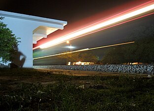
Aracataca railway
Train passing by the station
Related Research Articles
Macondo is a fictional town described in Gabriel García Márquez's novel One Hundred Years of Solitude. It is the home town of the Buendía family.
Magdalena is a department of Colombia with more than 1.3 million people, located to the north of the country by the Caribbean Sea. The capital of the Magdalena Department is Santa Marta and was named after the Magdalena River. It inherited the name of one of the original nine states of the United States of Colombia that its current territory integrated.
One Hundred Years of Solitude is a 1967 novel by Colombian author Gabriel García Márquez that tells the multi-generational story of the Buendía family, whose patriarch, José Arcadio Buendía, founded the fictitious town of Macondo. The novel is often cited as one of the supreme achievements in world literature. It was recognized as one of the most important works of the Spanish language during the 4th International Conference of the Spanish Language held in Cartagena in March 2007.
The Rómulo Gallegos International Novel Prize was created on 6 August 1964 by a presidential decree enacted by Venezuelan president Raúl Leoni, in honor of the Venezuelan writer and President Rómulo Gallegos, the author of Doña Bárbara.
Riohacha is a city in the Riohacha Municipality in the northern Caribbean Region of Colombia by the mouth of the Ranchería River and the Caribbean Sea. It is the capital city of the La Guajira Department. It has a sandy beach waterfront.
"Big Mama's Funeral" is a short story by Gabriel García Márquez. In the story, an unidentified narrator tells a mythical account of a historical event summarized on the first page. Through the exaggerated size of Big Mama herself and her extravagant birthday party, the story satirizes corruption in Latin America at all levels of power. The story is told in a "highly oral style of a public storyteller or carnival barker." The story is set in the mythical town of Macondo, the setting of García Márquez's famous novel One Hundred Years of Solitude. Big Mama's Funeral is one of only three of the author's short stories set in the town.
The Banana Massacre was a massacre of workers of the United Fruit Company that occurred between December 5 and 6, 1928, in the town of Ciénaga near Santa Marta, Colombia. A strike began on November 12, 1928, when the workers ceased to work until the company would reach an agreement with them to grant them dignified working conditions. After several weeks with no agreement, in which the United Fruit Company refused to negotiate with the workers, the government of Miguel Abadía Méndez assigned Cortés Vargas as military chief in the Magdalena department and sent 700 men from the Colombian Army to quell the strikers, resulting in the massacre of 47–2000 people.
Leaf Storm is the common translation for Gabriel García Márquez's novella La Hojarasca. First published in 1955, it took seven years to find a publisher. Widely celebrated as the first appearance of Macondo, the fictitious village later made famous in One Hundred Years of Solitude, Leaf Storm is a testing ground for many of the themes and characters later immortalized in said book. It is also the title of a short story collection by García Márquez.
Álvaro Cepeda Samudio was a Colombian journalist, novelist, short story writer, and filmmaker.
The Barranquilla Group was the name given to the group of writers, journalists, and philosophers who congregated in the Colombian city of Barranquilla in the middle of the twentieth century; it became one of the most productive intellectual and literary communities of the period.
Ciénaga is a municipality and city in the Magdalena Department, Colombia, the second largest population center in this department, after the city of Santa Marta. It is situated at 11° 00' North, 74° 15' West, between the Sierra Nevada de Santa Marta, the Caribbean Sea and the Ciénaga Grande de Santa Marta marsh in northern Colombia. The city is situated in the northern part of Magdalena, 35 km from Santa Marta. According to estimations in 2020, the city had a population of 110,303. The mean annual temperature is 34 °C.
Urumita is a town and municipality of the Colombian Department of La Guajira.
Gabriel José García Márquez was a Colombian writer and journalist, known affectionately as Gabo or Gabito throughout Latin America. Considered one of the most significant authors of the 20th century, particularly in the Spanish language, he was awarded the 1972 Neustadt International Prize for Literature and the 1982 Nobel Prize in Literature for One Hundred Years of Solitude. He pursued a self-directed education that resulted in leaving law school for a career in journalism. From early on he showed no inhibitions in his criticism of Colombian and foreign politics. In 1958, he married Mercedes Barcha Pardo; they had two sons, Rodrigo and Gonzalo. It is a lesser known fact that Gabriel had a daughter with Mexican writer Susana Cato, part of an extramarital affair. They named her Indira, and she took her mother's last name.
Leonet Matiz Espinoza was a Colombian photographer, caricaturist, newspaper publisher, painter and gallery owner.
Casa del Telegrafista is a museum in Aracataca. The town is the birthplace of author Gabriel García Márquez and photographer Leo Matiz. The museum is located to the north of the town.
The Fragrance of Guava is a book based on the long conversations between Gabriel García Márquez and his close friend Plinio Apuleyo Mendoza. Published in 1982, the book describes the life of García Márquez, from his early childhood to his encounters with celebrities. The title of the book in Spanish is El Olor de la Guayaba. It was translated as The Fragrance of Guava.
The Macondo Awards are given by the Colombian Academy of Cinematography Arts and Sciences to honor achievement in Colombian cinema.
The 1982 Nobel Prize in Literature was awarded to the Colombian writer Gabriel García Márquez (1927–2014) "for his novels and short stories, in which the fantastic and the realistic are combined in a richly composed world of imagination, reflecting a continent's life and conflicts."
The following is a list of works published by Colombian author Gabriel García Márquez, which includes short stories, novellas, novels, and collections, and other writings. Majority of his work deals with themes such as love, solitude, and the influence of Caribbean culture. García Márquez is recognized as a pivotal figure inLatin American literature around the world,as one of the founders of the magical realism genre. His contributions helped elevate Latin American literature to global prominence.
One Hundred Years of Solitude is a Colombian magical realism television series based on the 1967 novel of the same name by Gabriel García Márquez. The series will run for sixteen episodes on Netflix, with the first eight released on December 11, 2024.
This page is based on this Wikipedia article Text is available under the CC BY-SA 4.0 license; additional terms may apply. Images, videos and audio are available under their respective licenses.