Archer, Illinois | |
|---|---|
 Archer, Illinois  Archer, Illinois | |
| Coordinates: 39°46′53″N89°44′09″W / 39.78139°N 89.73583°W | |
| Country | United States |
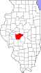
| State | Illinois |
| County | Sangamon |
| Elevation | 604 ft (184 m) |
| Time zone | UTC-6 (Central (CST)) |
| • Summer (DST) | UTC-5 (CDT) |
| Area code | 217 |
| GNIS feature ID | 422412 [1] |
Archer is an unincorporated community in Curran Township, Sangamon County, Illinois, United States. Archer is located on the Sangamon Valley Trail on the western border of Springfield. [2]