Arecibo Light

Last updated
Arecibo Lighthouse
Arecibo Lighthouse 2008.jpg
A closeup view of Arecibo Lighthouse
Arecibo Light
Location Arecibo
Puerto Rico
Coordinates 18°28′55.076″N66°41′55.335″W / 18.48196556°N 66.69870417°W / 18.48196556; -66.69870417
Tower
Constructed1898  OOjs UI icon edit-ltr-progressive.svg
FoundationStone base
ConstructionStone and Brick Tower
Automated1964
Height46 feet (14 m)
ShapeHexagonal tower with balcony and lantern attached to the primary building.
Markingswhite tower, black lantern
HeritageNational Register of Historic Places listed place  OOjs UI icon edit-ltr-progressive.svg
Light
First lit1898
Focal height120 feet (37 m)
LensThird order Fresnel lens (1898)
Range14 nautical miles (26 km; 16 mi)
Characteristic Fl W 5s.
Faro de Arecibo
Architectural style Neoclassic
MPS Lighthouse System of Puerto Rico TR
NRHP reference No. 77001546 [1]

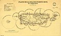
Arecibo Lighthouse & Historical Park (Spanish : Faro de Arecibo) is a historic lighthouse located in the city of Arecibo, Puerto Rico. It is also known as Los Morrillos Lighthouse and is as a monument to Puerto Rico's complex history under Spanish colonial rule. Perched atop the rugged Punta Morrillos headland since 1898, this iconic lighthouse was the last constructed under Spain's 300-year presence on the island. Despite the collapse of the Spanish Empire following the Spanish-American war that same year, the Arecibo Lighthouse endured as a beacon through subsequent decades of change.

Contents

The lighthouse was designed in the neoclassical architectural style popular during the 19th century, featuring a stately rectangular building with an attached hexagonal tower. The rectangular keeper's house measures 40 feet 4 inches (12.29 m) wide by 84 feet 2 inches (25.65 m) long. The hexagonal tower is topped by a dome made of bronze that encases the working lantern room.

The original lighting apparatus was a Fresnel lens of the third order, able to project a beam of light with a radius of 18 miles to warn approaching ships. In 1931, the lighthouse was modernized and converted to electric power. Today, the lantern houses a 190mm lens that emits a bright white flash repeating every five seconds.

After the light was automated in 1964, the unmanned structure fell victim to decay and vandalism without resident keepers. Sadly, the original Fresnel lens, a masterpiece of lighting engineering, met an ignoble end. The lens was damaged in 1975 and completely destroyed in 1977, severing another tangible link to the lighthouse's origins. For years the historic tower stood neglected. Despite this period of decline, the sturdy lighthouse endured as a testament to its sound construction.

After years of neglect, the iconic Arecibo Lighthouse underwent a meticulous restoration in 2001 by a private company dedicated to preserving the historic landmark. It is now operated as the Arecibo Lighthouse and Historical Park, featuring interactive exhibits that bring Puerto Rico's rich history to life. Visitors can explore a replica Taíno Indian village, models of Columbus' legendary ships, slavery quarters, a pirate ship replica and cave, mini zoo, saltwater aquariums, playground, and water park. The lighthouse itself houses a museum with maritime artifacts, exhibits on the lighthouse's engineering and history, and the Spanish-American War.

The painstaking restoration of this engineering marvel allows new generations to appreciate its history and purpose. In addition to guiding ships as originally intended, the Arecibo Lighthouse now helps visitors navigate the captivating narrative of Puerto Rico through engaging exhibits and displays. It once again stands as a respected coastal landmark, treasured both for its past service and the enriching experiences it offers today.

While the lighthouse itself remains little changed from its original construction, the history it represents is one of conflict and conquest. Its presence is a reminder of Puerto Rico's status as one of the last remnants of Spain's once vast empire. Yet it also stands as a symbol of the island's resilience through the rise and fall of colonial powers.

The Arecibo Lighthouse continues to watch faithfully over the waters it has illuminated for generations.

This lighthouse should not be confused with the Cabo Rojo lighthouse, known as Faro de Los Morrillos de Cabo Rojo.

See also

Related Research Articles

<span class="mw-page-title-main">Cabo Rojo, Puerto Rico</span> City and municipality in Puerto Rico

Cabo Rojo is a city and municipality situated on the southwest coast of Puerto Rico and forms part of the San Germán–Cabo Rojo metropolitan area as well as the larger Mayagüez–San Germán–Cabo Rojo Combined Statistical Area.

<span class="mw-page-title-main">Faro Los Morrillos de Cabo Rojo</span> Lighthouse in Cabo Rojo, Puerto Rico

Faro Los Morrillos de Cabo Rojo, also known as Los Morrillos Light, is a historic lighthouse located in Los Morrillos cape in the municipality of Cabo Rojo, Puerto Rico.

<span class="mw-page-title-main">Punta Higuero Light</span> Historic lighthouse in Rincón, Puerto Rico

Punta Higuero Lighthouse, also known as Faro de Punta Higuero, is an historic lighthouse located in Rincón, Puerto Rico. The original building was built in 1892 by the Spanish government and was rebuilt in 1922 by the United States Coast Guard.

<span class="mw-page-title-main">Punta de las Figuras Light</span> Lighthouse in Arroyo, Puerto Rico

Punta de las Figuras Light is an historic lighthouse located in Arroyo, Puerto Rico. It was first lit by the Spanish government in 1893. The light was relocated in 1938, and the structure was deactivated and abandoned. During World War II, the lighthouse was used as a lookout. After the U.S. Army abandoned the structure in 1963, the lighthouse was repeatedly vandalized. In 1969 the lens and lantern were destroyed. The lighthouse was again damaged by Hurricane Maria on September 20, 2017. The light housing is broken, all of the windows are boarded up, and several of the surrounding light pole fixtures are downed. The interior is currently inaccessible.

<span class="mw-page-title-main">Cardona Island Light</span> Lighthouse on Cardona Island, near Ponce, Puerto Rico

Cardona Island Light is the only 6th order lighthouse in Puerto Rico with a cylindrical attached tower. The light is located on Cardona Island, a small island on the west side of the entrance to the harbor of Ponce, Puerto Rico. It was listed in the U.S. National Register of Historic Places on 22 October 1981.

<span class="mw-page-title-main">Punta Tuna Light</span> Historic lighthouse in Maunabo, Puerto Rico

Punta Tuna Light is a historic lighthouse located in the southeast of the town of Maunabo, Puerto Rico on a narrow promontory at the southeasternmost point of the island. It was first lit in 1892 and automated in 1989. The light was a third-order lighthouse that served as the primary light connecting the island's southern and eastern lights system. The design was drawn and laid out by Joaquin Gisbert in 1890. The lighthouse construction was initially overseen by Adrian Duffaut. It was built from March 13, 1891, to September 29, 1893. Final construction was taken over by the Spanish Body of Engineers according to annotations of the historian Carlos Moral. It was originally named Faro de Mala Pascua after the cape to the west. Later, it was moved and renamed after the Point of the construction site so the light could perform a double duty warning ships off the Sargent reef. On August 8, 1899, the lighthouse suffered damage from Hurricane San Ciriaco; the town suffered heavy damage. On April 12, 1900, an act of Congress extended the jurisdiction of the Lighthouse Service to the noncontiguous territory of Puerto Rico and adjacent American waters. 1900 The Lighthouse Board took charge of the Puerto Rico lighthouses. September 13, 1928, Devastating Hurricane San Felipe II strikes, again the lighthouse stands firm, but the town housing is nearly totally destroyed. It was once again damaged by Hurricane Maria on Sept 20, 2017. The light's housing, the external facade, and the surrounding vegetation were all damaged, with some trees completely downed. It was listed in the U.S. National Register of Historic Places in 1981. In 2007, the government of Puerto Rico bought an area near the lighthouse to create a conservation area. The structure is being restored by the town of Maunabo and is open to the public. The light is not working and the lens appears to be missing. The lighthouse in a state of disrepair and locked, but one may still view it from the surrounding property.

<span class="mw-page-title-main">Punta Mulas Light</span> Lighthouse in Vieques, Puerto Rico

Punta Mulas Light, also known as Faro de Vieques, is a historic lighthouse located in the north shore of Vieques, an island-municipality of Puerto Rico. It was first lit in 1896 and automated in 1949. Punta Mulas Light was the second lighthouse built on Vieques after the Puerto Ferro Light. The light was established to guide through the dangerous passage formed by a chain of reefs. It was of key importance for navigation in the San Juan Passage.

<span class="mw-page-title-main">Mona Island Light</span> Lighthouse on the island of Mona, Puerto Rico

Mona Island Light, also known as Faro de la Isla de la Mona, is a historic lighthouse located on the island of Mona, Puerto Rico, in the Mona Passage between Puerto Rico and the Dominican Republic. It is the only lighthouse built of iron and steel in Puerto Rico. While some sources reported that the structure was designed by Gustav Eiffel, who also designed the Eiffel Tower in Paris, recent studies have shown that the tower was designed around 1885 by Spanish engineer Rafael Ravena.

<span class="mw-page-title-main">Caja de Muertos Light</span> 1887 lighthouse in Ponce, Puerto Rico

Caja de Muertos Light, is an 1887 lighthouse in Ponce, Puerto Rico, that is unique amongst all other lighthouses in Puerto Rico for its unusual Cross of Lorraine, double-arm, T-type shape structure. The historic lighthouse is located in Caja de Muertos, an uninhabited island off the coast of Ponce, Puerto Rico. The light stands at the highest point of the island.

<span class="mw-page-title-main">Guánica Light</span> Lighthouse at Guánica, Puerto Rico

Guánica Light was a historic lighthouse located in the municipality of Guánica, Puerto Rico in the Guánica State Forest. It was first lit in 1893 and deactivated in 1950. The light marked the entrance to Guánica Bay and bridge the gap between Los Morrillos Light and Caja de Muertos Light.

<span class="mw-page-title-main">Punta Borinquen Light</span> Lighthouse in Aguadilla, Puerto Rico

Punta Borinquen Light is a lighthouse located in the old Ramey Air Force Base in Aguadilla, Puerto Rico. The station was established in 1889 by the Spanish government. With the opening of the Panama Canal in 1914, the lighthouse would become "the most important aid to navigation on the route from Europe to Panama". In 1917, the U.S Congress provided funding for a new lighthouse in higher ground.

<span class="mw-page-title-main">Cabras Island Light</span> Lighthouse near Ceiba, Puerto Rico

Isla Cabras Light, also known as Faro de Isla Cabras, was a lighthouse located on a rocky but flat islet with the same name, which sit just off the coast near Ceiba, Puerto Rico, toward the Vieques Passage.

<span class="mw-page-title-main">Punta de Anaga Lighthouse</span> Lighthouse on Tenerife, Spain

The Punta de Anaga Lighthouse is an active lighthouse on the Canary island of Tenerife, in the municipality of Santa Cruz de Tenerife. Punta de Anaga is the most northerly point on the island, and is where the Anaga mountain range meets the sea.

<span class="mw-page-title-main">Punta Cumplida Lighthouse</span> Lighthouse on La Palma, Spain

Punta Cumplida Lighthouse is an active 19th century Spanish lighthouse on the Canary island of La Palma in the municipality of Barlovento. Punta Cumplida is the oldest of the four main lighthouses on La Palma, each one being located near to a different cardinal point of the island. Punta Cumplida marks the north-eastern tip; Fuencaliente the southern point, and the two modern lighthouses at Punta Lava and Arenas Blancas, the eastern and western points respectively.

<span class="mw-page-title-main">Puerto del Rosario Lighthouse</span> Lighthouse on Fuerteventura, Spain

The Puerto del Rosario Lighthouse also known as the Punta Gaviota Lighthouse is a modern active lighthouse on the Canary island of Fuerteventura. It is located in an industrial area at the north-eastern end of the town of Puerto del Rosario, the capital and major port of the island in the Province of Las Palmas.

<span class="mw-page-title-main">La Isleta Lighthouse</span> Lighthouse on Gran Canaria, Spain

La Isleta Lighthouse is an active 19th century lighthouse on the Spanish island of Gran Canaria in the Canary islands. The lighthouse has been constructed on the rocky peninsula of La Isleta, which overlooks the Port of Las Palmas to the north of the city of Las Palmas, the capital of Gran Canaria. Situated at the north-eastern tip of the island, the La Isleta light marks the approaches to the port and lies midway between the Sardina lighthouse to the east and the Punta de Melenara lighthouse of Telde to the south.

<span class="mw-page-title-main">Boquerón State Forest</span>

Boquerón State Forest is one of the 20 forestry units that make up the public forest system of Puerto Rico. Despite its name, the Boquerón State Forest is not only located in Boquerón, Cabo Rojo but also spans almost 5,000 acres across the municipalities of Cabo Rojo, Lajas and Mayagüez. The forest area is also known for its limestone cliffs, the lighthouse, and the salt flats which have been a source of salt since the pre-Hispanic era and, dating to 700 C.E., they are considered to be one of the oldest industries in the Americas.

<span class="mw-page-title-main">Los Morrillos (Cabo Rojo)</span> Cape and tombolo landform located in Puerto Rico

Los Morrillos de los Cabos Rojos or more commonly known as Los Morrillos de Cabo Rojo, is a cape and tombolo landform located in southwestern Puerto Rico in the municipality of Cabo Rojo. Los Morrillos is an excellent example of a tombolo, or a tied island, with two sand pits. The cape resembles a letter Y with its two promontories or morrillos being connected through sand pits which enclose a saltwater lagoon. The landform was designated a National Natural Landmark in 1980, and the site includes mangroves, beaches, important bird nesting areas, limestone caves, cliffs and rock formations. The reddish-colored limestone cliffs give the name to the town and municipality of Cabo Rojo.

References

  1. "Inventory of Historic Light Stations National Park Service". Archived from the original on 23 March 2009. Retrieved 2009-03-27.