![]() | |
![]() | |
Location | Mona Island, Mayagüez, Puerto Rico |
---|---|
Coordinates | 18°5′5.2″N67°51′4.4″W / 18.084778°N 67.851222°W Coordinates: 18°5′5.2″N67°51′4.4″W / 18.084778°N 67.851222°W |
Tower | |
Constructed | 1900 ![]() |
Foundation | Concrete |
Construction | Iron |
Automated | 1973 |
Height | 12 m (39 ft) ![]() |
Shape | Skeletal with central cylinder |
Markings | Black |
Heritage | National Register of Historic Places listed place ![]() |
Light | |
First lit | 1900 |
Deactivated | 1976 |
Focal height | 98 m (322 ft) ![]() |
Lens | Second-order Fresnel |
Characteristic | ![]() ![]() |
Faro de la Isla de la Mona | |
Part of | Isla de Mona historic district (ID93001398) |
MPS | Lighthouse System of Puerto Rico TR |
NRHP reference No. | 81000689 [1] [2] |
Added to NRHP | October 22, 1981 |
Mona Island Light, also known as Faro de la Isla de la Mona, is a historic lighthouse located on the island of Mona, Puerto Rico, in the Mona Passage between Puerto Rico and the Dominican Republic. It is the only lighthouse built of iron and steel in Puerto Rico. While some sources reported that the structure was designed by Gustav Eiffel, who also designed the Eiffel Tower in Paris, [3] [4] recent studies have shown that the tower was designed around 1885 by Spanish engineer Rafael Ravena. [5]
It is the first of two lighthouses built by the U.S. government in Puerto Rico.
It was first lit in 1900 and automated in 1973. [6] In 1976, the light was deactivated and replaced by a modern beacon. The structure has deteriorated severely since deactivation. The lighthouse is listed in "Frommer's 500 Places to See Before They Disappear" [3] and Lighthouse Digest magazine described the condition of the lighthouse as dire: "This lighthouse has to be among the most endangered in the U.S. – along with being one of the most isolated – rusting away in the tropical heat and humidity." [7]
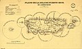
Two sets of plans were drawn up between 1885 and 1886 by Spanish engineer Rafael Ravena, [5] working for the Spanish government, for a lighthouse on the eastern side of Mona Island to help mark Mona Passage, which runs between Puerto Rico and the Dominican Republic. One set of plans called for a massive masonry structure with twenty five rooms for three keepers, families and supplies and a light with a range of 22 miles. However this was not the design that was finally used, probably due to the very porous and brittle sandstone conditions of Mona Island. [8]
The second set of plans called for an iron tower with a separate living quarters for one keeper and his family. This plan was approved in 1887, and work on the station started in the early 1890s. The lighthouse's materials were fabricated in France by Duclos & Cie. The U.S. government continued its construction after the Spanish–American War in 1898. [9]
The 1.1 miles (1.8 km) long narrow-gauge Mona Island Tramway had a gauge of 600 mm (1 ft 11+5⁄8 in). Its 231 ft long incline ran from the beach to a cave. Goods were carried through the cave, and then hauled by a stubborn donkey on a canopy-covered wagon along a 6000 ft long track to the lighthouse. [10] [11]
The lighthouse, as "Faro de la Isla de la Mona", was listed on the U.S. National Register of Historic Places in 1981. [2]
Mona is the third-largest island of the Puerto Rican archipelago, after the main island of Puerto Rico and Vieques. It is the largest of three islands in the Mona Passage, a strait between the Dominican Republic and Puerto Rico, the others being Monito Island and Desecheo Island. It measures about 7 miles by 4 miles, and lies 41 mi (66 km) west of Puerto Rico, of which it is administratively a part. It is one of two islands that make up the Isla de Mona e Islote Monito barrio in the municipality of Mayagüez.
Cabo Rojo is a city and municipality situated on the southwest coast of Puerto Rico and forms part of the San Germán–Cabo Rojo metropolitan area as well as the larger Mayagüez–San Germán–Cabo Rojo Combined Statistical Area.
Caborrojeños Pro Salud y Ambiente, Inc. is a non-profit environmentalist organization based in Cabo Rojo, Puerto Rico.
Faro Los Morrillos de Cabo Rojo, also known as Los Morrillos Light, is a historic lighthouse located in Los Morrillos cape in the municipality of Cabo Rojo, Puerto Rico.
Paradores in Puerto Rico is a brand of small inns similar to bed and breakfasts that have government permission to call themselves paradores based on a set of criteria. These inns are scattered across the island countryside, outside the main metropolitan area of San Juan. Often called "country inns" in English, paradores in Puerto Rico are known for their hospitality, affordable rates, exotic locations, and traditional Puerto Rican cuisine. They are frequented by guests looking to enjoy the local customs and charm.
Arecibo Light is a historic lighthouse located in the city of Arecibo, Puerto Rico. It is also known as Los Morrillos Lighthouse because of its location on top of a rocky headland known as Punta Morrillos. The lighthouse was constructed and lit in 1898. This was the last lighthouse built by the Spanish government on the island.
Cardona Island Light is the only 6th order lighthouse in Puerto Rico with a cylindrical attached tower. The light is located on Cardona Island, a small island on the west side of the entrance to the harbor of Ponce, Puerto Rico. It was listed in the U.S. National Register of Historic Places on 22 October 1981.
Caja de Muertos Light, is an 1887 lighthouse in Ponce, Puerto Rico, that is unique amongst all other lighthouses in Puerto Rico for its unusual Cross of Lorraine, double-arm, T-type shape structure. The historic lighthouse is located in Caja de Muertos, an uninhabited island off the coast of Ponce, Puerto Rico. The light stands at the highest point of the island.
Isla de Ratones also known as Cayo Ratones or Isla Ratones is a small island located near the Joyuda Lagoon in Cabo Rojo, Puerto Rico. The island is a popular spot for snorkeling and bathing.
Puerto Ferro Light, also known as Faro de Puerto Ferro, is a historic lighthouse located in the Vieques, Puerto Rico. The light was first lit in 1896. It is one of the last minor or local lights to be built by the Spanish government. The light was of crucial importance to cross the Vieques Passage. The lighthouse was deactivated in 1926 when it was abandoned.
Isla Cabras Light, also known as Faro de Isla Cabras, was a lighthouse located on a rocky but flat islet with the same name, which sit just off the coast near Ceiba, Puerto Rico, toward the Vieques Passage.
Culebrita Lighthouse is the only remaining Spanish-era structure in the Culebra archipelago. Construction of the lighthouse began on September 25, 1882, and was completed on February 25, 1886. The Spanish Crown built the lighthouse to help secure its claim over the main island of Culebra. It is the most eastern light outside mainland Puerto Rico. It guided navigation through the Virgin Passage and the Vieques Sound connecting in the Puerto Rico Light System with the Cape San Juan Light.
Punta Lava Lighthouse is an active 20th century Spanish lighthouse on the Canary island of La Palma. It is located in the municipality of Tazacorte, near the village of La Bombilla on the western side of the island. The larger settlement of Puerto Naos lies 2 kilometres to the south-west.
The Mona Island Tramway was a 1.8 kilometres (1.1 mi) long narrow-gauge industrial railway with a gauge of 600 mm on Mona Island, part of the municipality of Mayagüez, Puerto Rico. It was laid in the 1890s to transport building materials from the beach to the construction site of the 16 meter high Mona Island Lighthouse, which was put into operation on 30 April 1900.
Boquerón State Forest is one of the 20 forestry units that make up the public forest system of Puerto Rico. Despite its name, the Boquerón State Forest is not only located in Boquerón, Cabo Rojo but also spans almost 5,000 acres across the municipalities of Cabo Rojo, Lajas and Mayagüez. The forest area is also known for its limestone cliffs, the lighthouse, and the salt flats which have been a source of salt since the pre-Hispanic era and dating to 700 C.E. it is considered one of the oldest industries in the Americas.
Roosevelt Tower, more popularly known as La Torre, is a 173.54 feet clock tower located above the main entrance to the Baldorioty de Castro Building in the University of Puerto Rico, Río Piedras Campus. The tower is also referred to as El Faro and it is considered a symbol of the University of Puerto Rico and of higher education in Puerto Rico. The tower, along with the main historic quadrangle in campus, have been listed on the National Register of Historic Places since 1984.
Los Morrillos de los Cabos Rojos or more commonly known as Los Morrillos de Cabo Rojo, is a cape and tombolo landform located in southwestern Puerto Rico in the municipality of Cabo Rojo. Los Morrillos is an excellent example of a tombolo, or a tied island, with two sand pits. The cape resembles a letter Y with its two promontories or morrillos being connected through sand pits which enclose a saltwater lagoon. The landform was designated a National Natural Landmark in 1980, and the site includes mangroves, beaches, important bird nesting areas, limestone caves, cliffs and rock formations. The reddish-colored limestone cliffs give the name to the town and municipality of Cabo Rojo.
Mona and Monito Islands Nature Reserve consists of two islands, Mona and Monito, in the Mona Passage off western Puerto Rico in the Caribbean. Mona and Monito Islands Nature Reserve encompasses both land and marine area, and with an area of 38,893 acres it is the largest protected natural area in the Commonwealth of Puerto Rico. Much like the Galapagos Islands in the Pacific Ocean, the Mona and Monito Islands reserve represents a living laboratory for archaeological, biological, geological, oceanographical and wildlife management research.