Sorell is a town in Tasmania, Australia, north-east of Hobart. It is located on the Tasman Highway at the junction with the Arthur Highway. Sorell is one of Tasmania's oldest towns, being first settled in 1808 as a small farming community and becoming an official township in 1821. At the 2006 census, Sorell had a population of 1,546, and at the 2011 census, a population of 2,476. and at the 2016 census, a population of 2,907.

Camden Council is a local government area in the Macarthur region of Sydney, in the state of New South Wales, Australia. The area is located south west of the Sydney central business district and comprises 201 square kilometres (78 sq mi) with an estimated population at the 2016 census of 78,218. The Mayor of Camden is Cr. Theresa Fedeli, a member of the Liberal Party.

Whitton is a small town located in Leeton Shire in the Australian state of New South Wales. Founded in 1850, it is named after John Whitton (1820–98), Engineer-in-Charge of the New South Wales Government Railways. The railway reached Whitton in 1881. At the 2016 census, Whitton had a population of 496.

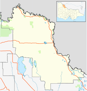
Ultima is a town in northern Victoria, Australia. The town is in the Rural City of Swan Hill local government area, 353 kilometres (219 mi) north-west of the state capital, Melbourne and 35 kilometres (22 mi) south of Swan Hill. At the 2016 census, Ultima had a population of 174, down from 333 in 2011.

Gowrie Junction is a rural locality in the Toowoomba Region, Queensland, Australia. It is north-west of Toowoomba. In the 2016 census, Gowrie Junction had a population of 2,120 people. The town of Gowrie is in the eastern part of the locality.

Goolgowi is a small town located in western New South Wales, Australia, around 650 kilometres (400 mi) west of Sydney via the Mid-Western Highway and is the administrative centre of Carrathool Shire. At the 2016 census, Goolgowi had a population of 402.

Patchewollock is a town in north-west Victoria, Australia. At the 2016 census, Patchewollock had a population of 133.

Tamworth Regional Council is a local government area in the New England region of New South Wales, Australia. The area under administration is located adjacent to the New England Highway and the Main North railway line. It was established in March 2004 through the amalgamation of the former City of Tamworth with surrounding shires of Barraba, Manilla, Nundle and Parry.

Tenterfield Shire is a local government area located in the New England region of New South Wales, Australia. The Shire is situated adjacent to the New England Highway.

Burraboi is a community in New South Wales, Australia. It is in the southwestern part of the Riverina and situated about 34 kilometres (21 mi) north of Barham and 50 km south of Moulamein. At the 2016 census, Burraboi had a population of 63.

Jugiong is a locality on the banks of the Murrumbidgee River, in the Hilltops Council Local Government area, New South Wales, Australia. It is situated just off the Hume Highway, by road, about 30 kilometres southwest from Bookham and 40 kilometres northeast from Gundagai. At the 2016 census, Jugiong had a population of 222 people.

Table Top is an outer suburb of the city of Albury, New South Wales, located 16 kilometres (10 mi) north of Albury and 19 kilometres (12 mi) west of Bowna. At the 2011 census, Table Top had a population of 1253. The area used to be part of the Greater Hume Shire but was recently integrated into the City of Albury.

Delungra is a small town on the Gwydir Highway, 33 kilometres (21 mi) from Inverell and 43 kilometres (27 mi) from Bingara in Inverell Shire, New South Wales, Australia. At the 2016 census, Delungra and the surrounding area had a population of 647. The urban centre had a population of 285.

Waitchie is a locality in Victoria, Australia, located approximately 44 km from Swan Hill, Victoria. At the 2006 census, Waitchie had a population of 118, decreasing to 48 at the 2016 census.

Cooyar is a rural town and locality in the Toowoomba Region, Queensland, Australia. In the 2016 census, Cooyar had a population of 224 people.

Mount Carbine is a rural town and locality in the Shire of Mareeba, Queensland, Australia. In the 2016 census, Mount Carbine had a population of 101 people.

Gunalda is a town in the Gympie Region and a locality split between Gympie Region and Fraser Coast Region in Queensland, Australia. In the 2016 census, Gunalda had a population of 392 people.

Daniel Eric Kent was an Australian politician, elected as a member of the Victorian Legislative Council in 1970.

Garradunga is a rural locality in the Cassowary Coast Region, Queensland, Australia. In the 2016 census, Garradunga had a population of 142 people.

Biddeston is a rural town and locality in the Toowoomba Region, Queensland, Australia. In the 2016 census, Biddeston had a population of 284 people.


