Windorah is a town and a locality in the Shire of Barcoo, Queensland, Australia. It is one of only three towns in the Shire of Barcoo in Central West Queensland. In the 2021 census, the locality of Windorah had a population of 104 people.

The Shire of Moyne is a local government area in the Barwon South West region of Victoria, Australia, located in the south-western part of the state. It covers an area of 5,481 square kilometres (2,116 sq mi) and in June 2018 had a population of 16,887. It includes the towns of Port Fairy, Koroit, Mortlake, Macarthur, Peterborough, Caramut, Ellerslie, Framlingham, Garvoc, Hawkesdale, Kirkstall, Panmure, Mailors Flat, Purnim, Wangoom and Woolsthorpe. It also entirely surrounds the City of Warrnambool, a separate local government area. It was formed in 1994 from the amalgamation of the Shire of Belfast, Shire of Minhamite, Borough of Port Fairy, and parts of the Shire of Mortlake, Shire of Warrnambool, Shire of Dundas, Shire of Mount Rouse and Shire of Hampden.

Laura is a rural town and locality in the Shire of Cook, Queensland, Australia. In the 2021 census, the locality of Laura had a population of 133 people.

Warracknabeal is a town in the Australian state of Victoria, located in the Victorian wheatbelt. Situated on the banks of the Yarriambiack Creek, 330 km northwest of Melbourne, it is the business and services centre of the northern Wimmera and southern Mallee districts, and hosts local government offices of the Shire of Yarriambiack. At the 2011 census, Warracknabeal district had a population of 2,745, of which 2,340 lived in the town.

Conargo is a town in the Riverina region of New South Wales, Australia. The town is in the Edward River Council local government area. It is on Billabong Creek, a tributary of the Edward River. The nearest towns are Jerilderie and Deniliquin. At the 2006 census, Conargo had a population of 117 people.
Upotipotpon is a locality in Victoria, Australia, 208 kilometres (129 mi) north-east of the state capital, Melbourne, and 27 kilometres (17 mi) km north of Violet Town. The name may derive from the Aboriginal expression pootong pootong, meaning "plenty of grass", and was used for a pastoral property taken up in 1841 between the Broken River and Stony Creek.

Ouyen is a town in Victoria, Australia, located in the Rural City of Mildura at the junction of the Calder Highway and Mallee Highway, 105 kilometres (65 mi) south of Mildura, and 441 km (274 mi) northwest of Melbourne. At the 2016 census, the town had a population of 1,045.
Tungkillo is a town in South Australia, located approximately 5 km (3.1 mi) south of Mount Pleasant. It sits on Adelaide-Mannum Road, 60 km (37 mi) north-east of the state capital, Adelaide and 25 km (16 mi) north-west of Mannum. At the 2006 census, Tungkillo had a population of 360.

Bamaga is an Indigneous town and locality about 40 kilometres (25 mi) from the northern tip of Cape York in the north of Queensland, Australia. It is within the Northern Peninsula Area Region. It is one of the northernmost settlements in continental Australia and is the administrative centre for the Northern Peninsula Area Regional Council.

Seisia is a coastal town and a locality in the Northern Peninsula Area Region, Queensland, Australia. In the 2021 census, the locality of Seisia had a population of 293 people.

Mapoon is a coastal town in the Aboriginal Shire of Mapoon and a locality split between the Aboriginal Shire of Mapoon and the Shire of Cook in Queensland, Australia. In the 2021 census, the locality of Mapoon had a population of 469 people.

The Shire of Cue is a local government area in the Mid West region of Western Australia, about 420 kilometres (260 mi) east-northeast of the port city of Geraldton and about 650 kilometres (400 mi) north-northeast of the state capital, Perth. The Shire covers an area of 13,623 square kilometres (5,260 sq mi), and its seat of government is the town of Cue.
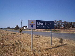
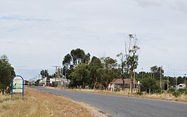
Merrinee is a locality situated in the Sunraysia region. It is situated about 7 kilometres west of Pirlta and 11 kilometres east of Karawinna, on the Red Cliffs-Meringur Road.

Fingal is a rural locality in the local government area (LGA) of Break O'Day in the North-east LGA region of Tasmania. The locality is about 56 kilometres (35 mi) south-west of the town of St Helens. The 2016 census recorded a population of 405 for the state suburb of Fingal.
Mundoo is a rural town and locality in the Cassowary Coast Region, Queensland, Australia. In the 2021 census, the locality of Mundoo had a population of 197 people.

Maxwelton is an outback town and locality in the Shire of Richmond in central north Queensland, Australia. In the 2021 census, the locality of Maxwelton had a population of 32 people.

Garradunga is a rural locality in the Cassowary Coast Region, Queensland, Australia. In the 2021 census, Garradunga had a population of 170 people.

Jimbour East is a rural locality in the Western Downs Region, Queensland, Australia. The town of Jimbour in the locality. In the 2021 census, Jimbour East had a population of 197 people.

Umagico is a town and coastal locality in the Northern Peninsula Area Region, Queensland, Australia. In the 2021 census, the locality of Umagico had a population of 394 people.

South Mission Beach is a coastal town and locality in the Cassowary Coast Region, Queensland, Australia. In the 2021 census, the locality of South Mission Beach had a population of 968 people.