Sunraysia | |||||||||||||
|---|---|---|---|---|---|---|---|---|---|---|---|---|---|
Jack De Garis promoting "Sun-Raysed", a coined word which later generated "Sunraysia". An image showing the outline of the Mallee and Sunraysia district (red circle) which is predominantly contained within the Rural City of Mildura. | |||||||||||||
| Country | Australia | ||||||||||||
| State | Australia | ||||||||||||
| LGAs | |||||||||||||
| Government | |||||||||||||
| • State electorates | |||||||||||||
| • Federal divisions | |||||||||||||
| |||||||||||||


Sunraysia is a region located in northwestern Victoria and southwestern New South Wales in Australia. The region is renowned for its sunshine, intensive horticulture including grapes and oranges. Its main centre is Mildura, Victoria.
Contents
- Etymology
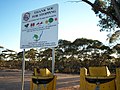
- Pest Free Area
- Major settlements
- Education facilities
- Media
- Gallery
- See also
- Notes
- References
The area of Victoria to the west of Sunraysia is known as the Millewa, the main distinction being that Sunraysia is the irrigated area and the Millewa is the dryland cropping area.
Sunraysia is sometimes incorrectly referred to as an economic region. [1] The area around Mildura, Victoria and Wentworth, New South Wales is also known as the Murray outback. [2]