The City of Cockburn is a local government area in the southern suburbs of the Western Australian capital city of Perth about 8 kilometres (5 mi) south of Fremantle and about 24 kilometres (15 mi) south of Perth's central business district. The City covers an area of 167.5 square kilometres (64.7 sq mi) and had a population of over 104,000 as at the 2016 Census.

The Town of Victoria Park is a local government area of Western Australia. It covers an area of 17.62 km² in metropolitan Perth, the capital of Western Australia. It had a population of approximately 35,000 as at the 2016 census.

The City of Wanneroo is a local government area with city status in the northern suburbs of Perth, Western Australia. It is centred approximately 25 kilometres (15.5 mi) north of Perth's central business district and forms part of the northern boundary of the Perth metropolitan area. Wanneroo encompasses the federal divisions of Cowan, Moore and Pearce.

The Shire of Augusta Margaret River is a local government area in the south-west corner of the South West region of Western Australia, approximately 270 kilometres (168 mi) south of Perth. The shire covers an area of 2,243 square kilometres (866 sq mi) and had a population of over 14,000 at the 2016 Census, about half of whom live in the towns of Margaret River and Augusta.

The Shire of Yilgarn is a local government area in the eastern Wheatbelt region of Western Australia about 400 kilometres (250 mi) east of Perth, the state capital. The Shire covers an area of 30,720 square kilometres (11,860 sq mi) and its seat of government is the town of Southern Cross. The main industries within the Shire are mining and farming.

The Shire of Bridgetown–Greenbushes is a local government area in the South West region of Western Australia, about 80 kilometres (50 mi) southeast of Bunbury and about 260 kilometres (162 mi) south of the state capital, Perth. The Shire covers an area of 1,340 square kilometres (517 sq mi), and its seat of government is the town of Bridgetown.

The City of Busselton is a local government area in the South West region of Western Australia, approximately 230 km (140 mi) south of Perth, the state capital. The city covers an area of 1,455 km2 (562 sq mi) and had a population of 40,640 as at the 2021 Census. It contains two large towns, Busselton and Dunsborough, and a number of smaller towns. The city office is located on Southern Drive, Busselton.

The City of Mandurah is a local government area of Western Australia, covering both Mandurah proper and an additional area reaching down as far south as Lake Clifton. The city has a total area of approximately 174 square kilometres (67 sq mi).

The Shire of Wandering is a local government area in the Wheatbelt region of Western Australia, and, with a population of 444 as at the 2016 census, is one of the nation's smallest. It covers an area of 1,901 square kilometres (734 sq mi) generally to the east of Albany Highway about 120 kilometres (75 mi) south-east of Perth, the state capital. The Shire's seat of government is the town of Wandering.

The Shire of Dumbleyung is a local government area in the Wheatbelt region of Western Australia, about 40 kilometres (25 mi) east of Wagin and about 275 kilometres (171 mi) southeast of Perth, the state capital. The Shire covers an area of 2,540 square kilometres (981 sq mi), and is involved in grain and livestock production and various biodiversity industries including cereals, summer crops, oil mallees, yabbies, emus, poultry and trout. Its seat of government is the town of Dumbleyung.

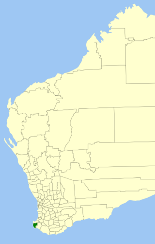
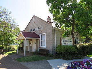
The Shire of Nannup is a local government area in the South West region of Western Australia, approximately 280 kilometres (174 mi) south of the state capital, Perth and 60 kilometres (37 mi) southeast of the coastal resort town of Busselton. Its seat of government is the town of Nannup, where about half of the Shire's population reside.

The City of Bunbury is a local government area in the South West region of Western Australia, covering an area of 65.7 square kilometres (25.4 sq mi) along the coast about 180 kilometres (112 mi) south of Perth, the capital of Western Australia. The City of Bunbury is one of four local governments comprising the Greater Bunbury urban area. As at the 2016 Census, the City of Bunbury had an estimated population of almost 32,000.

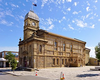
The City of Albany is a local government area in the Great Southern region of Western Australia, about 410 kilometres (255 mi) south-southeast of Perth, the capital of Western Australia. It covers an area of 4,312.3 square kilometres (1,665 sq mi), including the Greater Albany metropolitan area and the Port of Albany, as well as the surrounding agricultural district and some national parks. The City of Albany had a population of over 36,000 at the 2016 census.

The Shire of Merredin is a local government area in the Wheatbelt region of Western Australia, about 250 kilometres (155 mi) east of Perth, the state capital. Its seat of government is the town of Merredin, where 2,804 of the Shire's 3,595 residents live. The Shire covers an area of 3,300 square kilometres (1,274 sq mi).

The Shire of Dandaragan is a local government area located in the Wheatbelt region of Western Australia, about 200 kilometres (124 mi) north of the state capital, Perth. The Shire covers an area of 6,716 square kilometres (2,593 sq mi) and its seat of government is the town of Jurien Bay.

The Shire of Manjimup is a local government area in the South West region of Western Australia, about 320 kilometres (200 mi) south of the state capital, Perth. The Shire covers an area of 7,027 square kilometres (2,713 sq mi), and its seat of government is the town of Manjimup.

The Shire of Dalwallinu is a local government area in the Wheatbelt region of Western Australia, about 250 kilometres (155 mi) NNE of Perth, the state capital. The Shire covers an area of 7,236 square kilometres (2,794 sq mi) and its seat of government is the town of Dalwallinu.

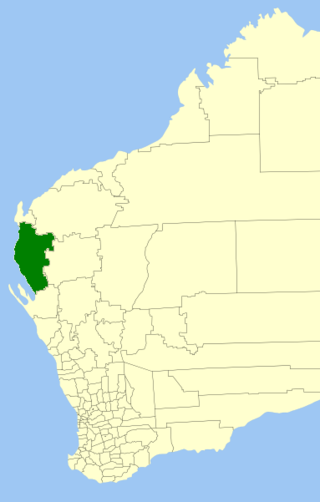
The Shire of Carnarvon is a local government area in the Gascoyne region of Western Australia, located about 900 kilometres (560 mi) north of the state capital, Perth. The Shire covers an area of 46,664 square kilometres (18,017 sq mi), and its seat of government is the town of Carnarvon. The major industries in the area are wool, agriculture and, more recently, tourism.

The Shire of Katanning is a local government area in the Great Southern region of Western Australia, about 170 kilometres (106 mi) north of Albany and about 290 kilometres (180 mi) southeast of the state capital, Perth. The Shire covers an area of 1,518 square kilometres (586 sq mi), and its seat of government is the town of Katanning.

The City of Greater Geraldton is a local government area in the Mid West region of Western Australia, 424 kilometres (263 mi) north of the state capital, Perth on the Indian Ocean. It covers an area of 12,625.5 square kilometres (4,874.7 sq mi), and its seat of government is the town of Geraldton.


