The Sturt Highway is an Australian national highway in New South Wales, Victoria, and South Australia. The Sturt Highway is an important road link for the transport of passengers and freight between Sydney and Adelaide and the regions situated adjacent to the route.

The Olympic Highway is a rural road in the central western and south-eastern Riverina regions of New South Wales, Australia. The 318-kilometre (198 mi) highway services rural communities and links the Hume Highway with the Mid-Western Highway and provides part of an alternate road link between Sydney and Albury via Bathurst and Cowra as well as servicing Wagga Wagga, linking with the Sturt Highway.

Marion is a suburb in the City of Marion, around 10 kilometres (6.2 mi) south-west of the city centre of Adelaide, the capital of South Australia. Founded as a rural village in 1838 on the banks of the Sturt River, Marion was found to have rich soil and the population expanded rapidly. Colonel William Light laid out the plan for the village, as he had done with the City of Adelaide itself.

The Kidman Way is a state rural road in the western Riverina and western region of New South Wales, Australia. The 644-kilometre (400 mi) highway services the Murrumbidgee Irrigation Area and outback communities and links the Newell Highway with the Sturt, Mid-Western, Barrier, Mitchell and Kamilaroi highways. The road carries the State Route B87 shield for its entire route, with its northern terminus at Bourke and its southern terminus at a junction with the Newell Highway, situated 16 kilometres (10 mi) north of Jerilderie. The Kidman Way is fully sealed and is accessible by two or four-wheel drive.

Werrimull is a small Australian town and locality in the state of Victoria and a part of the Sunraysia region. The place by road, is situated about 10 kilometres west of Karawinna and 10 kilometres east of Bambill. It is 79 kilometres (49 mi) west southwest of Mildura, 13 kilometres south of the Sturt Highway opposite Lake Cullulleraine. At the 2016 census, Werrimull and the surrounding area had a population of 112, declining from 320 in 2011.

Miles is a town and a locality in the Western Downs Region, Queensland, Australia. In the 2016 census, Miles had a population of 1,746 people.

Sreekandapuram is a municipality in Kannur district, in the Indian state of Kerala.

Carrathool is a village in the western Riverina region of New South Wales, Australia, in Carrathool Shire. In 2011 census, Carrathool had a population of 296 people. It is about 5 kilometres (3 mi) north of the Sturt Highway between Darlington Point and Hay. The village is situated on the plain a few kilometres north of the river, clustered around the now-disused railway station.
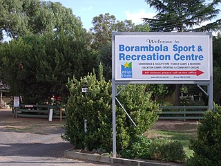
Borambola is a rural community in the central east part of the Riverina. It is situated on the Sturt Highway about 16 kilometres east of Alfredtown and 30 kilometres east of Wagga Wagga. At the 2006 census, Borambola had a population of 129 people.

Kywong is a rural locality in the Riverina region of New South Wales, Australia. The locality is situated on the Sturt Highway, 520 kilometres south west of the state capital, Sydney and 64 kilometres west of Wagga Wagga.

Waddi is a village community in the central part of the Riverina on the Sturt Highway. It is situated by road, about 2 kilometres south from Darlington Point and 29 kilometres north from Coleambally.
Sandigo is a locality situated on Sandy Creek in the central part of the Riverina. It is situated along the Sturt Highway, about 11 kilometres north west of Kywong and 21 kilometres south east of Narrandera. At the 2016 census, Sandigo had a population of 84 people.
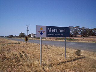
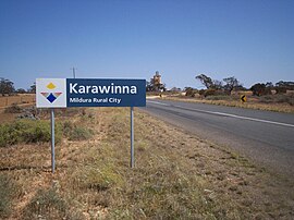
Merrinee is a locality situated in the Sunraysia region. It is situated about 7 kilometres west of Pirlta and 11 kilometres east of Karawinna, on the Red Cliffs-Meringur Road.

Karween is a locality situated on the Redcliffs-Merringur Road in the Sunraysia region, south of the Sturt Highway. It is about 9 kilometres east from Morkalla and 6 kilometres west from Meringur. The railway arrived soon after the area was settled by returned servicemen after World War I, in 1931, and closed in 1964. Karween had a progress association operating in the 1930s.
Morkalla is a locality situated at the farthest west point on the Redcliffs-Meringur Road in the Sunraysia region. It is situated about 31 kilometres south east from Yamba in South Australia and 9 kilometres west from Karween. It also lies 11 kilometres due south of the Sturt Highway.
Tunart is a locality situated on the Tarrango-Tunart Road in the Sunraysia region. The place by road, is situated about 10 kilometres south from Karween and 15 kilometres west from Kurnwill.

Yaroslavsky District, Moscow is an administrative district (raion) of North-Eastern Administrative Okrug, and one of the 125 raions of Moscow, Russia. The area of the district is 7.99 square kilometers (3.08 sq mi). The district is situated on both sides of a major highway, Yaroslavskoye shosse, east from Yaroslavsky railway, and is named after both. The railway serves as the district's western border, Losiny Ostrov national park is on its eastern border, and MKAD serves as its northern border. The Moscow State University of Civil Engineering is located in this district at 26 Yaroslavsky Highway.

Sturts Meadows Station, most commonly known as Sturts Meadows, is a pastoral lease that has operated as a cattle station and a sheep station in outback New South Wales.
Mount Poole Station is a pastoral lease operating as a sheep station in New South Wales.

The Morkalla railway line was a railway line in the Millewa region of northwestern Victoria, Australia. It extended west from Red Cliffs railway station on the Mildura railway line into the wheat farming areas established as soldier settlements after World War I.