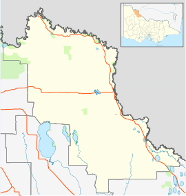
Balwyn is a city near Melbourne, Victoria, Australia, 10 km east of Melbourne's Central Business District. Its local government area is the City of Boroondara. At the 2016 Census, Balwyn had a population of 13,312.

Robinvale is a town on the south bank of the Murray River in north western Victoria, Australia. It is connected by a bridge to Euston on the other side of the river in New South Wales. At the 2016 census, Robinvale had a population of 3,313, however a population study conducted by the Rural City of Swan Hill that was undertaken in 2019 identified Robinvale had an estimated population of between 7,000 in November and 8,800 in March each year.

Euston is a small town on the banks of the Murray River, southern New South Wales, Australia in Balranald Shire. The twin town of Robinvale is on the other side of the river in the state of Victoria.

Yarrawonga is a town in the Shire of Moira local government area in the Australian state of Victoria. The town is situated on the south bank of the Murray River, the border between Victoria and New South Wales and is located approximately 265 kilometres (165 mi) north-east of the state capital, Melbourne. Yarrawonga's twin town of Mulwala is on the other side of the Murray River. At the 2016 census, Yarrawonga had a population of 7,930.

Nangiloc is a small rural community in North Western Victoria on the south (left) bank of the Murray River, about 50 km south east of Mildura. Primarily an agricultural settlement, at the 2016 census, Nangiloc and the surrounding area had a population of 141.

Finley is a town in the Riverina region of New South Wales, Australia. It is the largest town in the Berrigan Shire local government area. At the 2016 census, Finley had a population of 2,519 people. The town is located approximately 140 kilometres (87 mi) west of Albury on the intersection of the Newell Highway and Riverina Highways.

Coleambally is a small town in the Riverina of New South Wales, Australia, in Murrumbidgee Council.

Manangatang is a remote town in north-west Victoria, Australia. At the 2016 census, Manangatang had a population of 309. It is sometimes noted for its unusual name, from an Aboriginal term - "manang" meaning land and "kaaiti" meaning water.

Swan Hill is a city in the northwest of Victoria, Australia on the Murray Valley Highway and on the south bank of the Murray River, downstream from the junction of the Loddon River. At June 2018, Swan Hill had a population of 11,103.
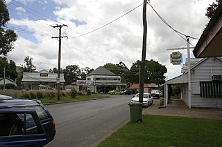
Nabiac is a small town on the Mid North Coast, New South Wales, Australia in Mid-Coast Council. It is north-west of Forster, and south of Taree. At the 2016 census, the population of Nabiac was 1,252.

Berrigan is a town on the Riverina Highway in the Riverina region of New South Wales, Australia. Berrigan is in the Berrigan Shire local government area and contains the Berrigan Shire Council offices. At the 2016 census, Berrigan had a population of 1,260.

Barooga is a border town in the Riverina region of New South Wales, Australia, located in the Berrigan Shire local government area. It is situated just north of the Murray River which forms the border with Victoria. Barooga's population at the 2016 census was 1,817.

Tooleybuc is a town in the western Riverina district of New South Wales, Australia. The town is located on the Mallee Highway, 919 kilometres (571 mi) south west of the state capital, Sydney and 381 kilometres (237 mi) north west of Melbourne. Situated on the banks of the Murray River across from Piangil in the neighbouring state of Victoria, at the 2011 census, Tooleybuc has a population of 277. The town is in the Murray River Council local government area. The Tooleybuc Bridgekeepers Cottage close to the Tooleybuc Bridge is of particular local historic interest. It is open to the public.

Ganmain is a town in the Riverina region of New South Wales, Australia. Ganmain is located around 55 kilometres (34 mi) north west of Wagga Wagga, and 50 kilometres (31 mi) east of Narrandera. Ganmain is in the Coolamon Shire local government area and had a population at the 2016 census of 779.

Wakool is a town in the western Riverina region of New South Wales, Australia. Wakool is in the Murray River Council local government area, 791 kilometres (492 mi) south west of the state capital, Sydney and 336 kilometres (209 mi) north-west of Melbourne. At the 2016 census, Wakool had a population of 297.
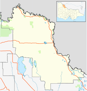
Beverford is a locality situated in the Sunraysia region. The place by road, is situated about 5 kilometres north west from Tyntynder South and 8 kilometres south east from Vinifera. At the 2011 census, Beverford and the surrounding area had a population of 372.

The Tyntynder Football Netball Club, nicknamed the Bulldogs, is an Australian rules football and netball club based in the Central Murray Football League. They won three premierships in a row from 1997–99, and also won the 2006 and 2007 Night Series (pre-season).
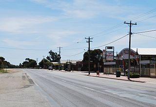
Nyah is a town in northern Victoria, Australia. The town is located on the Murray Valley Highway, in the Rural City of Swan Hill local government area, 365 kilometres (227 mi) north west of the state capital, Melbourne. At the 2011 census, Nyah had a population of 483.

Vinifera is a locality in Victoria, Australia, located approximately 22 km from Swan Hill, Victoria. It was named after Vitis vinifera the Common Grape Vine, when grapes were planted here on irrigated land. As of the 2016 census, Vinifera has a population of 159.
The Nyah Football Club was a country Australian rules football team from the small Victorian town of Nyah. The team competed in a number of leagues before staying in the Mid-Murray Football League from 1934 onwards. In 1978, the Nyah Football Club merged with the Nyah West Football Club to form the Nyah-Nyah West United Football Club.
