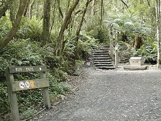
Ferntree Gully is a suburb in Melbourne, Victoria, Australia, at the foothills of the Dandenong Ranges, 30 km south-east of Melbourne's Central Business District, located within the City of Knox local government area. Ferntree Gully recorded a population of 27,398 at the 2021 census.

Mildura is a regional city in north-west Victoria, Australia. Located on the Victorian side of the Murray River, Mildura had a population of 34,565 in 2021. When nearby Wentworth, Irymple, Nichols Point and Merbein are included, the area had an estimated urban population of 51,903 at June 2018, having grown marginally at an average annual rate of 0.88% year-on-year over the preceding five years. It is the largest settlement in the Sunraysia region. Mildura is a major horticultural centre notable for its grape production, supplying 80% of Victoria's grapes. Many wineries also source grapes from Mildura. It is very close to the New South Wales border.

Nunawading is a suburb of Melbourne, Victoria, Australia, 24 km east of Melbourne's Central Business District, located within the Whitehorse local government area. Nunawading recorded a population of 12,413 at the 2021 census.

Mount Evelyn is a suburb in Melbourne, Victoria, Australia, 37 km north-east of Melbourne's central business district, located within the Shire of Yarra Ranges local government area. Mount Evelyn recorded a population of 9,799 at the 2021 census.

Cranbourne is a city in Melbourne, Victoria, Australia, 43 km south-east of Melbourne's Central Business District, located within the City of Casey local government area. Cranbourne recorded a population of 21,281 at the 2021 census.

Keysborough is a suburb in Melbourne, Victoria, Australia, 27 km south-east of Melbourne's Central Business District, located within the City of Greater Dandenong local government area. Keysborough recorded a population of 30,018 at the 2021 census.

Somerville is a suburb on the Mornington Peninsula in Melbourne, Victoria, Australia, 49 km (30 mi) south-east of Melbourne's Central Business District, located within the Shire of Mornington Peninsula local government area. Somerville recorded a population of 11,767 at the 2021 census.

Epping is a suburb in Melbourne, Victoria, Australia, 18 km (11 mi) north of Melbourne's Central Business District, located within the City of Whittlesea local government area. Epping recorded a population of 33,489 at the 2021 census.
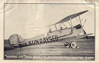
Sunraysia is a region located in northwestern Victoria and southwestern New South Wales in Australia. The region is renowned for its sunshine, intensive horticulture including grapes and oranges. Its main centre is Mildura, Victoria.

Hopetoun is a town which serves as the major service centre for the Southern Mallee area of Victoria, Australia. Hopetoun is situated 400 km (249 mi) north-west of Melbourne on the Henty Highway in the Shire of Yarriambiack. In the 2016 census, Hopetoun had a population of 739.

Merbein is a town just north of Mildura, Victoria, in the Sunraysia region of Australia. It is on the Calder Highway between Mildura and the Murray River crossing at the Abbotsford Bridge to Curlwaa. At the 2016 census, the town had a population of 1,981. Merbein is 12 kilometres from Mildura, 553 km from Melbourne and 389 km from Adelaide.

Strathfieldsaye is a suburb of the Greater City of Bendigo in Victoria, Australia. It is located 9 kilometres (5.6 mi) south-east of the Bendigo CBD.
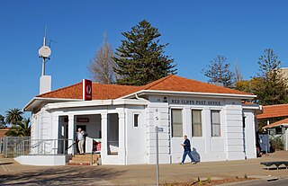
Red Cliffs is a town in Victoria, Australia in the Sunraysia region. It is located on the Calder Highway, 16 km south of Mildura and 544 km north-west of Melbourne.

Underbool is a town in the Mallee region of north-west Victoria, Australia. The town is in the Rural City of Mildura local government area and on the Mallee Highway—between Ouyen and the South Australian border – 476 kilometres (296 mi) north west of the state capital, Melbourne. The town services the grain farmers and graziers in the area. For tourists it provides access to the Pink Lakes in Murray-Sunset National Park.

Neerim South is a town in West Gippsland, Victoria, Australia, located in the Shire of Baw Baw, 109 kilometres (68 mi) east of Melbourne and 19 kilometres (12 mi) north of Warragul. At the 2016 census, Neerim South had a population of 1,305.

Woomelang is a town in the Mallee region of Victoria, Australia. The town is in the Shire of Yarriambiack local government area and on the Sunraysia Highway, 359 kilometres (223 mi) north-west of the state capital, Melbourne, 183 kilometres (114 mi) south-east of Mildura and 154 kilometres (96 mi) north of Horsham. At the 2011 census, Woomelang and the surrounding area had a population of 191.
Woorinen South is a town in Victoria, Australia. It is situated within the Rural City of Swan Hill within the Mallee region of north-west Victoria. At the 2011 census, Woorinen South had a population of 311. The town is located 350 kilometres (217 mi) north-west of Melbourne and 10 kilometres (6 mi) km north-west of the regional centre Swan Hill. The town contains a number of small businesses and is in the centre of a prosperous and diverse agricultural area which produces wine, stone fruit, vegetables, wool, and cereal crops. The town hosts the annual Vintage Steam Rally.

Walpeup is a town in the Mallee region of north west Victoria. The town is in the Rural City of Mildura local government area and on the Mallee Highway and Pinnaroo railway line between Ouyen and the South Australian border, 458 kilometres (285 mi) north west of the state capital, Melbourne and 130 kilometres (81 mi) south west of the regional centre of Mildura. At the 2016 census, Walpeup had a population of 158.
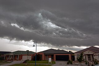
Narre Warren is a suburb in Melbourne, Victoria, Australia, 38 km southeast of Melbourne's Central Business District, located within the City of Casey local government area. Narre Warren recorded a population of 27,689 at the 2021 census.
The Sunraysia Football and Netball League, also known simply as the SFNL is an Australian rules league in the Sunraysia district of north-west Victoria and south-west New South Wales. Nine clubs – Mildura, South Mildura, Imperials, Irymple, Red Cliffs, Merbein, Robinvale–Euston, Ouyen United and Wentworth – participate in the competition, which includes senior and junior grades of football and netball. The SFNL is considered a major country league. The league's grand final is traditionally played at City Oval in Mildura.


