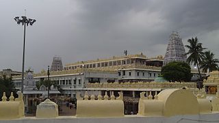
Arempudi

Last updated

Arempudi
Census Town
Location map India Andhra Pradesh EN.svg
Red pog.svg
Arempudi
Location in Andhra Pradesh, India
Coordinates: 17°09′44″N81°14′00″E / 17.16216°N 81.23345°E / 17.16216; 81.23345 Coordinates: 17°09′44″N81°14′00″E / 17.16216°N 81.23345°E / 17.16216; 81.23345
Country India
State Andhra Pradesh
District East Godavari
Area [1]
  Total 7.02 km2 (2.71 sq mi)
Elevation 129 m (423 ft)
Population (2011) [1]
  Total 5,073
  Density 720/km2 (1,900/sq mi)
Languages
  Official Telugu
Time zone IST (UTC+5:30)

Arempudi is a census town in East Godavari district of the Indian state of Andhra Pradesh. It is located near Sankhavaram mandal of Rampachodavaram revenue division. [1]

A census town is a type of town that satisfies certain characteristics, depending on the country in which it is located.

East Godavari district District of Andhra Pradesh in India

East Godavari district or Toorpu Godavari Jilla is a district in Coastal Andhra region of Andhra Pradesh, India. Its district headquarters is at Kakinada. As of Census 2011, it became the most populous district of the state with a population of 5,151,549. Rajahmundry and Kakinada are the two largest cities in the Godavari districts in terms of population.

India Country in South Asia

India, also known as the Republic of India, is a country in South Asia. It is the seventh largest country by area and with more than 1.3 billion people, it is the second most populous country as well as the most populous democracy in the world. Bounded by the Indian Ocean on the south, the Arabian Sea on the southwest, and the Bay of Bengal on the southeast, it shares land borders with Pakistan to the west; China, Nepal, and Bhutan to the northeast; and Bangladesh and Myanmar to the east. In the Indian Ocean, India is in the vicinity of Sri Lanka and the Maldives, while its Andaman and Nicobar Islands share a maritime border with Thailand and Indonesia.

Contents

Geography

Arempudi is located near famous pilgrim centre Annavaram. It has an average elevation of 129 metres.

Annavaram Village in Andhra Pradesh, India

Annavaram is a village on the banks of the Pampa River. It is located in, Sankhavaram Mandal, East Godavari district of the Indian state of Andhra Pradesh. The village has the temple of Veera Venkata Satyanarayana, a form of Vishnu on the Ratnagiri Hill.

Demographics

As of 2011 Census of India, Arempudi had a population of 5073. The total population constitute, 2537 males and 2536 females —a sex ratio of 1000 females per 1000 males. 584 children are in the age group of 0–6 years, with a sex ratio of 814 per 1000. The average literacy rate stands at 66.25%, significantly lower than the state average of 67.41%. [1] [2]

The decennial Census of India has been conducted 15 times, As of 2011. While it has been conducted every 10 years, beginning in 1872, the first complete census was taken in the year 1881. Post 1949, it has been conducted by the Registrar General and Census Commissioner of India under the Ministry of Home Affairs, Government of India. All the census since 1951 are conducted under 1948 Census of India Act. The last census was held in 2011 and next census will be held in 2021.

Related Research Articles

Tadepalligudem city in Andhra Pradesh, India

Tadepalligudem (TPG) is a city in West Godavari district of the Indian state of Andhra Pradesh. It is a municipality and the mandal headquarters of Tadepalligudem mandal in Eluru revenue division.

Bandarulanka Census town in Andhra Pradesh, India

Bandarulanka is a census town in East Godavari district of the Indian state of Andhra Pradesh.

Rampachodavaram Census Town in Andhra Pradesh, India

Rampachodavaram is a census town in East Godavari district of the Indian state of Andhra Pradesh. It is located in Rampachodavaram mandal of Rampachodavaram revenue division.

Kakinada (rural) mandal Mandal in Andhra Pradesh, India

Kakinada (rural) mandal is one of the 59 mandals in East Godavari of the state of Andhra Pradesh, India. It has its headquarters at Kakinada. The mandal is bounded by Samalkota mandal, Pedapudi mandal, Karapa mandal, Kothapalle mandal and waters of Bay of Bengal.

Peravali Village in Andhra Pradesh, India

Peravali is a village in West Godavari district of the Indian state of Andhra Pradesh.

Kommugudem is a village in West Godavari district of the Indian state of Andhra Pradesh. It is located in Tadepalligudem mandal of Eluru revenue division.

Ganapavaram, West Godavari district Village in Andhra Pradesh, India

Ganapavaram is a village in West Godavari district of the Indian state of Andhra Pradesh.

Jagannadhapuram, Tadepalligudem mandal Village in Andhra Pradesh, India

Jagannadhapuram is a village in West Godavari district of the Indian state of Andhra Pradesh. It is located in Tadepalligudem mandal of Eluru revenue division.

Kakinada (urban) mandal Mandal in Andhra Pradesh, India

Kakinada (urban) mandal is one of the 59 mandals in East Godavari district of the state of Andhra Pradesh, India. It has its headquarters at Kakinada city, that covers the entire mandal. The mandal is surrounded by Kakinada (rural) mandal and lies on the coast of Bay of Bengal.

Rajahmundry Urban mandal Mandal in Andhra Pradesh, India

Rajahmundry (urban) mandal is one of the 59 mandals in East Godavari of the state of Andhra Pradesh, India. It has its headquarters at Rajahmundry city, that covers the entire urban mandal. The mandal is surrounded by Rajahmundry (rural) mandal and lies on the banks of Godavari River.

Tangellamudi Census Town in Andhra Pradesh, India

Tangellamudi is a census town in West Godavari district of the Indian state of Andhra Pradesh. It is located in Eluru mandal of Eluru revenue division. The town is a constituent of Eluru urban agglomeration.

Gavaravaram Census Town in Andhra Pradesh, India

Gavaravaram is a census town in West Godavari district of the Indian state of Andhra Pradesh. It is located in Eluru mandal of Eluru revenue division. The town is a constituent of Eluru urban agglomeration.

Madepalle Village in Andhra Pradesh, India

Madepalle is a village in West Godavari district of the Indian state of Andhra Pradesh. It is located in Eluru mandal of Eluru revenue division. The town is a constituent of Eluru urban agglomeration.

Malkapuram, West Godavari Village in Andhra Pradesh, India

Malkapuram is a village in West Godavari district of the Indian state of Andhra Pradesh. It is located in Eluru mandal of Eluru revenue division. The town is a constituent of Eluru urban agglomeration.

Kokkirapadu Village in Andhra Pradesh, India

Kokkirapadu is a village in West Godavari district of the Indian state of Andhra Pradesh. It is located in Pedapadu mandal of Eluru revenue division.

Kothuru, West Godavari district Village in Andhra Pradesh, India

Kothuru is a village in West Godavari district of the Indian state of Andhra Pradesh. It is located in Pedapadu mandal of Eluru revenue division.

Nandikeswarapuram Village in Andhra Pradesh, India

Nandikeswarapuram is a village in West Godavari district of the Indian state of Andhra Pradesh. It is located in Pedapadu mandal of Eluru revenue division.

Rajupeta, West Godavari district Village in Andhra Pradesh, India

Rajupeta is a village in West Godavari district of the Indian state of Andhra Pradesh. It is located in Pedapadu mandal of Eluru revenue division.

Satyavolu Village in Andhra Pradesh, India

Satyavolu is a village in West Godavari district of the Indian state of Andhra Pradesh. It is located in Pedapadu mandal of Eluru revenue division.

Tallagudem Village in Andhra Pradesh, India

Tallagudem is a village in West Godavari district of the Indian state of Andhra Pradesh. It is located in Pedapadu mandal of Eluru revenue division.

References

  1. 1 2 3 4 "District Census Handbook - East Godavari" (PDF). Census of India. pp. 16–18, 54–55. Archived from the original (PDF) on 13 November 2015. Retrieved 18 January 2015.
  2. "Literacy of AP (Census 2011)" (PDF). Official Portal of Andhra Pradesh Government. p. 43. Archived from the original (PDF) on 14 July 2014. Retrieved 5 September 2014.