Aigeira is a town and a former municipality in northeastern Achaea, West Greece, Greece. Since the 2011 local government reform it is part of the municipality Aigialeia, of which it is a municipal unit. The municipal unit has an area of 103.646 km2. The municipal unit stretches from the Gulf of Corinth, where the town Aigeira is located, to the mountains in the south. The town Aigeira is 26 km (16 mi) southeast of Aigio, 55 km (34 mi) northwest of Corinth and 55 km (34 mi) east of Patras. The Greek National Road 8A and the railway Corinth - Patras run through the town. In a distance of 6 Km from modern Aigeira there is the archaeological site of Ancient Aigeira and the Mycenean Acropolis.
Mesatis was a town of ancient Achaea, in the neighbourhood of Patrae. It is said to have been founded by the Ionians, when they were in the occupation of the country. After the expulsion of the Ionians, the Achaean hero Patreus withdrew the inhabitants from Antheia and Mesatis to Aroë, which he enlarged and called Patrae after himself. The acropolis of the city probably continued to bear the name of Aroë, which was often used as synonymous with Patrae. In the war between the Achaeans and the Romans Patrae suffered so severely, that the greater part of the inhabitants abandoned the city and took up their abodes in the surrounding villages of Mesatis, Antheia, Bolina, Argyra, and Arba.

Tritaia is a former municipality in Achaea, West Greece, Greece. Since the 2011 local government reform it is part of the municipality Erymanthos, of which it is a municipal unit. The municipal unit has an area of 244.798 km2. Population 3,086 (2011). The seat of the municipality was in Stavrodromi. Tritaia was named after the ancient Achaean city Tritaea, which was located near the present village Agia Marina. Tritaia is situated in mountainous southern Achaea, on the border with Elis. It nearly surrounds the municipal unit Kalentzi. Mount Erymanthos is located in the eastern part of Tritaia. The Greek National Road 33 runs through Tritaia.
Larissos is a river in the western part of Achaea, southern Greece. Its source is on the western slope of the mountain Movri, near the village Mataragka. It flows through the Prokopos lagoon, and empties into the Ionian Sea in the village Kalogria. Other villages along its course are Kagkadi, Apideonas and Lappas. Its complete course lies within the municipal unit Larissos, which took its name from the river. It is 19.5 km (12.1 mi) long.

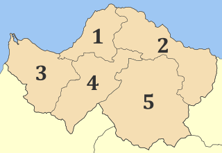
Aigialeia is a municipality and a former province (επαρχία) in the eastern part of the Achaea regional unit, Greece. The seat of the municipality is the town Aigio. The municipality has an area of 723.063 km2. The main towns are Aigio, Akrata and Diakopto. The municipality Aigialeia stretches from the south coast of the Gulf of Corinth to the mountainous interior of the Peloponnese peninsula. The main rivers of the municipality are the Selinountas and the Vouraikos.
Fares is a village in the municipal unit of Farres, Achaea, Greek. It is located on the left bank of the river Peiros, 2 km southeast of Isoma and 17 km south of Patras. In 2011 Fares had a population of 466 for the village and 519 for the community, which includes the village Prevedos. Prevedos is on the Greek National Road 33.
Keryneia is a village and a community in the municipal unit of Diakopto, Achaea, Greece. The community consists of the villages Keryneia and Nea Keryneia. It is located 6 km southeast of Aigio and 7 km west of Diakopto. The Greek National Road 8A passes between Keryneia and Nea Keryneia. In 2011 Keryneia had a population of 35 for the village and 362 for the community. The town takes its name from the ancient town of Ceryneia
Skotani, is a small mountain village in the municipal unit of Paion, Achaea, Greece. In 2011 its population was 60 for the village and 99 for the community, which includes the village Agios Georgios. Skotani is 5 km east of Chovoli, 7 km northeast of Dafni, 7 km southwest of Kleitoria and 20 km south of Kalavryta. Its elevation is about 700 m above sea level.
Paos is a village and a community in Achaea, Greece. It was the seat of the municipality of Paion. In 2011 its population was 253 for the village and 298 for the community, which includes the villages Dechounaiika, Palaios Paos, Potamia and Vesini. It is 25 km southwest of Kalavryta, and 50 km northwest of Tripoli. The Greek National Road 33 passes through the village.
In Greek mythology, Argyra was one of the Naiads, a nymph who resided in a well. There was a city in ancient Achaea, also named Argyra, that was the site of a spring. According to legend, the nymph Argyra was in love with a shepherd named Selemnus whom she visited frequently. But when he aged and his youthful beauty vanished, she forsook him. When the boy died of grief, the goddess Aphrodite out of pity changed him into a river. There was a popular belief in Achaia that a forsaken lover who bathes in this river will forget their pain.
Sella is a village in the municipal unit of Rio, Achaea, Greece. It is located in the northern foothills of the Panachaiko, at 500 m above sea level. The river Volinaios flows east and north of the village. It is 2 km east of Argyra and 9 km east of Rio. In 2011, it had a population of 302.
Seires is a mountain village and a community in the municipal unit of Aroania, Achaea, Greece. It was named after the ancient town Seirae, that was part of Arcadian Azania. In 2011, it had a population of 76 for the village and 263 for the community, which includes the villages Agioi Theodoroi, Agios Georgios, Krini and Thomaiika. Seires is situated at 940 m above sea level. Seires is 3 km west of Alestaina, 4 km northwest of Paos, 5 km east of Psofida and 23 km southwest of Kalavryta.
Drepano, is a village in the municipality of Patras, Achaea, Greece. In 2011, it had a population of 541. It is situated on the river Volinaios, about 60 m above sea level. It is 2 km west of Psathopyrgos and 7 km northwest of Rio. The Greek National Road 8A passes north of the village.
In Greek mythology, Bolina or Boline (Βολίνη) was a nymph. According to Pausanias, Bolina was once a mortal maiden of Achaea. She was loved by the god Apollo, and when he attempted to approach her, Bolina fled from him and threw herself into the sea to escape his advances. Thereupon the god made her immortal. On the spot where Bolina fell into the sea, the town Bolina was founded.
Scotane or Skotane was a settlement in ancient Arcadia, Greece. Pausanias wrote that it was located near Nasi, Lycuntes and Argeathae, which places it in the southern part of present Achaea.