
Greek National Road 9 is a single carriageway with at-grade intersections in the West Greece and Peloponnese regions. It runs along the west coast of the Peloponnese peninsula, from Patras to Methoni via Pyrgos. Its length is around 220 km (140 mi), making it the second-longest national highway of Greece.

Mintilogli or Midilogli is a village and a community in the municipal unit of Paralia in the municipality of Patras in Achaea, Greece. It is 1 km south of Paralia, and 8 km southwest of Patras city centre. Ovrya is to the east. The community consists of the villages Mintilogli (seat) and Chantziliako. Its population is around 2,000. The Greek National Road 9 passes the village on the north and west.

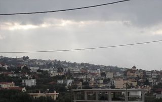
Vrachnaiika is a town and a former municipality in Achaea, West Greece, Greece. Since the 2011 local government reform it is part of the municipality Patras, of which it is a municipal unit. The municipal unit has an area of 32.111 km2. It is suburb of a Patras, about 11 km southwest of the city centre, on the Gulf of Patras coast. The population of the town is around 2,700 and of the municipal unit around 4,600. The community has a disused rail station on the line from Patras to Pyrgos. The Greek National Road 9 passes south of the centre.
Saravali is a village and a community in the municipal unit of Messatida, Achaea, Greece. The community is located at the southeastern edge of the agglomeration of Patras. The community consists of the villages Saravali, Agios Stefanos, Demenika, Kefalovryso and Bakari. Saravali is 6 km south of Patras city centre. Adjacent communities are Petroto to the east, Patras to the north, Ovrya to the west and Krini to the south. The Greek National Road 9 runs through the community.
Roitika or Royitika is a village in the municipal unit of Paralia, Achaea, Greece. It is situated on the Gulf of Patras, 2 km southwest of the village Paralia, and 8 km southwest from Patras city centre. The population is around 1,300. The Greek National Road 9 runs east of the village.

Pyrgos is the capital of the Elis regional unit in Greece. The city is located in the western part of the Peloponnese, in the middle of a plain, 4 kilometres from the Ionian Sea. The river Alfeios flows into sea about 7 km (4 mi) south of Pyrgos. The population of the town Pyrgos is 25,180, and of the municipality 47,995 (2011). Pyrgos is 16 km (10 mi) west of Olympia, 16 km (10 mi) southeast of Amaliada, 70 km (43 mi) southwest of Patras and 85 km (53 mi) west of Tripoli.
Kavasila is a village in the municipal unit of Gastouni, Elis, Greece. Its population is around 1500. It is situated in a flat rural area, on the right bank of the river Pineios, at about 20 m elevation. It is 1 km northwest of Lefkochori, 2 km east of Kardiakafti, 3 km south of Andravida and 3 km northeast of Gastouni. Kavasila had a train station on the line from Patras to Kalamata via Pyrgos. A branch line to Vartholomio and Kyllini was shut down around 2001. The Greek National Road 9 passes east of the village.
Savalia is a village in the municipal unit of Amaliada, Elis, southern Greece. It is in the plains near the Ionian Sea, 1 km (0.62 mi) northwest of Roviata, 2 km (1.2 mi) southwest of Ampelokampos, 3 km (1.9 mi) east of Palaiochori, 5 km (3.1 mi) southeast of Gastouni, and 5 km (3.1 mi) northwest of Amaliada. The Greek National Road 9 (Patras–Pyrgos) passes southwest of the village. The railway from Patras to Pyrgos passes northeast of the village. Its population is 1,206.
Kourtesi is a village and a community in the southwestern part of the municipal unit of Vouprasia, Elis, Greece. It is in a flat rural area, southeast of the Kotychi lagoon, 7 km southwest of Varda in the northeast, 1 km east of Areti and 7 km northeast of Lechaina. Kourtesi lies on the Greek National Road 9 connecting Patras and Pyrgos, and on the railway from Patras to Pyrgos. The community consists of the villages Kourtesi, Ano Kourtesi and Kotteika. The smaller villages Ano Kourtesi and Kotteika lie to the southeast of Kourtesi.
Alissos is a village and a community in the municipal unit of Dymi, Achaea, Greece. It is located near the Gulf of Patras, 3 km east of Kato Achaia, 3 km southwest of Kaminia and 17 km southwest of Patras. The community consists of the villages Alissos, Kamenitsa, Paralia Alissou and Profitis Elissaios. The Greek National Road 9 and the railway from Patras to Pyrgos run between Alissos and Paralia Alissou.
Niforeika is a village and a community in the municipality of West Achaea in northwestern Achaea, Greece. It is located near the Gulf of Patras, 4 km east of Limnochori, 3 km west of Kato Achaia and 22 km southwest of Patras. The distance from the Greek National Road 9 is about 4 km. The community consists of the villages Niforeika and Paralia Niforeikon.
Nea Manolada is a community in the municipal unit of Vouprasia, Elis, southwestern Greece. It is located in a vast, rural plain, It is 3 km southwest of Neo Vouprasio, 3 km northeast of Varda and 37 km southwest of Patras. The Greek National Road 9 passes east of the village, and the railway Patras - Pyrgos runs through the village. In 2001, a train derailment occurred in Nea Manolada injuring two passengers as a train was heading from Athens to Kyparissia.
Metochi is a village and a community in the municipal unit of Larissos, western Achaea, Greece. The community consists of the villages Metochi, Vouprasio, Neo Vouprasio and Lappas. Lappas was the seat of the former municipality of Larissos. Metochi is located in the plains near the Ionian Sea coast, 5 km south of Araxos, 3 km southwest of Araxos Airport, 14 km west of Kato Achaia and 32 km west of Patras. The Prokopos lagoon, which is fed by the river Larissos, is 1 km north of Metochi. Lappas is on the Greek National Road 9 and on the railway from Patras to Pyrgos.
Kaminia is a village in Achaea, Greece. It is part of the municipal unit of Vrachnaiika. Kaminia is situated on the Ionian Sea coast, 15 km southwest of Patras, and 6 km east of Kato Achaia. Since the 1980s, the village is bypassed by Greek National Road 9. Kaminia had a small train station on the currently unexploited Patras–Pyrgos railway.
Tsoukalaiika is a village and a community in the municipal unit of Vrachnaiika in the northern part of Achaea, Greece. It is on the southwestern edge of the metropolitan area of Patras, on the Gulf of Patras, 13 km southwest of Patras city centre. It is located on the Greek National Road 9 and the railway from Patras to Pyrgos.
Lasteika is a village and a community in the municipality of Pyrgos, Elis, Greece. It is situated at the foot of a low hill, 4 km northwest of the centre of Pyrgos. It is 2 km southwest of Agios Georgios, 2 km northeast of Vytinaiika, and 3 km southwest of Prasino, in the municipal unit Iardanos. The Greek National Road 9/E55 passes southwest of the village. The community consists of the villages Lasteika and Itia.
Kareika is a village and a community in the municipal unit of Movri, Achaea, Greece. The community consists of the villages Kareika, Gomosto, Karamesineika and Rachi. It is located north of the Movri hills, 3 km east of Sageika, 6 km southwest of Kato Achaia and 25 km southwest of Patras. The Greek National Road 9/E55 passes through the community.

Kato Achaia is a town and a community in Achaea, West Greece, Greece. Since the 2011 local government reform it is part of the municipality West Achaea, of which it is the seat of administration. The community Kato Achaia consists of the town Kato Achaia and the villages Alykes, Manetaiikia, Paralia Kato Achaias and Piso Sykea. Nearby are the ruins of the ancient city of Dyme.

Patras Province was a province covering the western part of the Achaea prefecture, Greece. Its largest city and seat of administration was Patras. Its territory corresponded with that of the current municipalities Patras, Erymanthos and West Achaea, and the municipal unit Erineos. It was abolished in 2006.
Myrtia or Myrtea, is a village in the municipality of Pyrgos, Elis, Greece. In 2011, it had a population of 898. It is located on a hillside near the Ionian Sea. It is 3 km southeast of Douneika, 3 km southwest of Alpochori, 3 km north of Skourochori and 9 km northwest of Pyrgos town centre. The Greek National Road 9/E55 passes northeast of the village.


