Arlington, Monroe County, Indiana

Last updated
Arlington
Unincorporated community
USA Indiana location map.svg
Red pog.svg
Arlington
Usa edcp location map.svg
Red pog.svg
Arlington
Coordinates: 39°11′02″N86°33′00″W / 39.18389°N 86.55000°W / 39.18389; -86.55000 Coordinates: 39°11′02″N86°33′00″W / 39.18389°N 86.55000°W / 39.18389; -86.55000
Country United States
State Indiana
County Monroe
Township Bloomington
Elevation [1] 863 ft (263 m)
Time zone Eastern (EST) (UTC-5)
  Summer (DST) EDT (UTC-4)
ZIP code 47404
Area code(s) 812, 930
GNIS feature ID 430244

Arlington is an unincorporated community in Bloomington Township, Monroe County, in the U.S. state of Indiana. [2]

Unincorporated area Region of land not governed by own local government

In law, an unincorporated area is a region of land that is not governed by a local municipal corporation; similarly an unincorporated community is a settlement that is not governed by its own local municipal corporation, but rather is administered as part of larger administrative divisions, such as a township, parish, borough, county, city, canton, state, province or country. Occasionally, municipalities dissolve or disincorporate, which may happen if they become fiscally insolvent, and services become the responsibility of a higher administration. Widespread unincorporated communities and areas are a distinguishing feature of the United States and Canada. In most other countries of the world, there are either no unincorporated areas at all, or these are very rare; typically remote, outlying, sparsely populated or uninhabited areas.

Bloomington Township, Monroe County, Indiana Township in Indiana, United States

Bloomington Township is one of eleven townships in Monroe County, Indiana, United States. As of the 2010 census, its population was 44,167 and it contained 15,346 housing units.

Monroe County, Indiana County in Indiana, USA

Monroe County is a county located in the U.S. state of Indiana, and determined by the U.S. Census Bureau to include the mean center of U.S. population. The population was 137,974 at the 2010 census. The county seat is Bloomington.

Contents

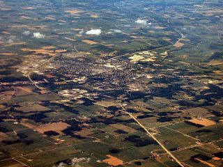
The community is a neighborhood of the city of Bloomington, and is part of the Bloomington Metropolitan Statistical Area.

Bloomington, Indiana City in Indiana, United States

Bloomington is a city in and the county seat of Monroe County in the southern region of the U.S. state of Indiana. It is the seventh-largest city in Indiana and the fourth-largest outside the Indianapolis metropolitan area. According to the Monroe County History Center, Bloomington is known as the "Gateway to Scenic Southern Indiana." The city was established in 1818 by a group of settlers from Kentucky, Tennessee, the Carolinas, and Virginia who were so impressed with "a haven of blooms" that they called it Bloomington.

Bloomington metropolitan area, Indiana human settlement in United States of America

The Bloomington, Indiana, Metropolitan Statistical Area, as defined by the United States Census Bureau, is an area comprising three counties in south-central Indiana. The city of Bloomington in Monroe County is the area's principal municipality and its anchor. At the 2010 United States census, the MSA had a population of 192,714.

History

Arlington was founded in 1893. [3]

Geography

Arlington is located at 39°11′02″N86°33′00″W / 39.18389°N 86.55000°W / 39.18389; -86.55000 .

Related Research Articles

Monroe County, Ohio County in the United States

Monroe County is a county located on the eastern border of the U.S. state of Ohio, across the Ohio River from West Virginia. As of the 2010 census, the population was 14,642, making it the second-least populous county in Ohio. Its county seat is Woodsfield. The county was created in 1813 and later organized in 1815.

Tippecanoe County, Indiana County in the United States

Tippecanoe County is a county located in the west central portion of the U.S. state of Indiana about 22 miles east of the Illinois state line. As of the 2010 census, the population was 172,780. The county seat and largest city is Lafayette. It was created in 1826 from Wabash County portion of New Purchase and unorganized territory.

Randolph County, Indiana County in the United States

Randolph County is a county located in the U.S. state of Indiana. As of 2010, the population was 26,171. The county seat is Winchester.

Pulaski County, Indiana County in Indiana, United States

Pulaski County is a county located in the U.S. state of Indiana. According to the 2010 U.S. census, the population was 13,402. The county seat is Winamac.

Greene County, Indiana County in the United States

Greene County is a county in the U.S. state of Indiana. As of 2010, the population was 33,165. The county seat is Bloomfield. The county was determined by the US Census Bureau to include the mean center of U.S. population in 1930.

Zionsville, Indiana Town in Indiana, United States

Zionsville is a suburban town located in the extreme southeast area of Boone County, Indiana, United States, northwest of Indianapolis. The population was 14,160 at the 2010 census, and grew to 26,784 in the Census 2016 estimates.

Carmel, Indiana City in Indiana, United States

Carmel is a fast-growing suburban edge city on the north side of Indianapolis. Home to 92,198 residents, the city spans 47 square miles (120 km2) across Clay Township in Hamilton County, Indiana, and is bordered by the White River to the east; Michigan Road and the county line to the west; 96th Street to the south and 146th Street to the north. Although Carmel had one of the nation's first stoplights, it is now known as the "Roundabout Capital of the U.S." because it has more roundabouts than any city in America.

Noblesville, Indiana City in Indiana, United States

Noblesville is a city in and the county seat of Hamilton County, Indiana, United States, just north of Indianapolis. The population was 51,969 at the 2010 census making it the state's 14th largest city/town, up from 19th in 2007. As of 2017 the estimated population was 61,882. The city is part of Delaware, Fall Creek, Noblesville, and Wayne townships.

Westfield, Indiana City in Indiana, United States

Westfield is a city in Hamilton County, Indiana, United States. As of the 2010 census the population was 30,068, and in 2017 the estimated population was 39,493. Westfield is in the Indianapolis metropolitan area.

Greenfield, Indiana City in Indiana, United States

Greenfield is a city in and the county seat of Hancock County, Indiana, United States, and a part of the Indianapolis metropolitan area. The population was 20,602 at the 2010 census, and an estimated 21,709 in 2016. It lies in Center Township.

Avon, Indiana Town in Indiana, United States

Avon is a town in Washington Township, Hendricks County, Indiana, United States. The population was 12,446 at the 2010 census, and in 2017 the estimated population was 17,568.

Danville, Indiana Town in Indiana, United States

Danville is a town in Center Township, Hendricks County, Indiana, United States. The population was 9,001 at the 2010 census, up from 6,418 at the 2000 census. In 2017 the estimated population was 9,819. The town is the county seat of Hendricks County.

Huntington, Indiana City in Indiana, United States

Huntington, known as the "Lime City", is the largest city in and the county seat of Huntington County, Indiana, United States. It is in Huntington and Union townships. The population was 17,391 at the 2010 census.

Greenwood, Indiana City in Indiana, United States

Greenwood is a city in Johnson County, Indiana, United States. The population was 49,791 at the 2010 Census, and increased to 56,545 in the Census 2016 estimates. Greenwood is located between Indiana State Road 37 and Interstate 65. The city shares a border with Indianapolis and is the most populous suburb in the southern portion of the Indianapolis Metropolitan Area.

Bedford, Indiana City in Indiana, United States

Bedford is a city in Shawswick Township, Lawrence County, Indiana, United States. The population was 13,413 at the 2010 census. The city is the county seat of Lawrence County.

Martinsville, Indiana City in Indiana, United States

Martinsville is a city in Washington Township, Morgan County, in the U.S. state of Indiana. The population was 11,828 at the 2010 United States Census. The city is the county seat of Morgan County.

Mooresville, Indiana Town in Indiana, United States

Mooresville is a town in Brown Township, Morgan County, in the U.S. state of Indiana. As of the 2010 census, the town population was 9,326.

Shelbyville, Indiana City in Indiana, United States

Shelbyville is a city in Addison Township, Shelby County, in the U.S. state of Indiana and is the county seat. The population was 19,191 as of the 2010 census.

Clinton, Indiana City in Indiana, United States

Clinton is a city in Clinton Township, Vermillion County, in the U.S. state of Indiana. The population was 4,893 at the 2010 census.

References

  1. "US Board on Geographic Names". United States Geological Survey. October 25, 2007. Retrieved 2016-11-17.
  2. "Arlington, Monroe County, Indiana". Geographic Names Information System . United States Geological Survey . Retrieved 2017-06-19.
  3. Baker, Ronald L. (October 1995). From Needmore to Prosperity: Hoosier Place Names in Folklore and History. Indiana University Press. p. 53. ISBN   978-0-253-32866-3. ...was platted on February 25, 1893.